Home > Mapping Dickens > Dickens' London Map
Charles Dickens London Map
Explore the London of Charles Dickens
Places on the Map: A - B - C - D - E - F - G - H - I - J - K - L - M - N - O - P - Q - R - S - T - U - V - W - X - Y - Z
Select a location to learn more...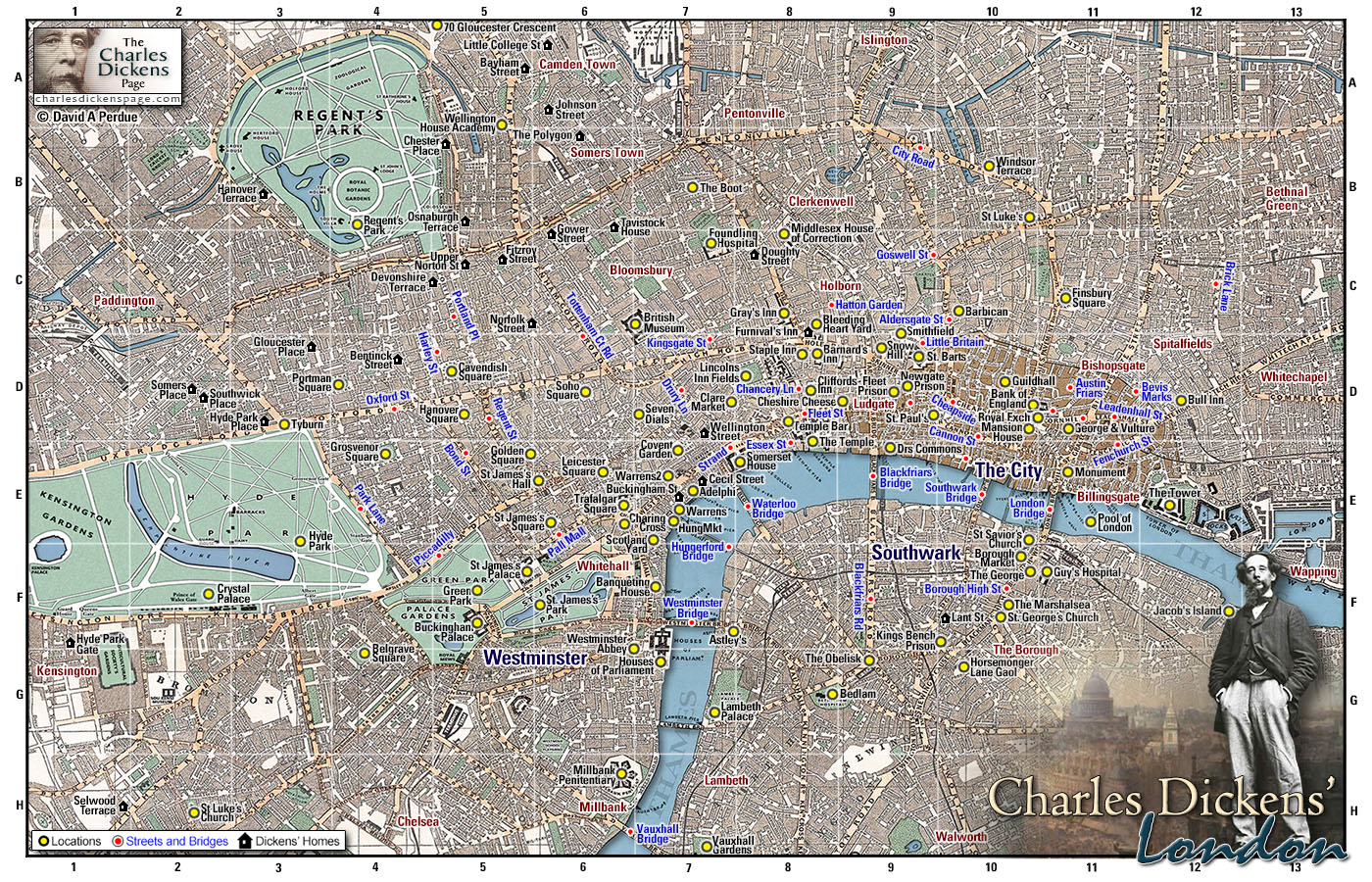
|
Additional information available at each location: Zoom - See the selected location on maps from 1862, 1843, and 1827. Dictionary - Description of that location taken from the 1879 Dickens's Dictionary of London by Charles Dickens Jr compiled for the web by Lee Jackson, who has also compiled The Victorian Dictionary. Google - See the selected location in London today, courtesy of Googles. From here further zoom and pan, aerial photography, and street view are available. Photo - Displays photos of the location Wikipedia - Additional information on that location in Wikipedia Aerial - View the location in an aerial view of Victorian London Back - Go Back to the map See this page for London locations listed by novel Map last updated August 2022 |
Purchase a copy of the Charles Dickens' London Map in digital form or as a printed posterBoth versions of the map come with descriptions of all of the locations marked on the map. Digital download - instant download of a high-resolution (6400 x 8000 pixel) digital copy of the map for $20 (US) and pay securely through your Amazon.com account. More Info... Printed poster - Purchase a high resolution (32x40 inches) poster of the map printed on quality paper at Zazzle. More Info... |
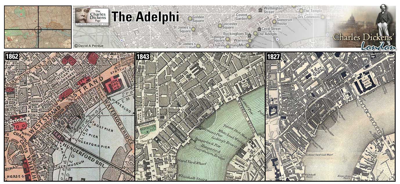
The Adelphi (Map: E-7) - Elegant housing complex along the Thames built by the Adam brothers in the 1760s (Adelphi is Greek for brothers) and torn down in the 1930s (Leapman, 1989, p. 78). A few of the elegant homes in the area still stand, such as number 7 Adam Street (Weinreb et al, 2008, p. 7).
- David Copperfield lodges in Mrs Crupp's house here (David Copperfield).
- Arthur Clennam follows Miss Wade to the Adelphi where she meets Riguad (Little Dorrit).
- Dickens visited the Adelphi Theatre here.
Zoom Google Wikipedia Aerial 1 Aerial 7 Back
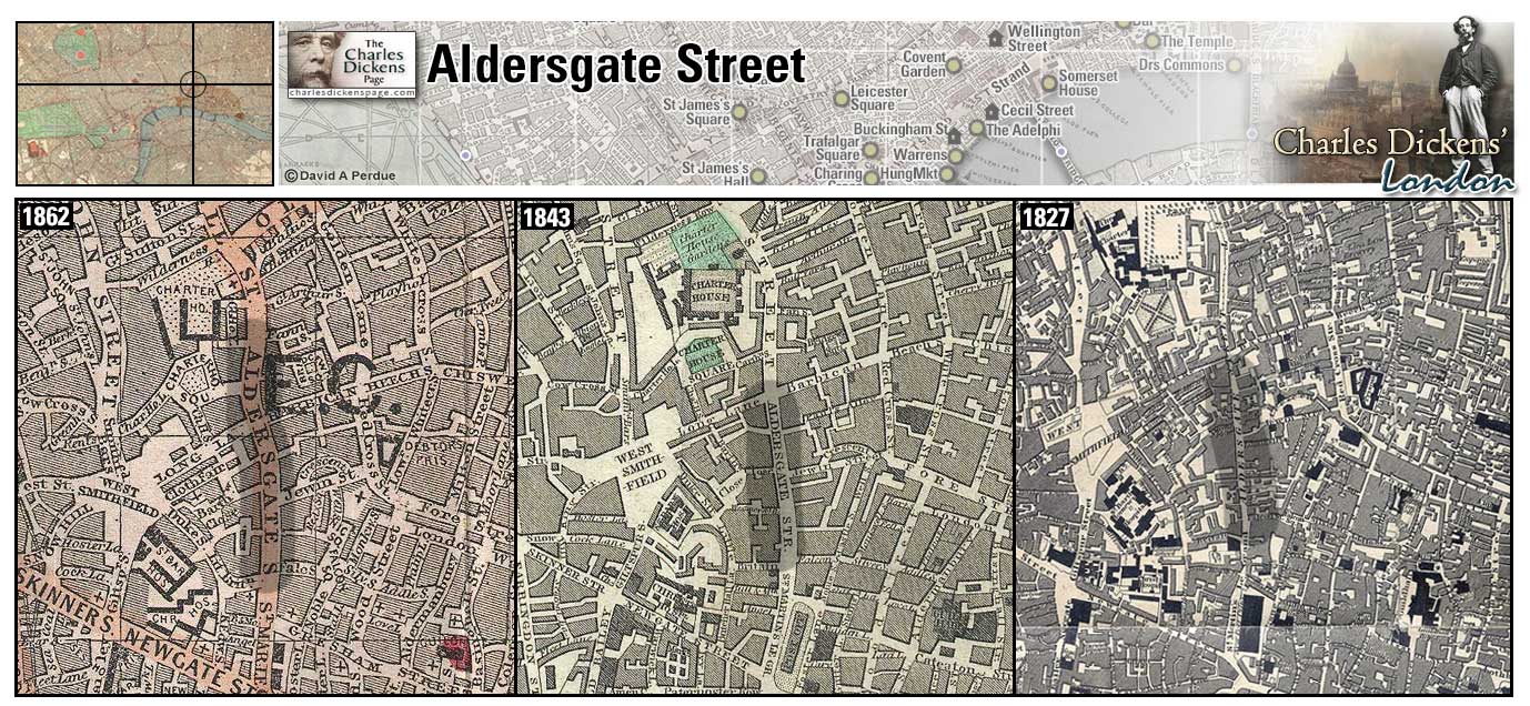
Aldersgate Street (Map: C-10) - Named for Aldergate, one of the Roman gates in the City wall (Weinreb et al, 2008, p. 14).
- Arthur Clennam is walking down Aldersgate Street towards St Paul's when he comes across a crowd carrying John Baptist Cavalletto from the scene of the accident with the mail coach (Little Dorrit).
- On his trips to London John Jasper stays in a hybrid hotel in a little square behind Aldersgate Street near the General Post Office (The Mystery of Edwin Drood).
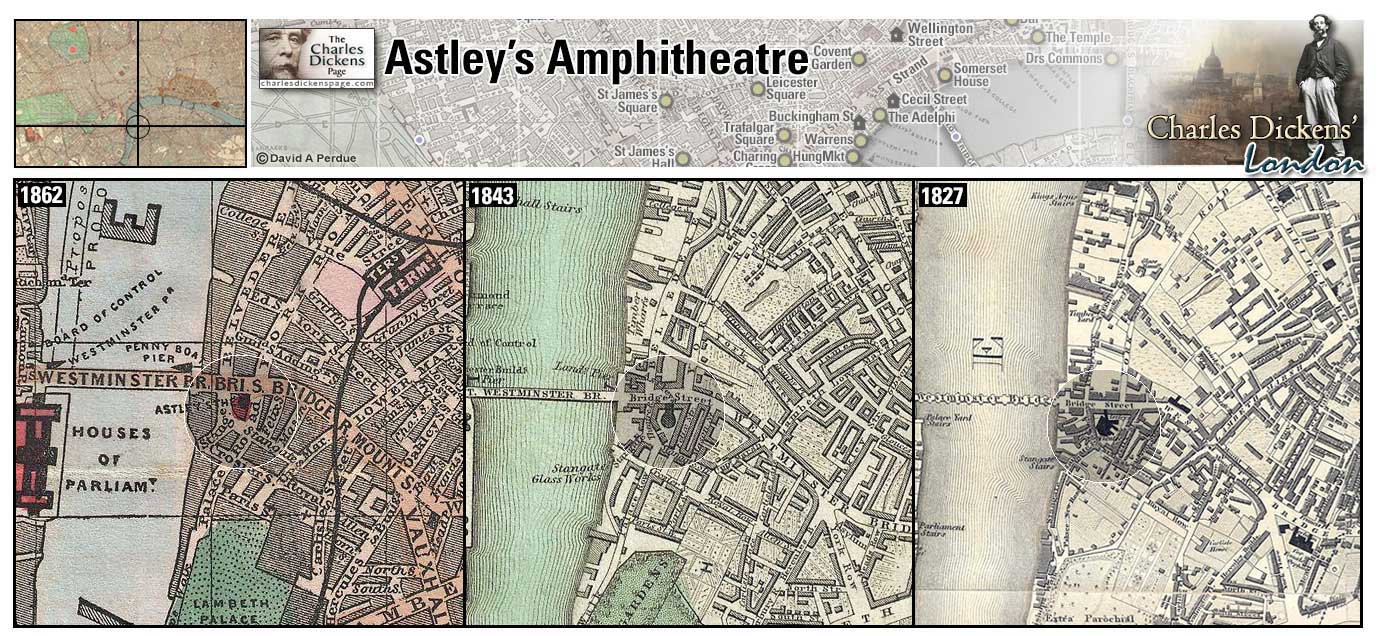
Astley's Royal Equestrian Amphitheatre (Map: F-7) - Popular outdoor amphitheatre which mixed theatre with circus including equestrian performances. Philip Astley, who opened the amphitheatre in 1794 after his original tent structure of 1769 burned down, is considered a pioneer of the modern circus. After being rebuilt several times the structure was demolished in 1893 (Weinreb et al, 2008, p. 30).
- Dickens described the theatre in Astley's (Sketches by Boz).
- Kit Nubbles takes his mother to Astley's (Old Curiosity Shop).
- George Rouncewell goes to Astley's and is delighted with the horses and feats of strength (Bleak House).
Zoom Google Wikipedia Aerial 7 Back
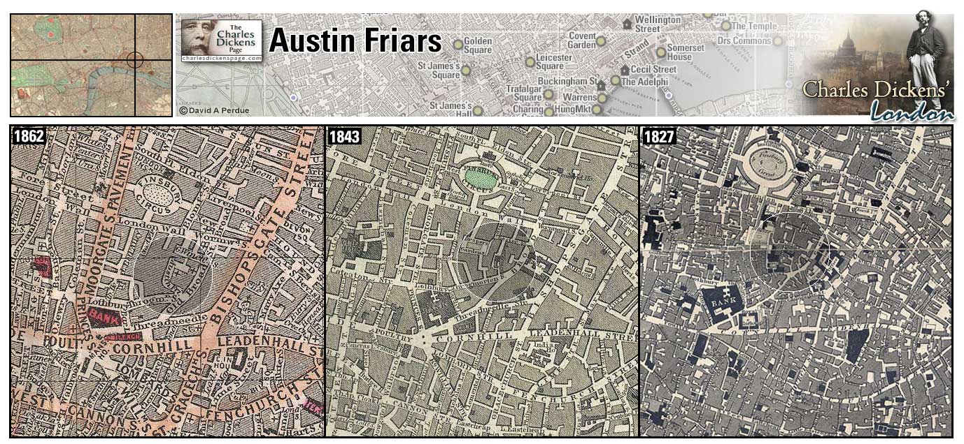
Austin Friars (Map: D-11) - Street named for a Augustinian monastery founded here in 1253. The friary was dissolved by Thomas Cromwell in 1538 and later became home to the Dutch Church (Weinreb et al, 2008, p. 31-32).
- The office of Mr Fips, solicitor to Old Martin Chuzzlewit who hires Tom Pinch to organize his library, was located here (Martin Chuzzlewit).
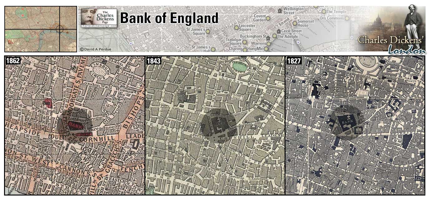
Bank of England (Map: D-10) - Established in 1694, and known as the Old Lady of Threadneedle Street, the Bank was privately owned until 1946 when it was nationalized and came under government control (Weinreb et al, 2008, p. 37-38).
- Arthur Clennam and Daniel Doyce shared a portion of a roomy house in one of the grave old-fashioned City streets, lying not far from the Bank of England, by London Wall (Little Dorrit).
Zoom Photo Google Wikipedia Aerial 9 Back
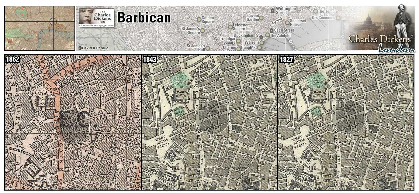
Barbican (Map: C-10) - Area named for an outer fortification of the City. The area was heavily damaged by German bombs in 1940 (Weinreb et al, 2008, p. 40).
- Oliver Twist and Bill Sikes pass through the Barbican on their way to burglarize the Maylie home (Oliver Twist).
- Simon Tappertit and the Prentis Knights have headquarters here (Barnaby Rudge).
- Tom Pinch finds himself lost in the Barbican while searching for Furnival's Inn (Martin Chuzzlewit).
- Pancks parts company with Arthur Clennam at Barbican just before Clennam comes across a crowd carrying John Baptist Cavalletto from the scene of the accident with the mail coach (Little Dorrit).
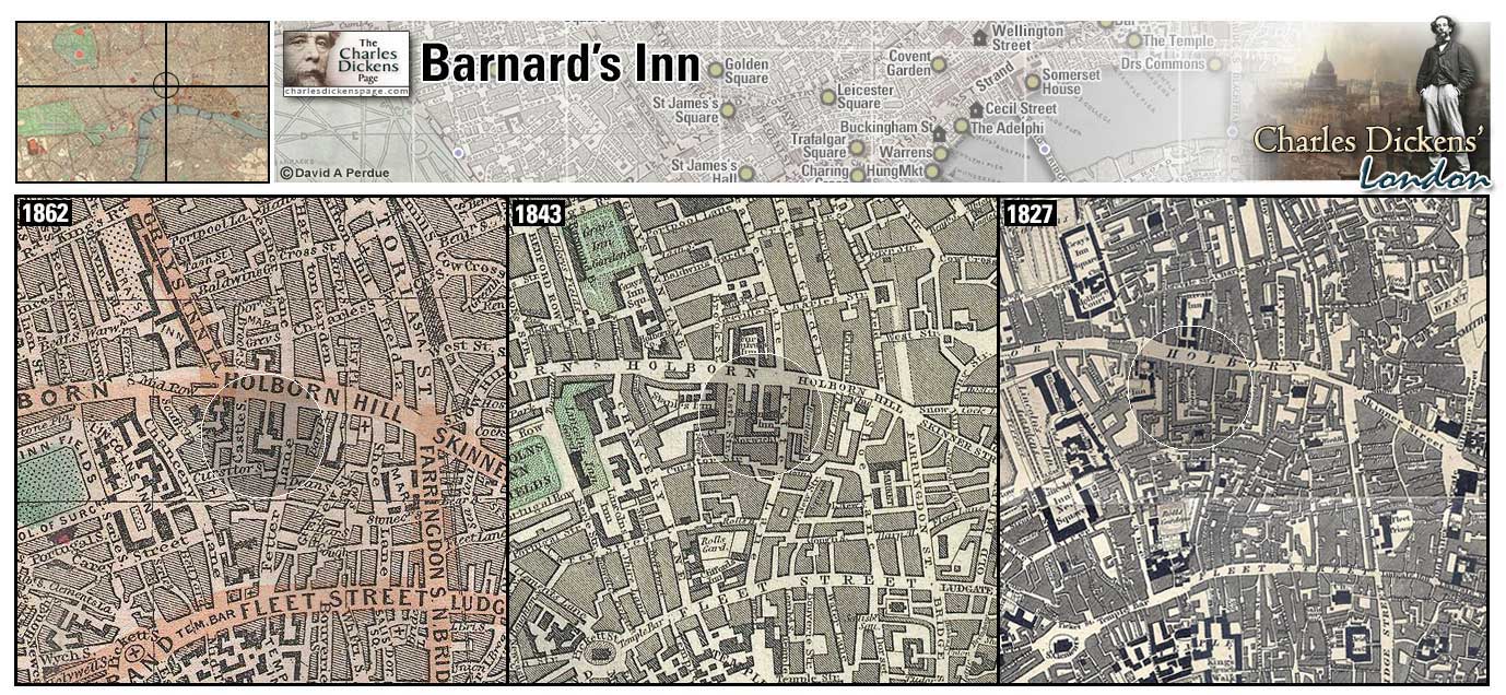
Barnard's Inn (Map: D-8) - One of the medieval Inns of Chancery which, during Dickens' time had effectively become residential chambers (Weinreb et al, 2008, p. 432). Dickens describes the Inn in Great Expectations as "the dingiest collection of shabby buildings ever squeezed together in a rank corner as a club for Tom-cats" (Great Expectations, p. 162).
- Pip and Herbert Pocket have dilapidated chambers at Barnard's Inn (Great Expectations).
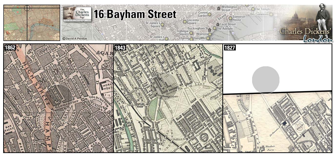
16 Bayham Street (Map: A-5) - Four-roomed house in Camden Town that the Dickens family rented for £22 a year upon their move from Chatham in 1822. Dickens later said of the area that "is was as shabby, dingy, damp, and mean a neighbourhood as one would desire not to see" (Ackroyd, 1990, p. 57-58).
- The Micawbers (David Copperfield) and the Cratchits (A Christmas Carol) live in this same house.
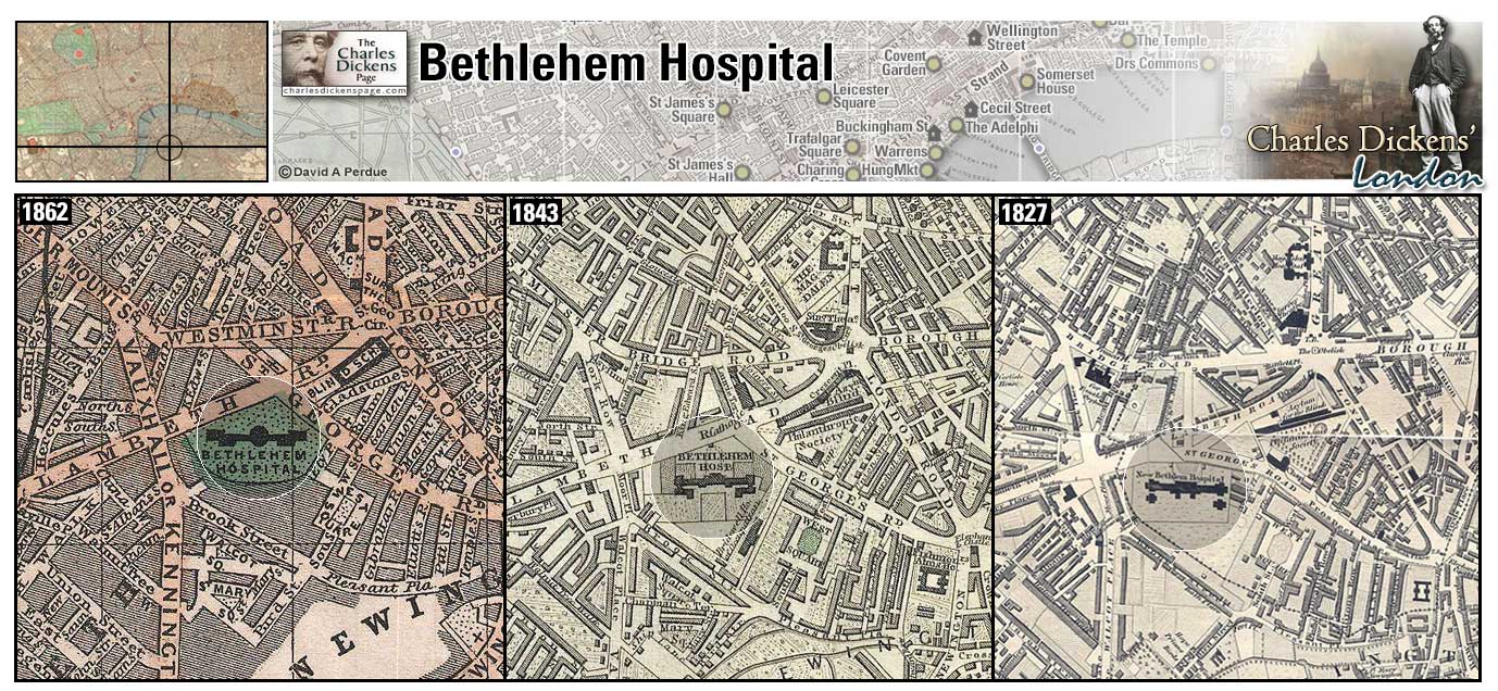
Bedlam (Map: G-8) - Officially Bethlehem Hospital, a hospital for the insane, founded in 1247. Originally the hospital was near Bishopsgate. It moved to Moorfields in 1676, and then to Southwark in 1815. The hospital moved to its present location in Croyden in 1930 (Weinreb et al, 2008, p. 63-64). Dickens uses the term "bedlam" to describe any act of lunacy.
- On contemplating the lunacy of his clerk, Bob Cratchit, taking on a wife and family on 15 shillings a week, Ebenezer Scrooge laments "I'll retire to Bedlam" (A Christmas Carol).
- Dickens describes the mob during the Gordon Riots: "If Bedlam gates had been flung wide open, there would not have issued forth such maniacs as the frenzy of that night had made " (Barnaby Rudge).
Zoom Google Wikipedia Aerial 4 Back
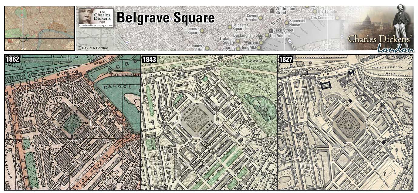
Belgrave Square (Map: G-4) - Fashionable square in Belgravia, named for Lord Grosvenor who also had the title of Viscount Belgrave. Formerly a swamp filled in with dirt from St. Katherine's Dock, it was developed by Thomas Cubitt in 1826 (Weinreb et al, 2008, p. 56).
- The Wititterly's live near here (Nicholas Nickleby).
- Dickens bought the carriage used on the 1844-45 trip to Italy at the Pantechnicon (business selling carriages) located in Belgrave Square. (Pictures from Italy)
Zoom Google Wikipedia Aerial 8 Back
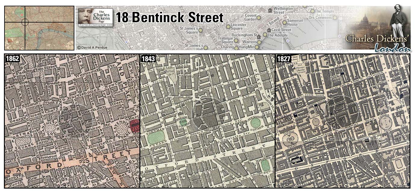
18 Bentinck Street (Map: D-4) - John Dickens moved his family here at the beginning of 1833 and Charles celebrated his twenty-first birthday with a party here four days after the fact on February 11, 1833 (Johnson, 1952, p. 73).
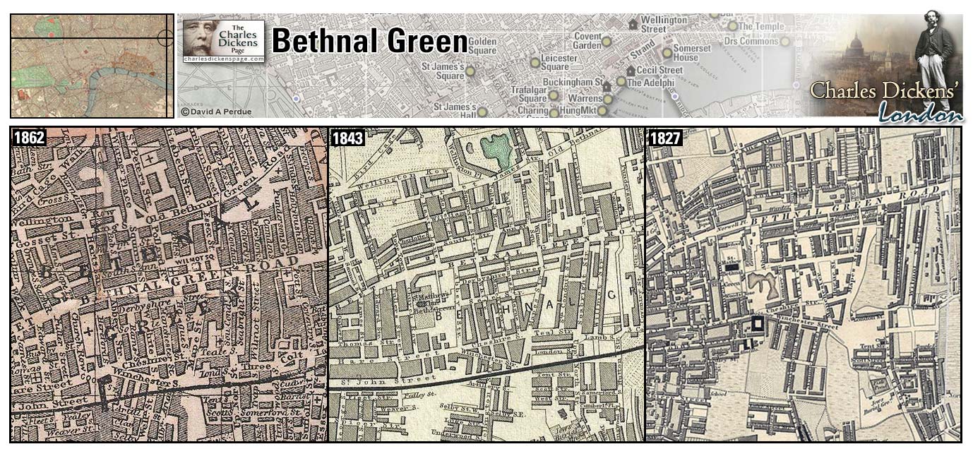
Bethnal Green (Map: B-13) - Area in London's east end and one of the poorest parts of the metropolis in Dickens' time (Weinreb et al, 2008, p. 64).
- Bill Sikes and Nancy live in a house in Bethnal Green (Oliver Twist).
- Mortimer Lightwood and Eugene Wrayburn are heading to Bethnal Green when they are spied upon by Bradley Headstone (Our Mutual Friend).
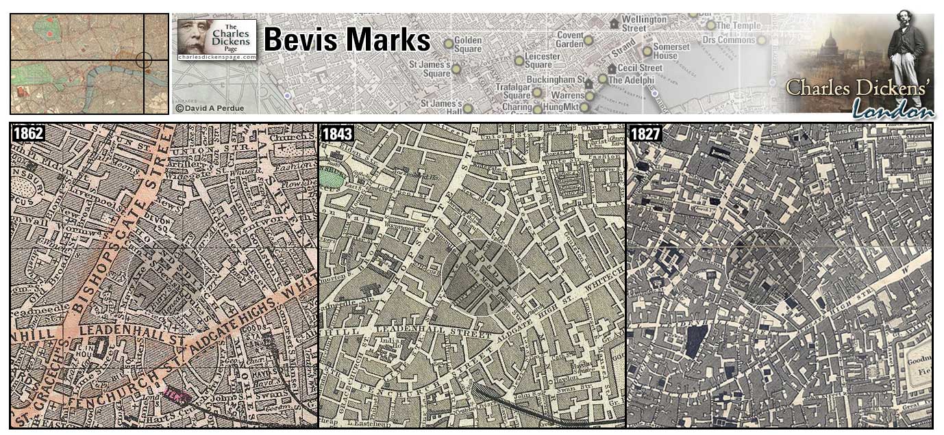
Bevis Marks (Map: D-11) - Street just inside the Roman city wall. Its name is a corruption of Burics Marks, the house of the Abbot of Bury St. Edmunds which was once located here (Weinreb et al, 2008, p. 65).
- Sampson and Sally Brass have an office at No. 10 Bevis Marks. (The Old Curiosity Shop).
Zoom Google Wikipedia Aerial 9 Back
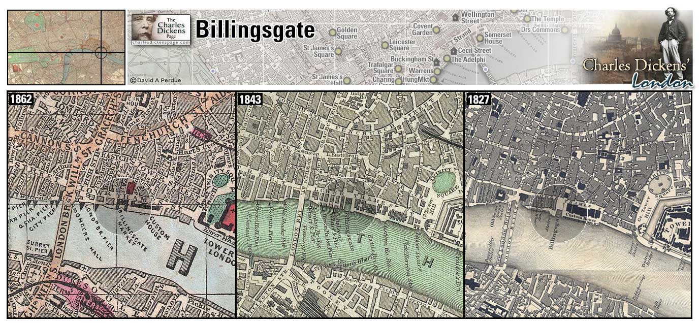
Billingsgate (Map: E-11) - London's preferred wharf for shipping because of its location below London Bridge. It became the City's official fish market in 1698. Also reknowned for the foul language used there (Weinreb et al, 2008, p. 69).
- Amy Dorrit tries to set her brother Tip up in the Billingsgate (fish) trade (Little Dorrit).
- Pip and Herbert Pocket pass Billingsgate on their way to smuggle Magwitch out of England. (Great Expectations).
- Charles Dickens, in his sketch Night Walks, passes Billingsgate in the disappointed hope of finding some market people about at that late hour (The Uncommercial Traveller).
Zoom Dictionary Google Wikipedia Aerial 7 Aerial 6 Back
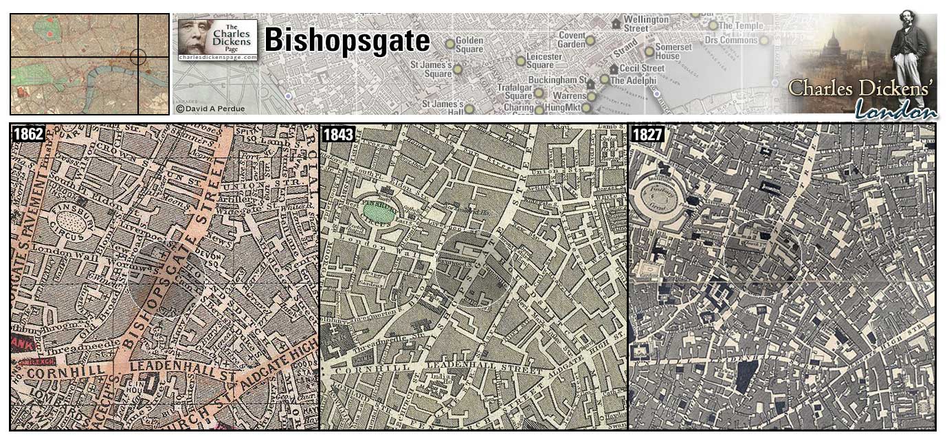
Bishopsgate (Map: D-11) - London Ward named for the northern gate in the walled medieval city (Weinreb et al, 2008, p. 70). In Dickens' time the area included many coaching inns convenient to passengers travelling on the Old North Road.
- One of the Gordon rioters was hanged at Bishopsgate (Barnaby Rudge).
- Brogley, 'sworn broker and appraiser', kept a second-hand furniture shop at Bishopsgate (Dombey and Son).
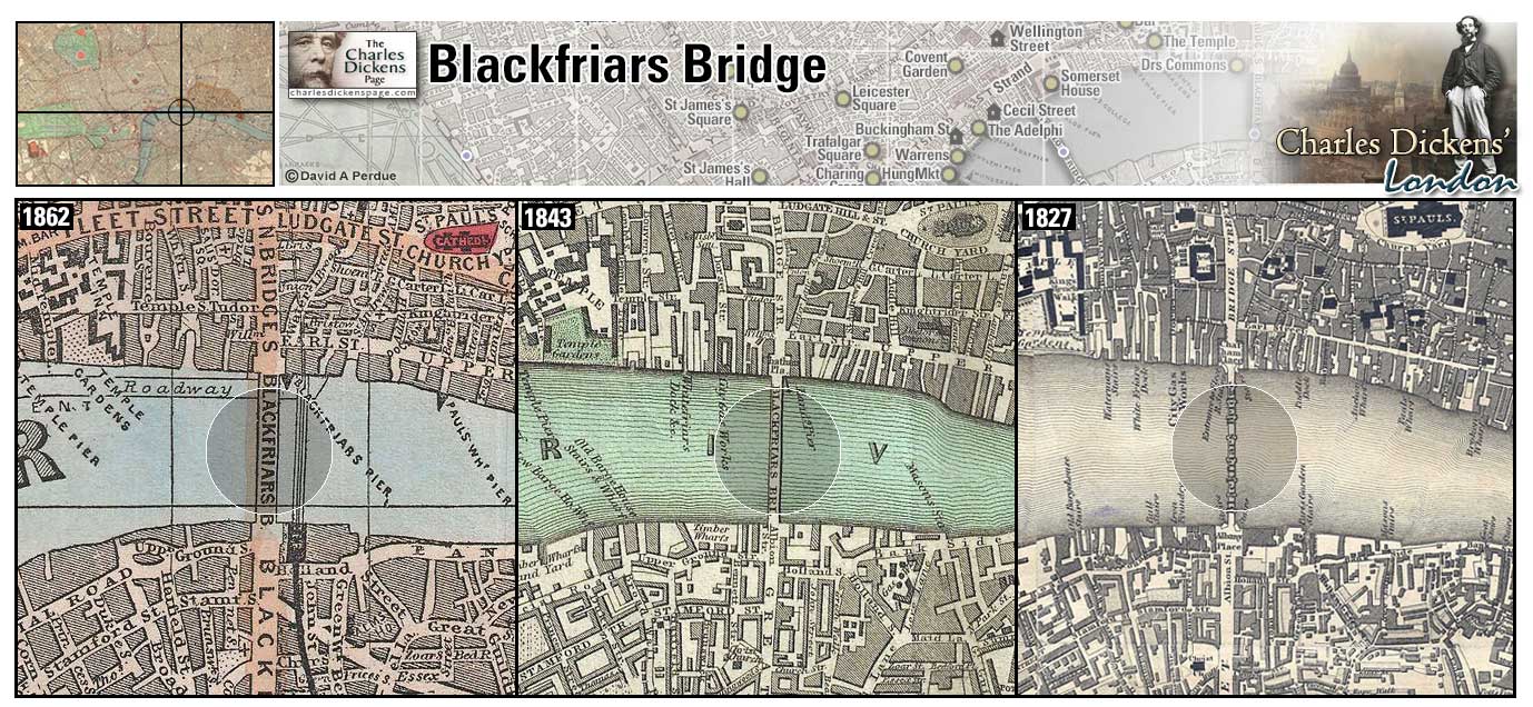
Blackfriars Bridge (Map: E-9) - Bridge over the Thames built in the late 1700's, demolished and rebuilt in the 1860s. The bridge was officially named the William Pitt Bridge but the public insisted on referring to it by the name of the Blackfriars Monastery close by. The Black Friars were Dominican monks who set up a priory in the area in 1221 (Weinreb et al, 2008, p. 71-72).
- Hugh breaks open the tollhouses on Blackfriars Bridge during the Gordon Riots (Barnaby Rudge).
- Jo stops to rest and eat on Blackfriars Bridge and gazes upon the cross atop St Paul's. George Rouncewell crosses Blackfriars Bridge on his way to visit the Bagnets (Bleak House).
- Arthur Clennam and Thomas Plornish cross Blackfriars Bridge on their way to the Marshalsea to gain Tip's release (Little Dorrit).
- Pip practices rowing a boat between Temple Stairs and Blackfriars Bridge prior to the attempt to get Magwitch out of England (Great Expectations).
- Dickens frequently crossed this bridge while working at Warren's Boot Blacking factory to visit his family at the Marshalsea prison in Southwark.
Zoom Dictionary Photo Google Wikipedia Aerial 7 Back
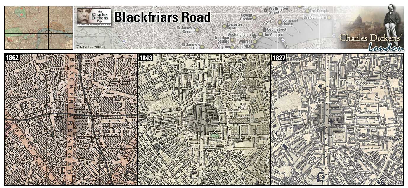
Blackfriars Road (Map: F-9) - Road built between 1770 and 1800 in Southwark that runs from Blackfriars Bridge to the Obelisk in St. George's Circus. Formerly known as Great Surrey Street (Weinreb et al, 2008, p. 73).
- George Rouncewell takes Blackfriars Road on his way to visit the Bagnets (Bleak House).
- David Copperfield has his box and money stolen by a young man with a donkey-cart in Blackfriars Road near the Obelisk as he is running away from Murdstone and Grinby's to his aunt's home in Dover (David Copperfield).
Zoom Google Wikipedia Aerial 4 Back
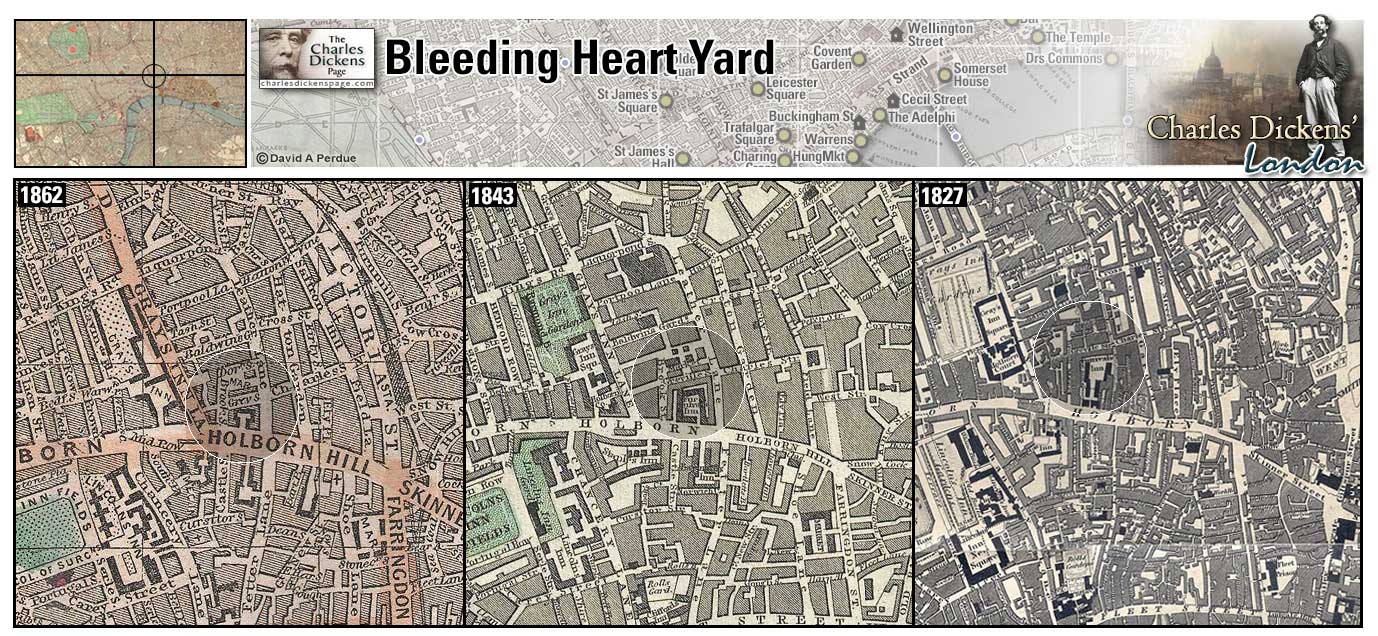
Bleeding Heart Yard (Map: C-8) - A cobbled courtyard off Greville Street in the City of London and part of the original courtyard of Hatton House. The courtyard got its name from a ghostly tale in which Lady Hatton partners with the Devil in order to obtain favors for her husband, Sir Christopher Hatton. After favors are granted Lady Hatton neglects to give the Devil his due and the residents of the Yard find her bleeding heart lying by the pump. The ghost of Lady Hatton is said to haunt the Yard and the tale, part of The Ingoldsby Legends by Rev. Richard Barham, ends with a warning:
The last piece of advice which I'd have you regard
Is, "don't go of a night into Bleeding-Heart-Yard,"
It's a dark, little, dirty, black, ill-looking square,
With queer people about, and unless you take care,
You may find, when your pocket's clean'd out and left bare,
That the iron one is not the only "Pump" there!
(Weinreb et al, 2008, p. 75).
- The Plornish family lives in Bleeding Heart Yard and the factory owned by Daniel Doyce and Arthur Clennam was also here (Little Dorrit).
Zoom Google Wikipedia Aerial 3 Back
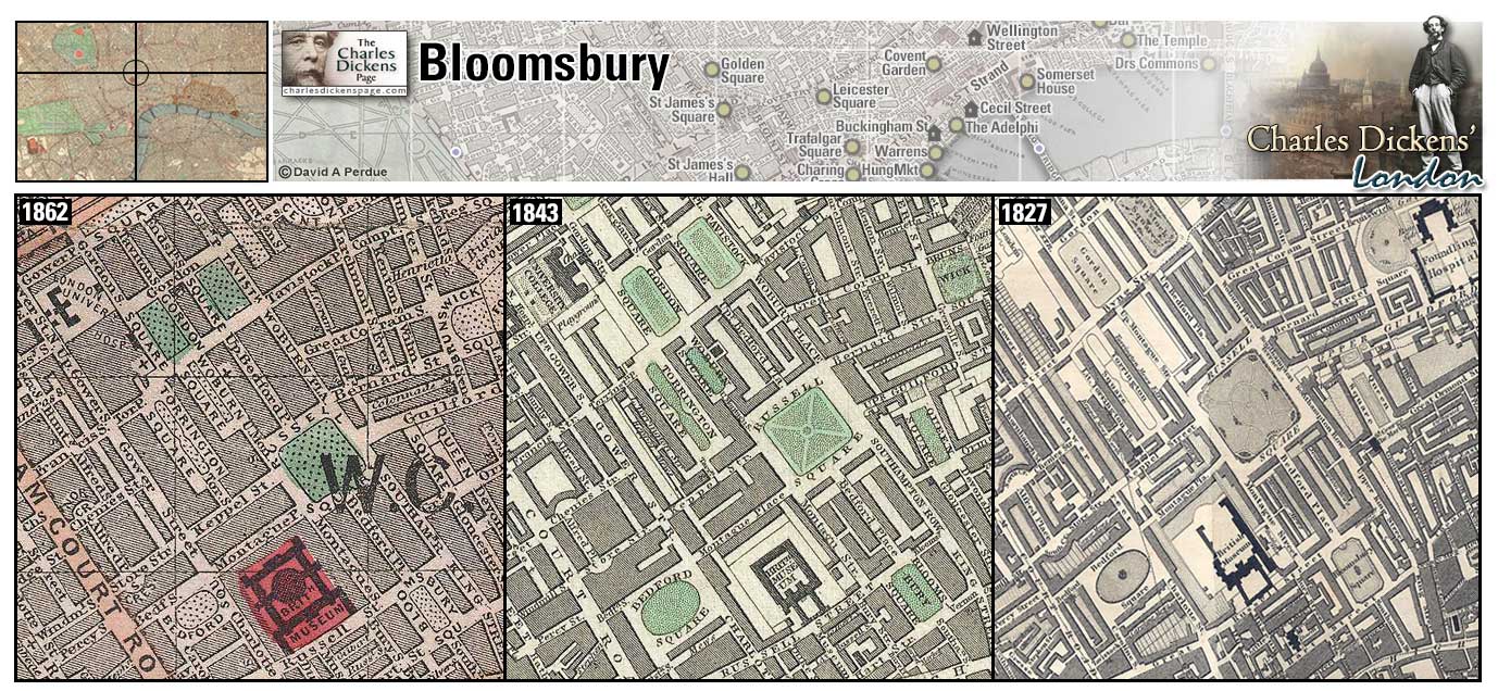
Bloomsbury (Map: C-6) - Residential area of Holborn. Charles Dickens lived at Doughty Street (now the Charles Dickens Museum) here from 1837-1839 and at Tavistock House here from 1851-1860.
- Barnaby Rudge is to be hanged in Bloomsbury Square for his part in the Gordon Riots (Barnaby Rudge).
- Rosa Bud and Miss Twinkleton take lodging at Mrs Billickin's lodging house on Southhampton Street Bloomsbury Square (The Mystery of Edwin Drood).
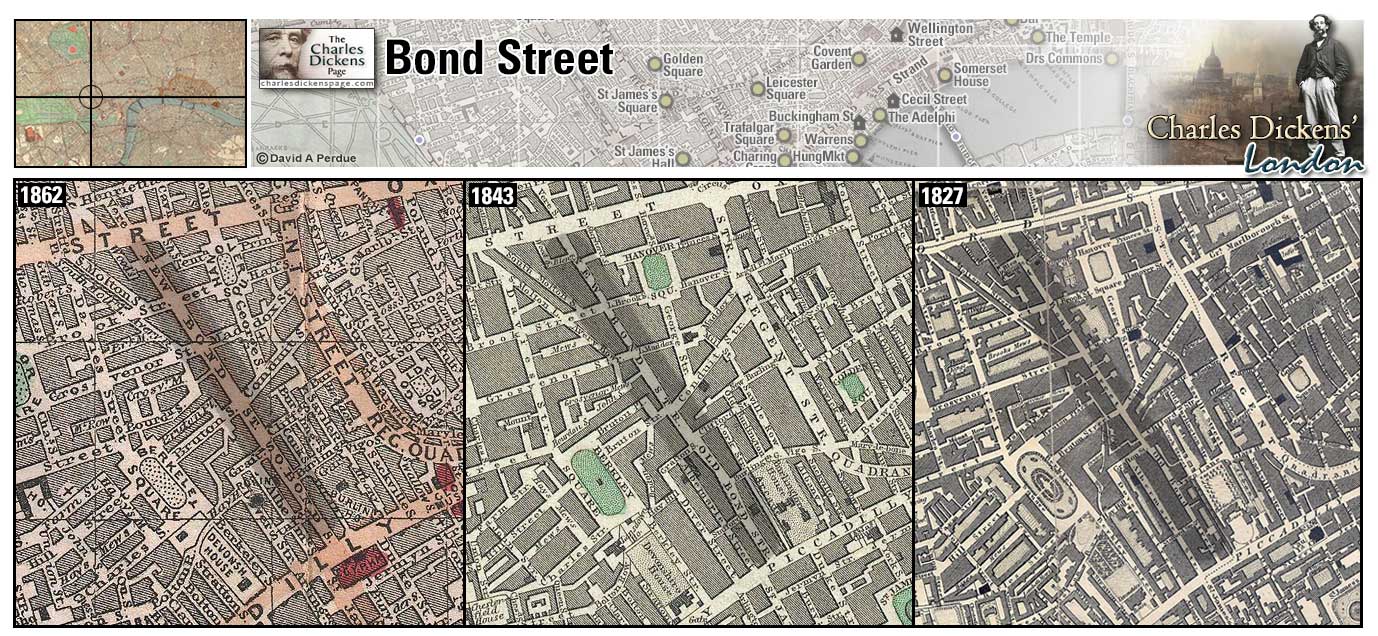
Bond Street (Map: E-5) - Area of Fashionable shops in Northwest London. Dickens uses Bond Street as an example of a well-to-do area of the City.
- Mrs Billickin, describing the residence which Mr Grewgious is considering renting for Rosa Bud, says "It is not Bond Street nor yet St. James's Palace; but it is not pretended that it is." (The Mystery of Edwin Drood).
- Nicholas Nickleby encounters Sir Mulberry Hawk at a handsome hotel along one of the thoroughfares between Park Lane and Bond Street (Nicholas Nickleby).
- Cousin Feenix has a sleepy shave at Long's Hotel in Bond Street (Dombey and Son).
- The doll's dressmaker, Jenny Wren, tells Fascination Fledgeby that she has two dolls to drop off in Bond Street (Our Mutual Friend).
Zoom Dictionary Google Wikipedia Aerial 10 Back
The Boot (Map: B-7) - The original Boot tavern was located in the fields behind the Foundling Hospital and was of bad repute. The area was made over in the early 19th century and the present Boot Tavern at 116 Cromer Street was rebuilt on or near the site of the original tavern (Hayward, 1924, p. 20).
- Historical headquarters of the Gordon Rioters (Barnaby Rudge).
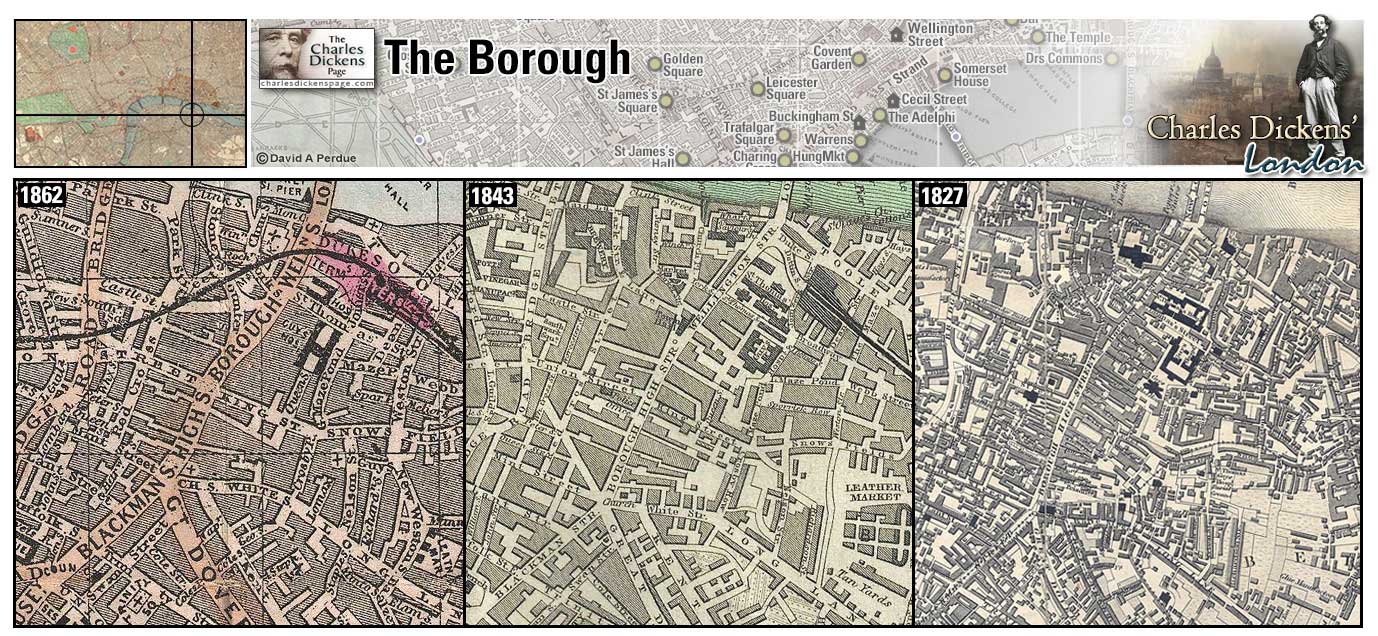
The Borough (Map: G-10) - Area south of London bridge in Southwark.
- It was at the White Hart Inn, in the Borough, that Samuel Pickwick meets Sam Weller. Samuel Pickwick and Wardle catch up with Alfred Jingle and Rachael Wardle after their mad dash to be married (Pickwick Papers).
- Much of the action in Little Dorrit happens in the Borough (Little Dorrit).
- The rioting mob burn the Clink and King's Bench prisons in the Borough during the Gordon Riots (Barnaby Rudge).
Zoom Dictionary Photo Google Aerial 7 Back
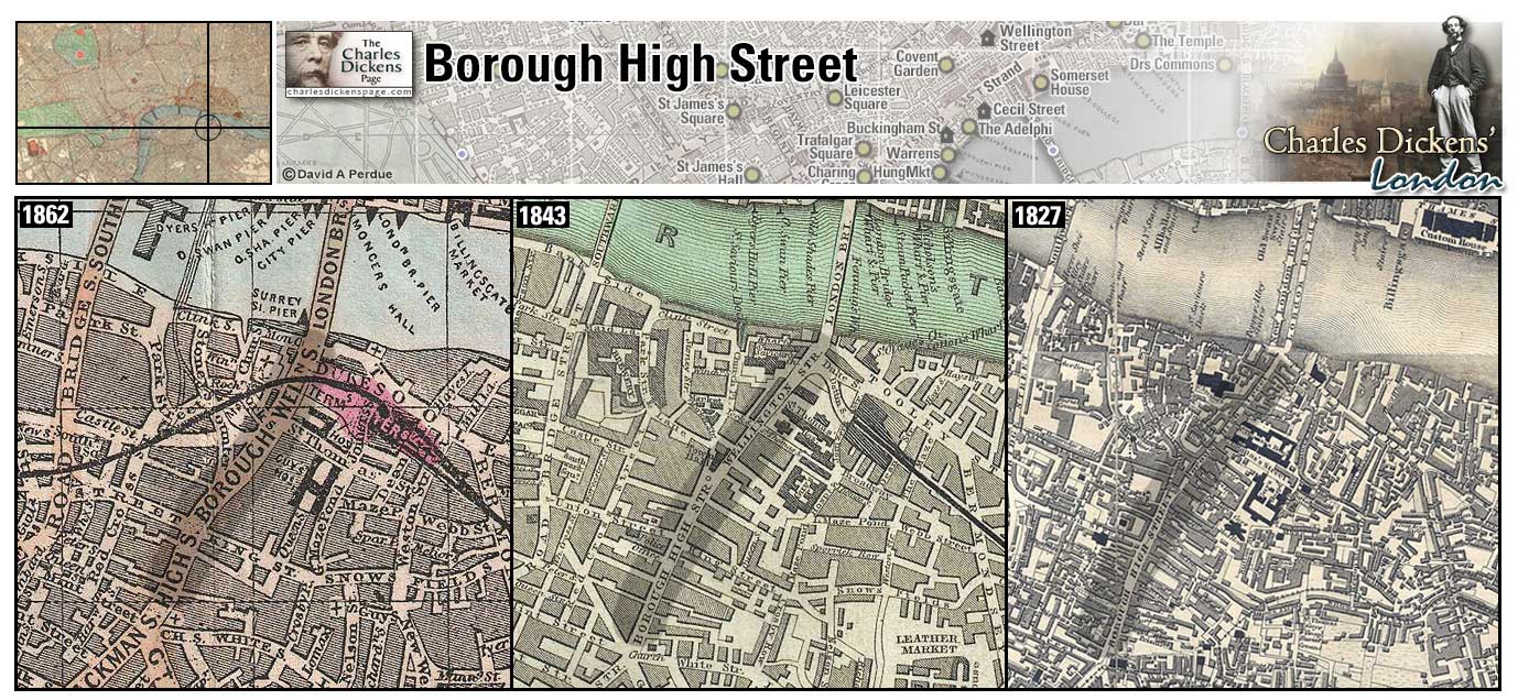
Borough High Street (Map: F-10) - Major thoroughfare in Southwark lined with coaching inns for travelers coming to London from the south (Weinreb et al, 2008, p. 82-83).
- Borough High Street is mentioned in the tale told by the little old man to Samuel Pickwick and Sam Weller in the Magpie and Stump public house (Pickwick Papers).
- Much of the action in Little Dorrit happens in and around Borough High Street (Little Dorrit).
Zoom Google Wikipedia Aerial 4 Back
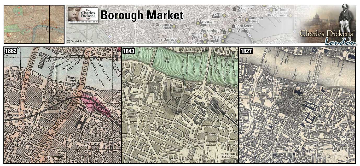
Borough Market (Map: F-10) - May be the oldest fruit and vegetable market in London. The original market had spread to the southern end of London Bridge by 1276. By the mid 18th century the market was causing such a disruption to traffic that it was closed. The City granted the parishioners of St Saviour's church to set up a new market in a different location which still exists (Weinreb et al, 2008, p. 83).
- Sam Weller polishes the boots of a farmer who was resting after spending the morning selling at Borough Market. A drunken Ben Allen knocked double knocks at the door of the Borough Market office, and took short naps on the steps alternately, until daybreak, under the firm impression that he lived there, and had forgotten the key (Pickwick Papers).
Zoom Google Wikipedia Aerial 4 Aerial 7 Back
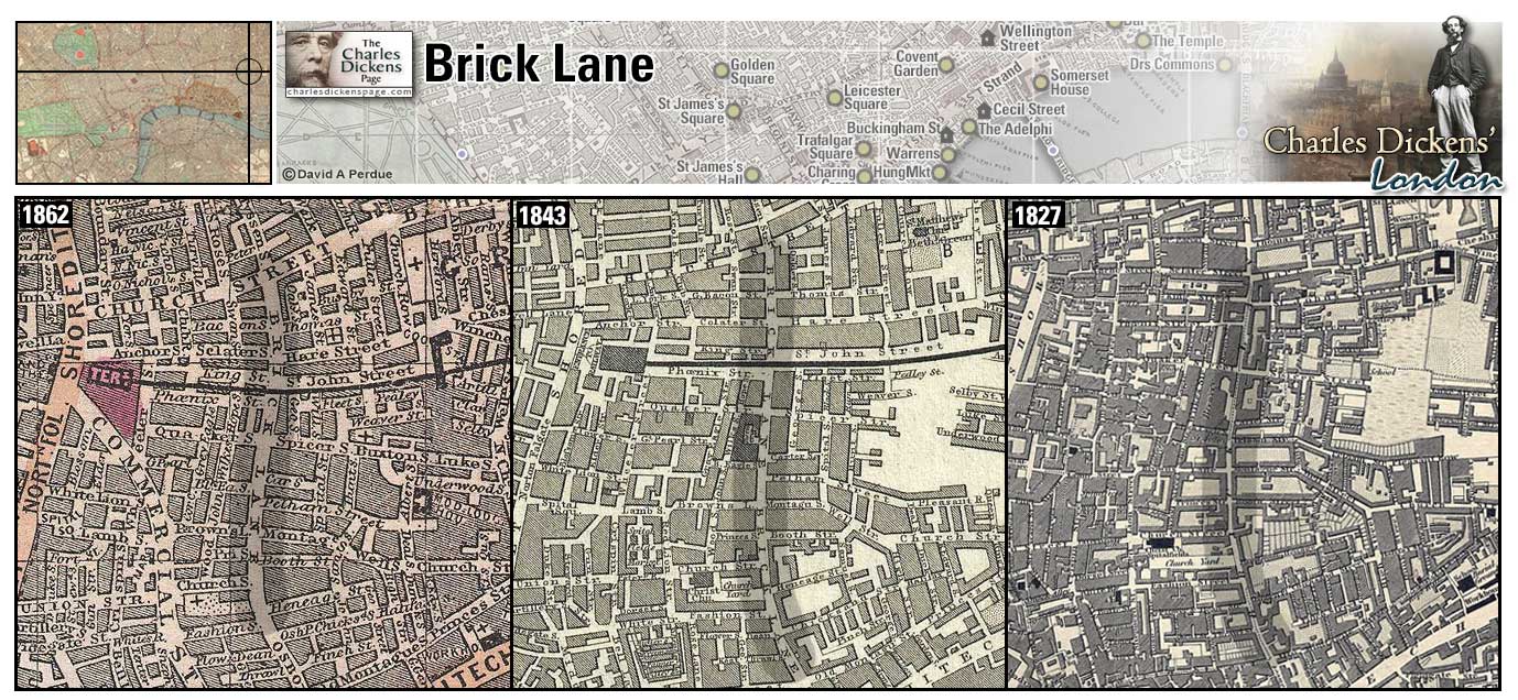
Brick Lane (Map: C-12 ) - Street in London's East End named for the brick and tile manufactured nearby in the 16th century (Weinreb et al, 2008, p. 91).
- Home of the Brick Lane Branch of the United Grand Junction Ebenezer Temperance Association where Susan Weller is a member (Pickwick Papers).
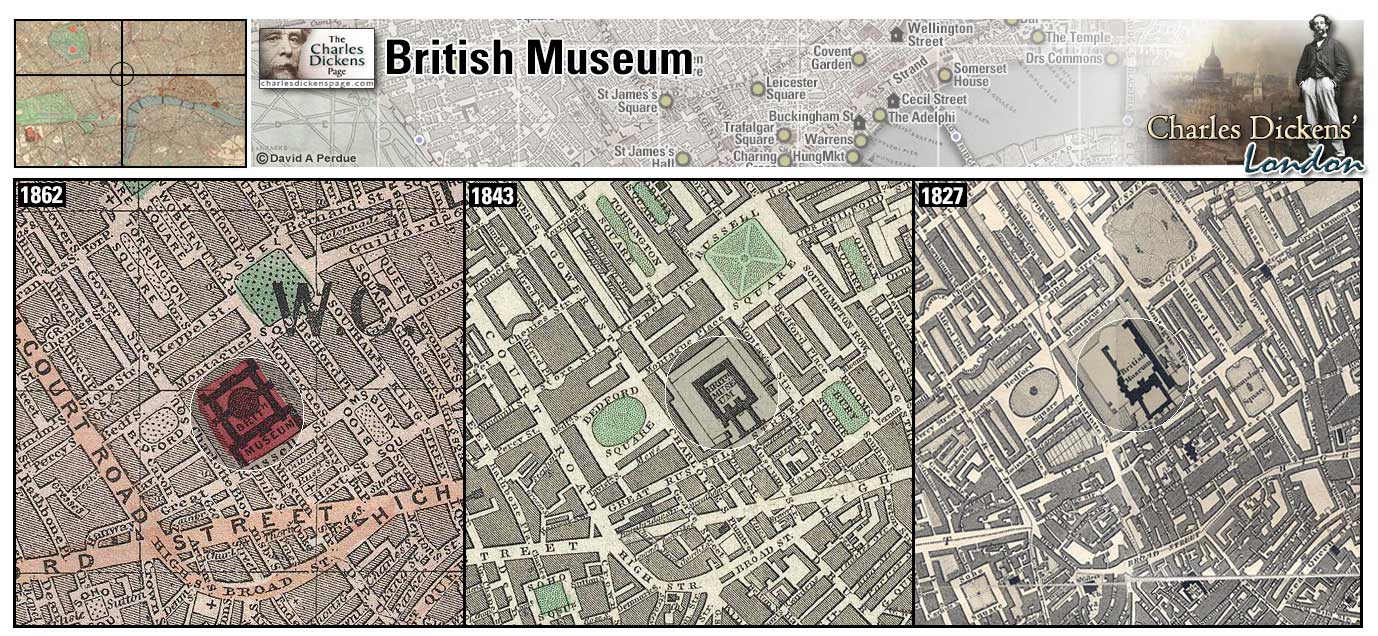
British Museum (Map: C-7) - The collection was originally housed at Montagu House, Bloomsbury and opened in 1759 although public access was limited. The current neo-classical building was completed in 1857 (Weinreb et al, 2008, p. 95-97).
- David Copperfield and James Steerforth visit the Museum. (David Copperfield)
Zoom Photo Google Wikipedia Aerial 3 Back
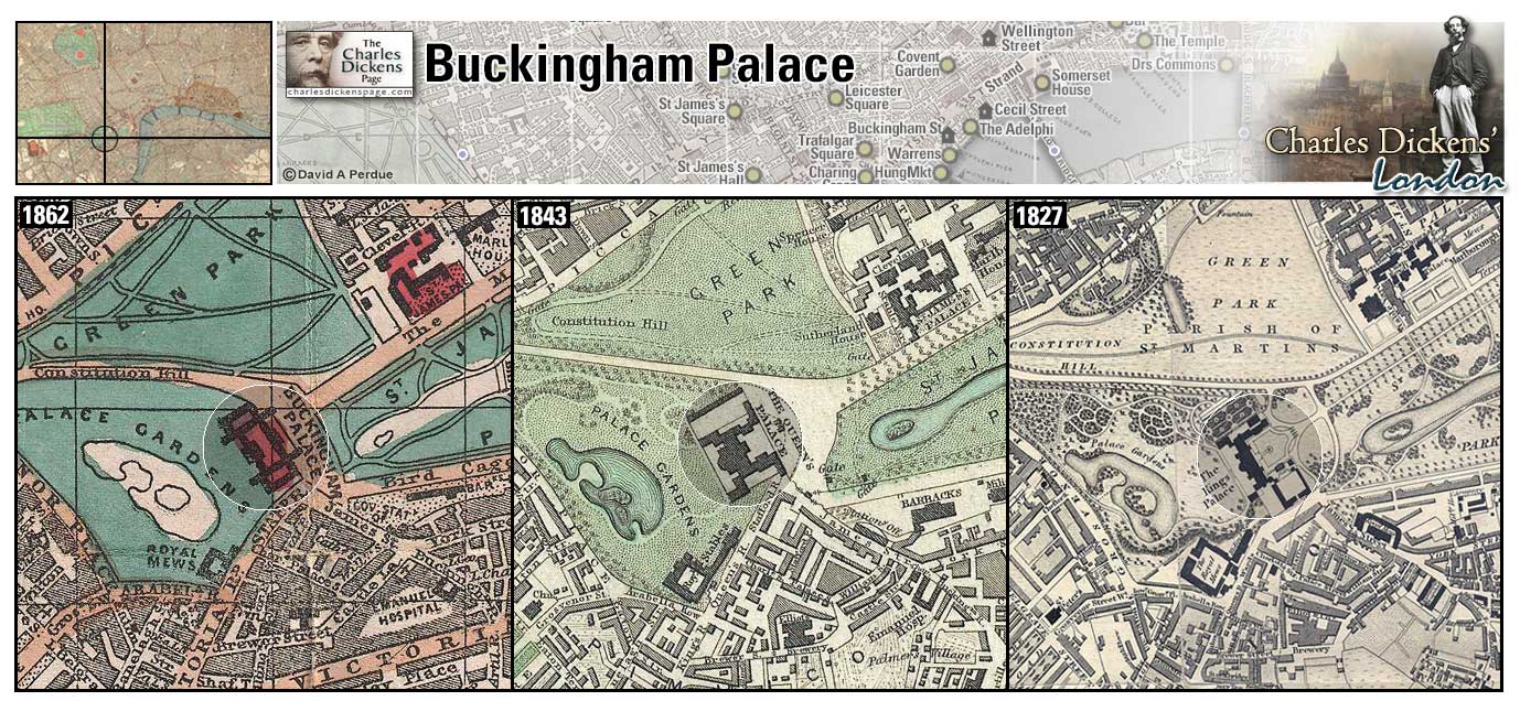
Buckingham Palace (Map: F-5) - Built 1702-1705 for John Sheffield, 1st duke of Buckingham. Purchased for the royal family in 1762 by George III. It became the official London residence of the monarchy in 1837 when Queen Victoria moved there (Weinreb et al, 2008, p. 108-109). Dickens had a private audience with the Queen at Buckingham Palace in 1870 (Ackroyd, 1990, p. 1066).
Zoom Dictionary Photo Google Wikipedia Aerial 8 Back
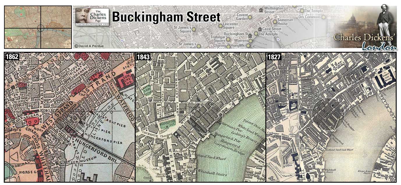
Buckingham Street (Map: E-7) - Street in West London running from the Strand down towards the Thames.
- David Copperfield takes lodging with Mrs Crupp at number 15 here (David Copperfield). Dickens lived in the same house briefly in 1832 while working as a parliamentary reporter.
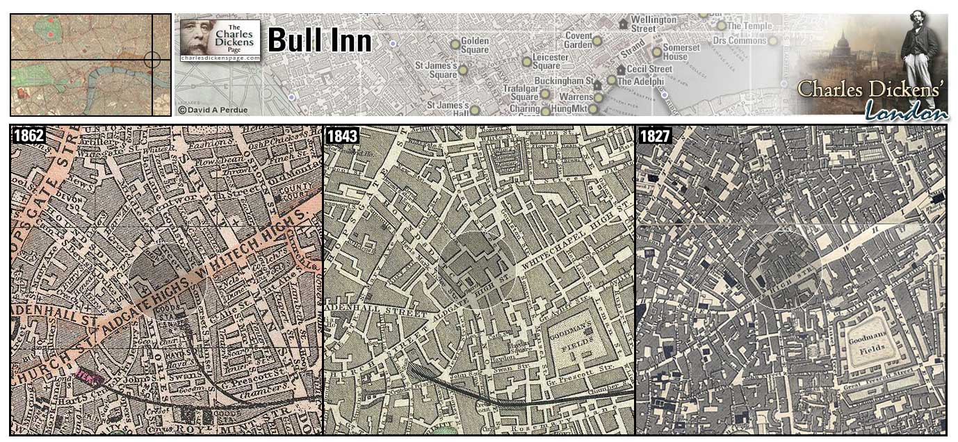
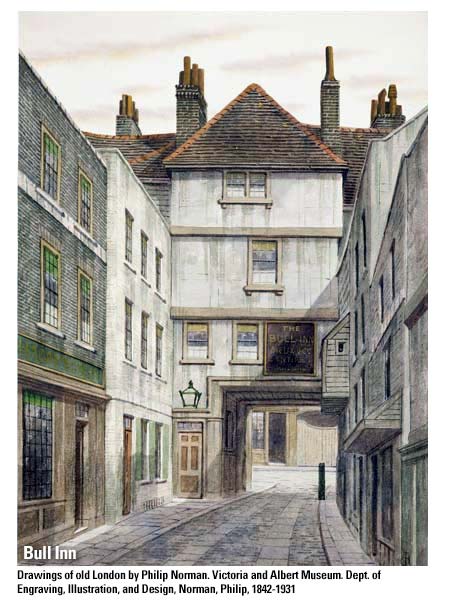
Bull Inn (Map: D-12) - Coaching Inn in Whitechapel. It was at its zenith shortly before the advent of railways, when Mrs Anne Nelson, coach proprietor, was the landlady. Mrs Nelson was called the "Napoleon and Caesar" of the coaching business. (Matz, 1921, p. 119-121).
- Samuel Pickwick and his friends start for Ipswich from here (Pickwick Papers).
Zoom Photo Google Aerial 9 Back
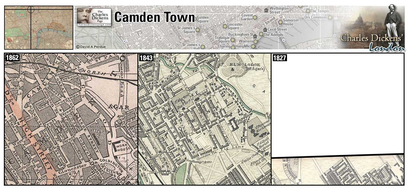
Camden Town (Map: A-6) - Rural suburb in northwest London at the start of the nineteenth century. Urban sprawl encroached first by Regent's Canal in 1816 and in the 1840s by the railroad. Dickens' family lived here in the early 1820s at 16 Bayham Street (Weinreb et al, 2008, p. 123). Twelve-year-old Charles had lodging at 37 Little College Street with Mrs Roylance while his father was in prison for debt and Charles worked at Warren's Blacking Factory (Hayward, 1924, p. 98).
- Fagin claims that Camden Town is ripe for taking money from children running errands for their mothers (Oliver Twist).
- The Cratchits live in Camden Town (A Christmas Carol).
- Tommy Traddles and the Micawbers live in Camden Town (David Copperfield).
- Polly Toodle's family lives in Camden Town where the railroad is being built. (Dombey and Son).
Zoom Dictionary Google Wikipedia Back
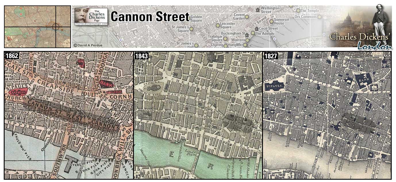
Cannon Street (Map: D-10) - Street leading from St. Paul's-churchyard to the end of King William-street. It was formerly known as Candelwrithe Street and then Candlewick Street, due to the candlemakers who lived there. Its present name is a corruption of these former names (Weinreb et al, 2008, p. 127).
- Mr Jinkins refuses to compare Todger's boarding house with a similar establishment in Cannon Street (Martin Chuzzlewit).
Zoom Dictionary Google Wikipedia Aerial 2 Aerial 6 Back
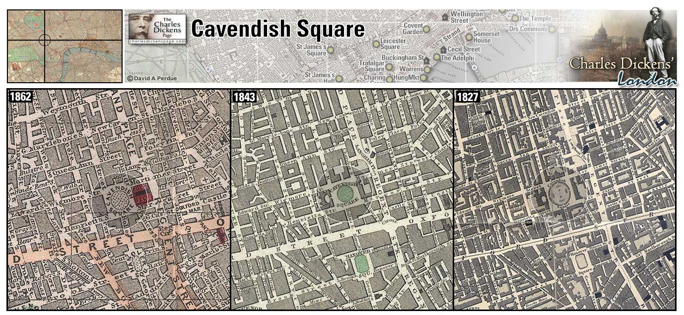
Cavendish Square (Map: D-5) - Fashionable square in West London. Developed by John Prince beginning in 1717 (Weinreb et al, 2008, p. 136-137).
- Madame Mantalini has her dressmaking shop here (Nicholas Nickleby).
- The Merdles live in Harley Street, Cavendish Square (Little Dorrit).
- Lord George Gordon lives /at Welbeck Street near the square (Barnaby Rudge).
- Silas Wegg maintains a stall near the house the Boffins later occupy near Cavendish Square (Our Mutual Friend).
Zoom Dictionary Google Wikipedia Aerial 10 Back
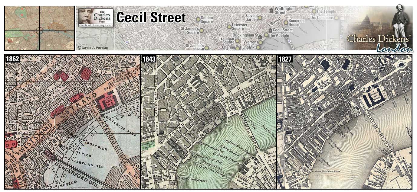
Cecil Street (Map: E-7) - Former street leading from the Strand down to the river. A young Charles Dickens took lodgings in Cecil Street briefly in 1832 while working as a parliamentary reporter (Ackroyd, 1990, p. 146).
- Watkins Tottle lived in Cecil Street during his bachelor days in the sketch A Passage in the Life of Mr Watkins Tottle (Sketches by Boz).
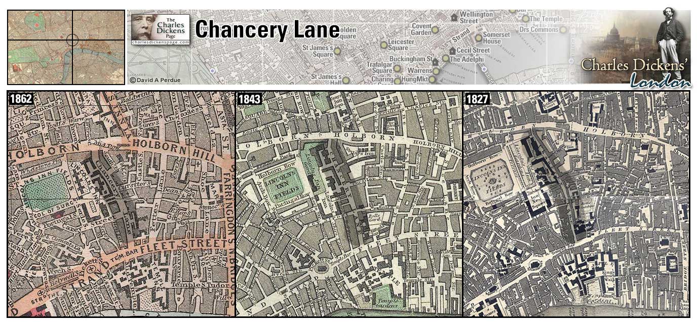
Chancery Lane (Map: D-8) - London street associated with the legal profession. In Dickens' time Chancery cases were heard by the Lord High Chancellor at Lincoln's Inn Hall off Chancery lane (Davis, 1999, p. 55).
- Jarndyce and Jarndyce was heard here, Krook's Rag and Bone Shop, where Miss Flite and Nemo/Captain Hawdon have rooms, and the residences of the Jellybys and the Snagsbys were in the vicinity of Chancery Lane (Bleak House).
Zoom Google Wikipedia Aerial 2 Aerial 3 Back
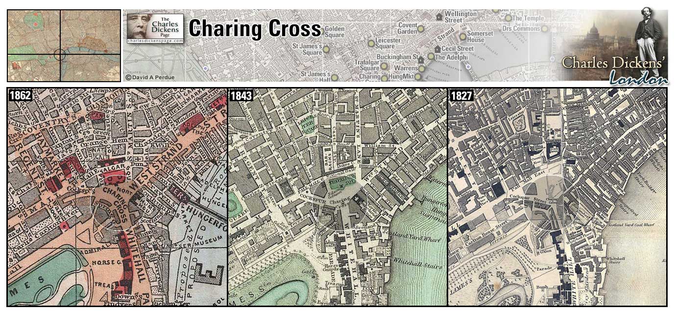
Charing Cross (Map: E-6) - District of London named for the last of the stone crosses erected by Edward I in 1291 to mark the stops of Queen Eleanor's funeral procession from Nottinghamshire to Westminster Abbey. The original Charing Cross was taken down and demolished during the English Civil War in the 1640s. An equestrian statue of Charles has stood on the spot since 1675. The present Eleanor Cross was erected in 1863 a little ways down the Strand from the original (Weinreb et al, 2008, p. 148).
- The Pickwickians begin their travels at the Golden Cross Hotel here (Pickwick Papers).
- David Copperfield stayed at the same hotel referring to it as "a mouldy sort of establishment in a close neighborhood" (David Copperfield).
- Eugene Wrayburn stops at Charing Cross "to look about him, with as little interest in the crowd as any man might take" after leaving Jenny Wren's house in Millbank (Our Mutual Friend).
Zoom Dictionary Google Wikipedia Aerial 5 Back
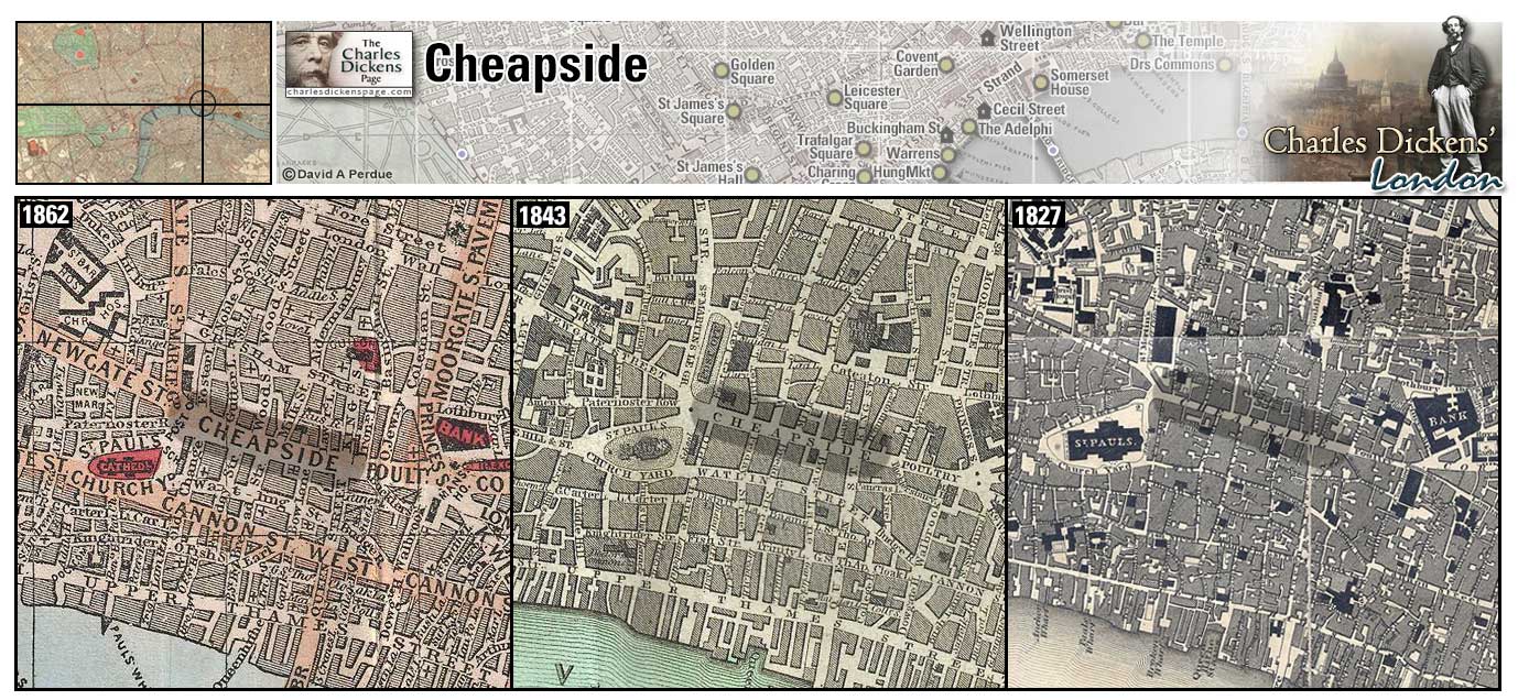
Cheapside (Map: D-10) - Medieval London's shopping district, ceap was Old English for market (Weinreb et al, 2008, p. 153).
- Tim Linkinwater was reportedly seen walking down Cheapside with an uncommonly handsome spinster (Nicholas Nickleby).
- Mould, the undertaker, lives here (Martin Chuzzlewit).
- Samuel Pickwick is taken to meet Tony Weller at an inn in Cheapside (Pickwick Papers).
- During the Gordon Riots there "were rumours of martial law being declared and dismal stories of prisoners having been seen hanging on lamp-posts in Cheapside and Fleet Street" (Barnaby Rudge).
- Pip, like Dickens himself as described in Dullborough Town, comes to London from Kent in a stage coach and arrives at the Cross Keys, Wood Street, Cheapside (Great Expectations).
Zoom Dictionary Photo Google Wikipedia Aerial 2 Aerial 3 Back
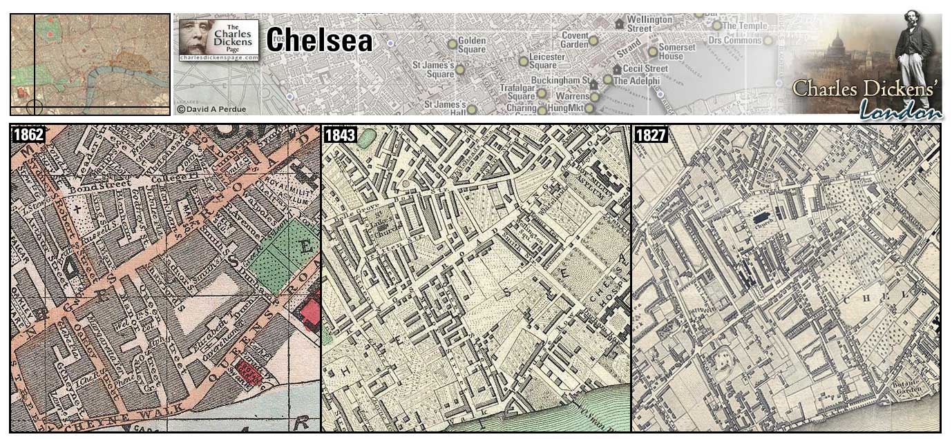
Chelsea (Map: H-4) - Residential area of West London where Dickens married Catherine Hogarth in 1836 (Hayward, 1924, p. 33).
- Richard Carstone studies medicine at Bayham Badger's in Chelsea (Bleak House).
- Sophy Wackles lives with her widowed mother and two sisters, with whom she runs a day-school for girls, in Chelsea (Old Curiosity Shop).
Zoom Dictionary Google Wikipedia Back
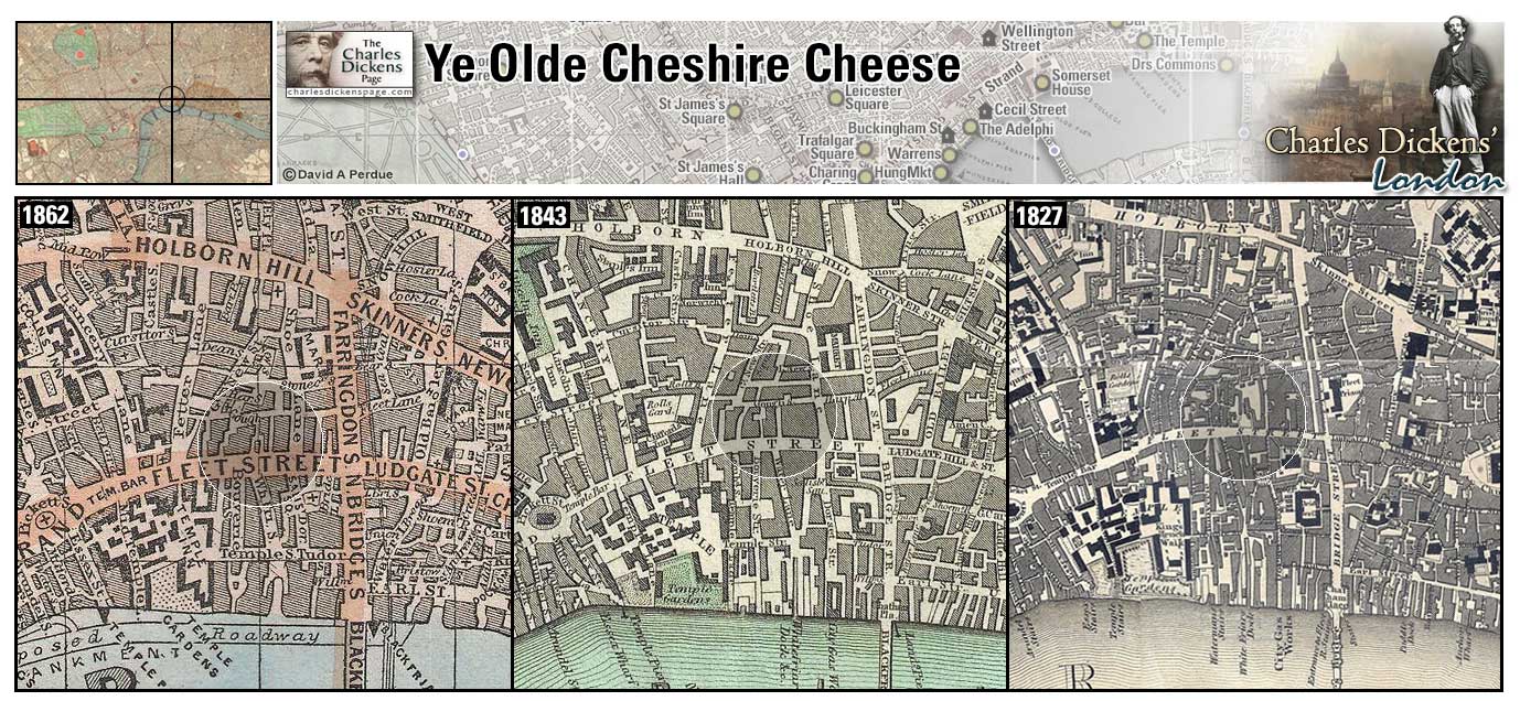
Ye Olde Cheshire Cheese (Map: D-9) - This charming little pub was frequented by Dickens (Weinreb et al, 2008, p. 160). The sign on the present building states that it was rebuilt in 1667 after it was destroyed in the Great Fire.
- Charles Darnay accompanies Sydney Carton down Ludgate hill to Fleet Street, and so, up a covered way, into a tavern. Here, they were shown into a little room, where Charles Darnay was soon recruiting his strength with a good plain dinner and good wine. This was almost certainly the Cheshire Cheese (A Tale of Two Cities).
- Read about a visit to Ye Olde Cheshire Cheese by Joseph Pennell for Harper's Weekly in November 1887.
Zoom Photo Google Wikipedia Aerial 2 Back
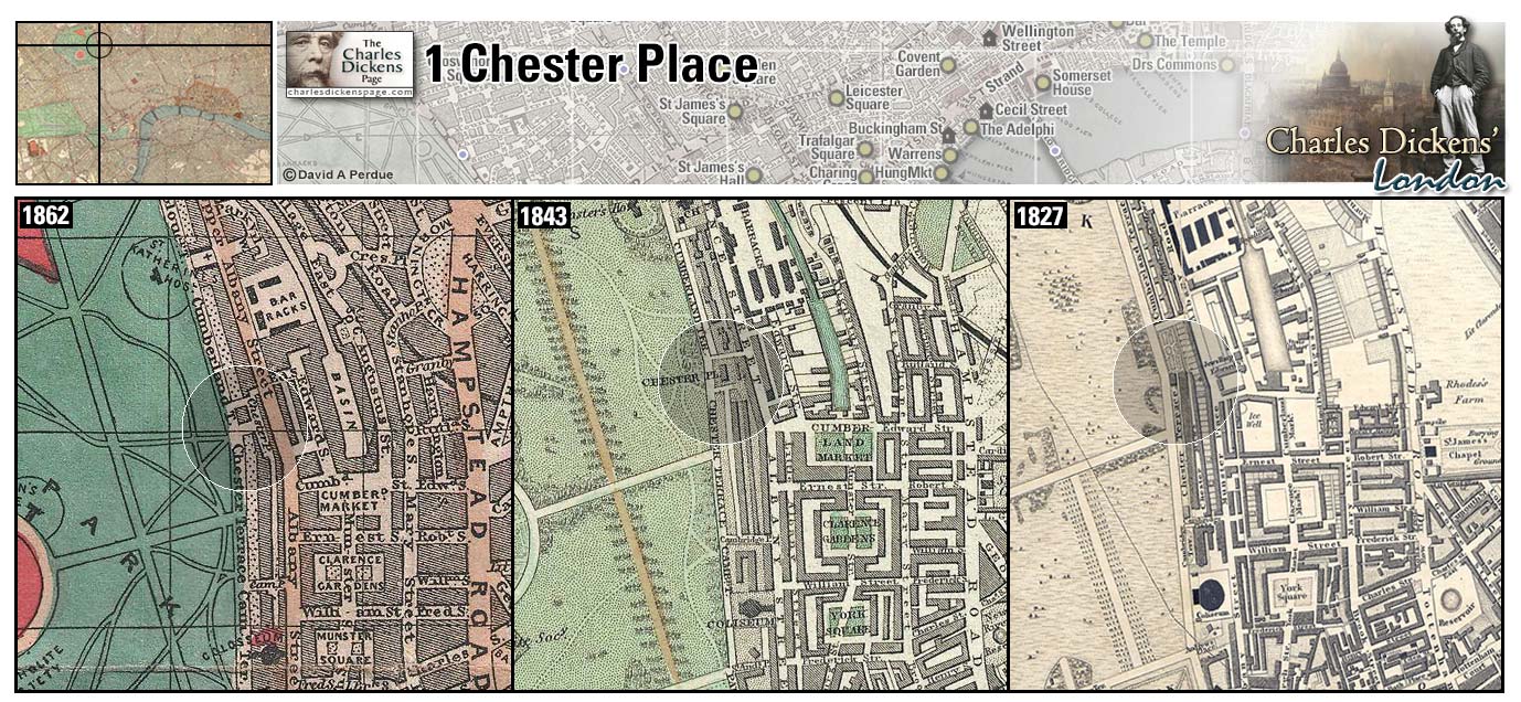
1 Chester Place (Map: B-5) - Elegant address on the east side of Regent's Park. Dickens and Catherine came from Paris and took lodging here for three months in 1847 while 10-year-old Charley recuperated from scarlet fever (Ackroyd, 1990, p. 523).
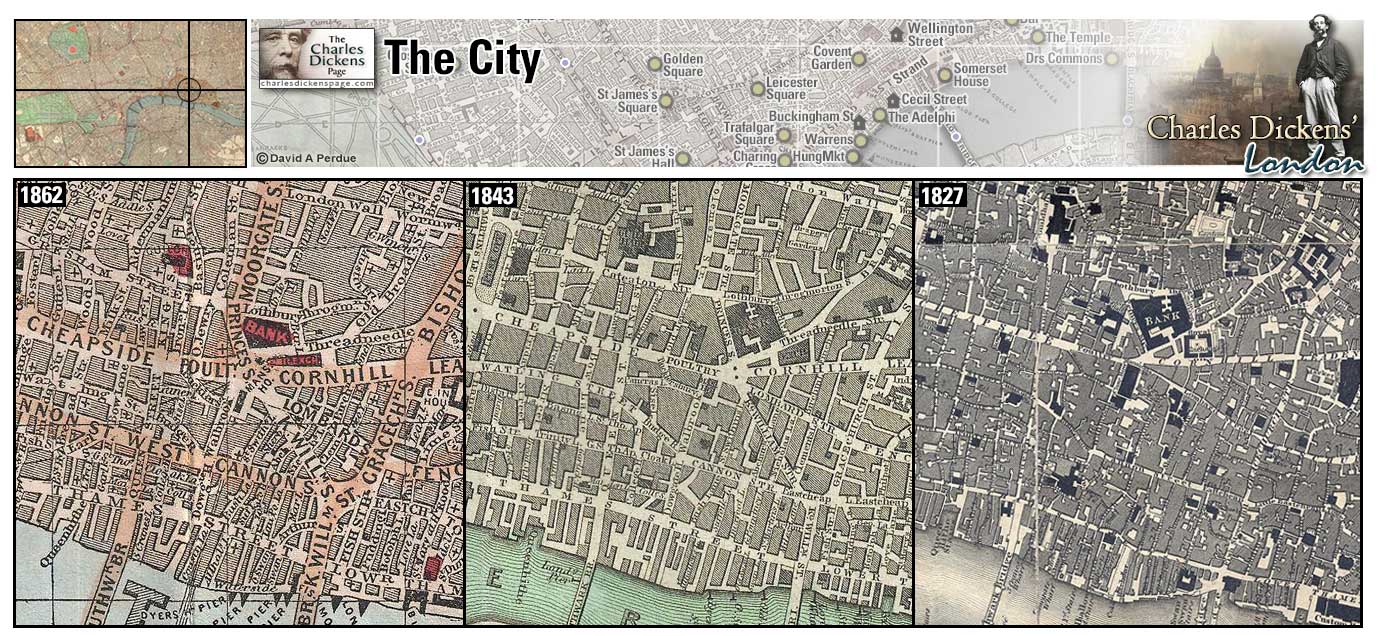
The City (Map: E-10) - Area of London comprising the walled medieval city, most of which was destroyed in the Great Fire of 1666. In Dickens' time the City was evolving from a residential area to a banking and finance center, the former residents moving to the western and northern suburbs and commuting to the City as mass transportation was introduced (Weinreb et al, 2008, p. 172-174).
- Ebenezer Scrooge's counting house was here (A Christmas Carol).
- Paul Dombey's business and Solomon Gills' The Wooden Midshipman were in the City (Dombey and Son).
- Anthony Chuzzlewit's business was located behind the post office in the City (Martin Chuzzlewit).
- Fascination Fledgeby's company, Pubsey and Co, at Saint Mary Axe, and the offices of Chicksey, Veneering, and Stobbles on Mincing Lane where R.W. Wilfer works are located in the City. (Our Mutual Friend).
Zoom Dictionary Google Wikipedia Back
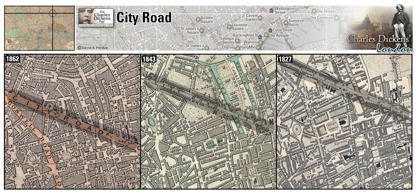
City Road (Map: B-9) - Road, built in 1761, that enters central London from the north (Weinreb et al, 2008, p. 188).
- The Micawbers have a residence at Windsor Terrace, City Road (David Copperfield).
- Florence Dombey is kidnapped by Good Mrs Brown here (Dombey and Son).
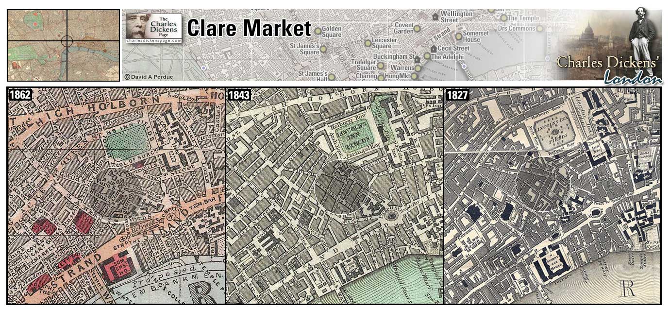
Clare Market (Map: D-7) - Meat market that dated from the 17th century. In Dickens' time it was described as a "crowded, noisy, and unsavoury place." The area was razed in the early 1900s to make way for Aldwych and Kingsway (Weinreb et al, 2008, p. 191).
- Mr Pickwick and Sam Weller find Mr Perker in the Magpie and Stump near Clare Garden (Pickwick Papers). Note: Although there was (and still is) a Magpie and Stump near Newgate Prison and the Old Bailey, Dickens states that the pub to which Pickwick and Weller find Mr Perker was near Clare Market. Peter Clark, in his book Dickens: London into Kent, says that it is more likely that The George IV public house (first appeared 1823, rebuilt 1899) was the Magpie and Stump mentioned in Pickwick.
- During the Gordon Riots the mob pulled down the houses of two witnesses near Clare Market (Barnaby Rudge).
- In the sketch Gin Shops Dickens reports that the gin-shops in and near Drury-Lane, Holborn, St. Giles's, Covent-garden, and Clare-market, are the handsomest in London. There is more of filth and squalid misery near those great thorough-fares than in any part of this mighty city (Sketches by Boz).
Zoom Dictionary Google Wikipedia Aerial 1 Back
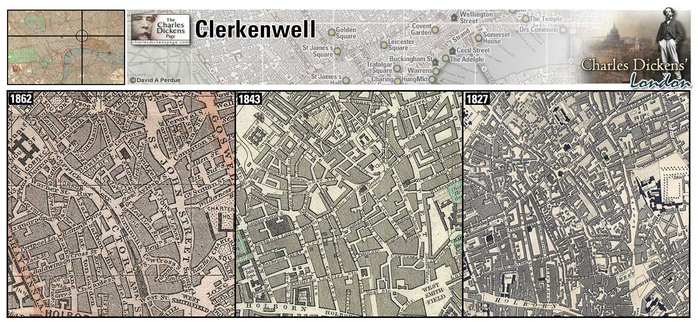
Clerkenwell (Map: B-8) - Originally an ancient rural hamlet north of the City. During Dickens' time the population exploded as London expanded north and west and the area suffered as a result (Weinreb et al, 2008, p. 193-195).
- Gabriel Varden's locksmith shop, the Golden Key, is in Clerkenwell (Barnaby Rudge).
- Jarvis Lorry, clerk at Tellson's bank, lives in Clerkenwell (A Tale of Two Cities).
- Mr Venus' taxidermy shop is located in Clerkenwell (Our Mutual Friend).
- Present day photos of scenes in the Clerkenwell area.
Zoom Photo Google Wikipedia Back
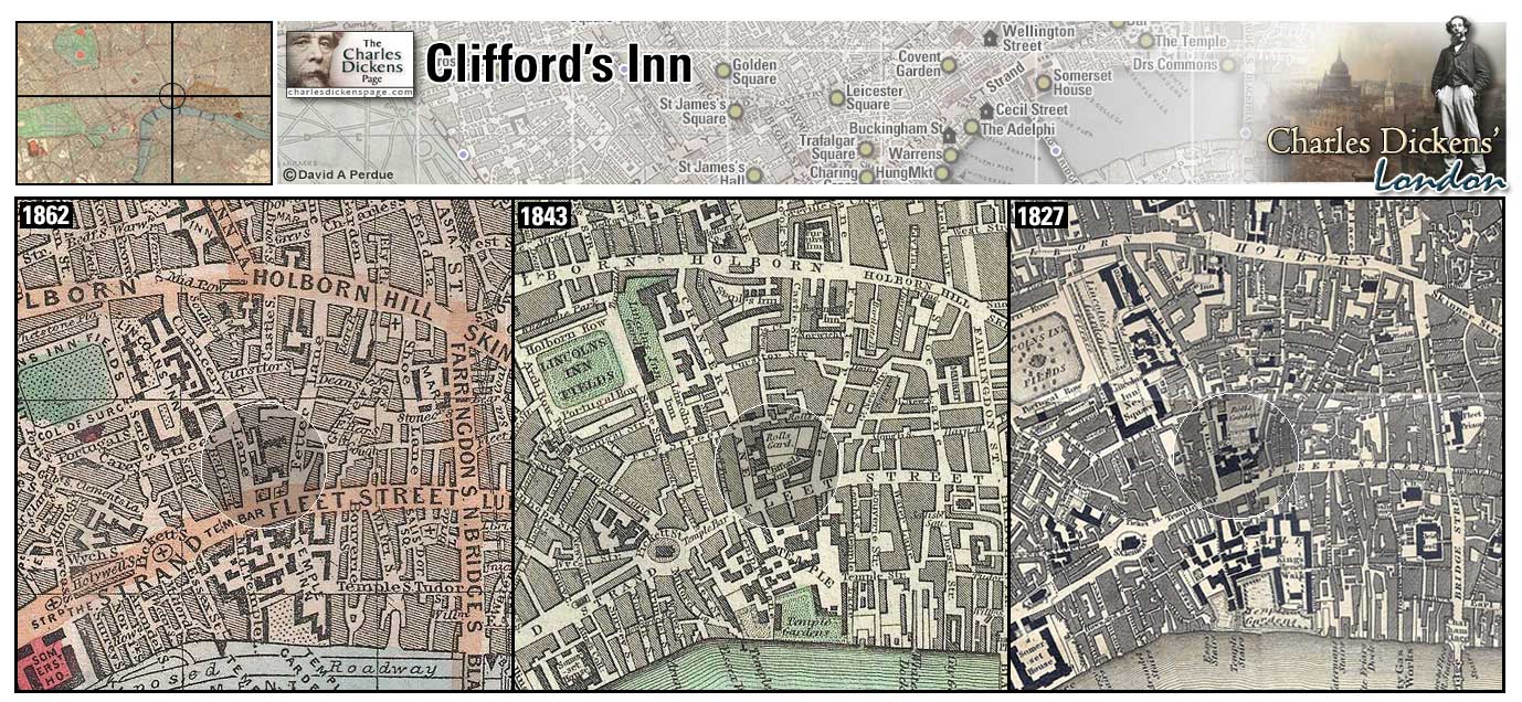
Clifford's Inn (Map: D-8) - Clifford's Inn was previously an Inn of Chancery. Founded in 1345 and dissolved in 1903, most of its original structure was demolished in 1934 (Weinreb et al, 2008, p. 432).
- Melchisedech is a solicitor in Clifford's Inn (Bleak House).
- Edward Dorrit (Tip) languished as a clerk in Clifford's Inn for six months (Little Dorrit).
- John Rokesmith turns Noddy Boffin into Clifford's Inn as a quiet place for him to offer himself as Boffin's secretary (Our Mutual Friend).
Zoom Photo Google Wikipedia Aerial 2 Back
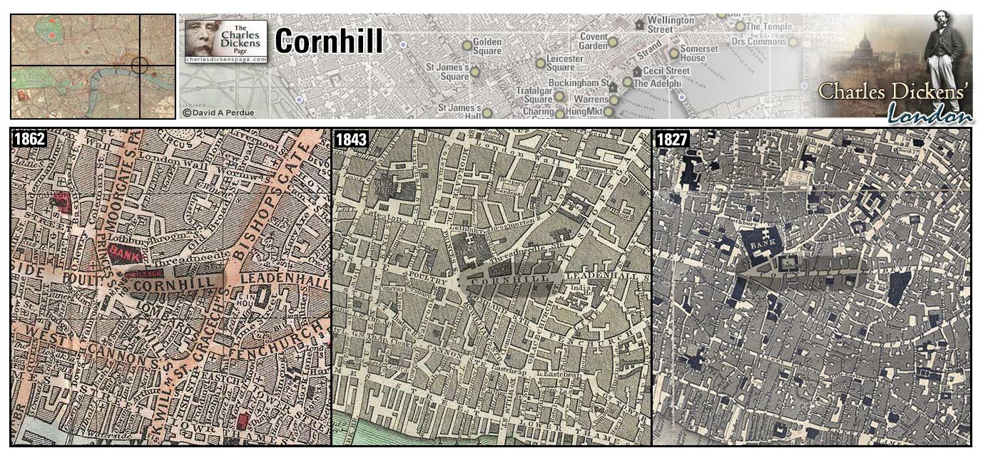
Cornhill (Map: D-11) - Well-known thouroughfare in The City named for a medieval grain market. Cornhill is the highest hill in the City (Weinreb et al, 2008, p. 207-208).
- Dodson and Fogg have offices on a ground floor front of a dingy house, at the furthest end of Freeman's Court, Cornhill (Pickwick Papers).
- Bob Cratchit passes Cornhill on his way home to Camden Town and slides down the ice (A Christmas Carol).
- Garraway's Coffee House in Change Alley, Cornhill, was the scene of action in several of Dickens' works. Samuel Pickwick writes his Chops and tomato sauce letter to Martha Bardell from here (Pickwick Papers). Nadgett watches Jonas Chuzzlewit from Garraway's (Martin Chuzzlewit). Jeremiah Flintwinch carries out some of his business here (Little Dorrit). (The Uncommercial Traveller) finds Garraway's bolted and shuttered on a Sunday.
Zoom Google Wikipedia Aerial 9 Back
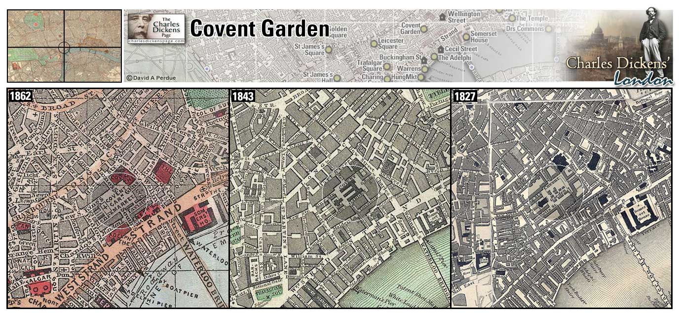
Covent Garden (Map: E-7) - Originally a convent garden that supplied food to Westminster Abbey, after the dissolution of the monasteries in 1540 the land passed to first Earl of Bedford whose family commissioned architect Inigo Jones to develope the area in the 1630s. License for a flower, fruit, and herb market was granted in 1670 (Leapman, 1989, p. 75-77). The Covent Garden Theatre is located here.
Dickens description of Covent Garden in Martin Chuzzlewit where Tom Pinch and his sister Ruth enjoy frequent walks: Many and many a pleasant stroll they had in Covent-Garden Market: snuffing up the perfume of the fruits and flowers, wondering at the magnificence of the pine-apples and melons; catching glimpses down side-avenues, of rows and rows of old women, seated on inverted baskets shelling peas; looking unutterable things at the fat bundles of asparagus with which the dainty shops were fortified as with a breastwork; and, at the herbalists’ doors, gratefully inhaling scents as of veal-stuffing yet uncooked, dreamily mixed up with capsicums, brown-paper, seeds: even with hints of lusty snails and fine young curly leeches. Many and many a pleasant stroll they had among the poultry markets, where ducks and fowls, with necks unnaturally long, lay stretched out in pairs, ready for cooking; where there were speckled eggs in mossy baskets; white country sausages beyond impeachment by surviving cat or dog, or horse or donkey; new cheeses to any wild extent; live birds in coops and cages, looking much too big to be natural, in consequence of those receptacles being much too little; rabbits, alive and dead, innumerable. Many a pleasant stroll they had among the cool, refreshing, silvery fish-stalls, with a kind of moonlight effect about their stock in trade, excepting always for the ruddy lobsters. Many a pleasant stroll among the waggon-loads of fragrant hay, beneath which dogs and tired waggoners lay fast asleep, oblivious of the pieman and the public-house (Martin Chuzzlewit, p. 621-622).
- David Copperfield bought flowers for Dora Spenlow in the market and attends Julius Caesar at the theatre (David Copperfield).
- Pip spends the night at Hummums Hotel in Covent Garden when given a note from John Wemmick not to go home (Great Expectations).
- Arthur Clennam has lodgings here (Little Dorrit).
- Job Trotter spends the night in a vegetable basket in Covent Garden (Pickwick Papers).
- Tom and Ruth Pinch enjoy many and many a pleasant stroll in Covent Garden (Martin Chuzzlewit).
- Mr Dolls staggers into Covent Garden Market and has an attack of the trembles succeeded by an attack of the horrors (Our Mutual Friend).
- The Bow Street Runners, London's first regular detective force, mentioned in Oliver Twist and Great Expectations, operated from Bow Street near here.
Zoom Dictionary Photo Google Wikipedia Aerial 1 Back
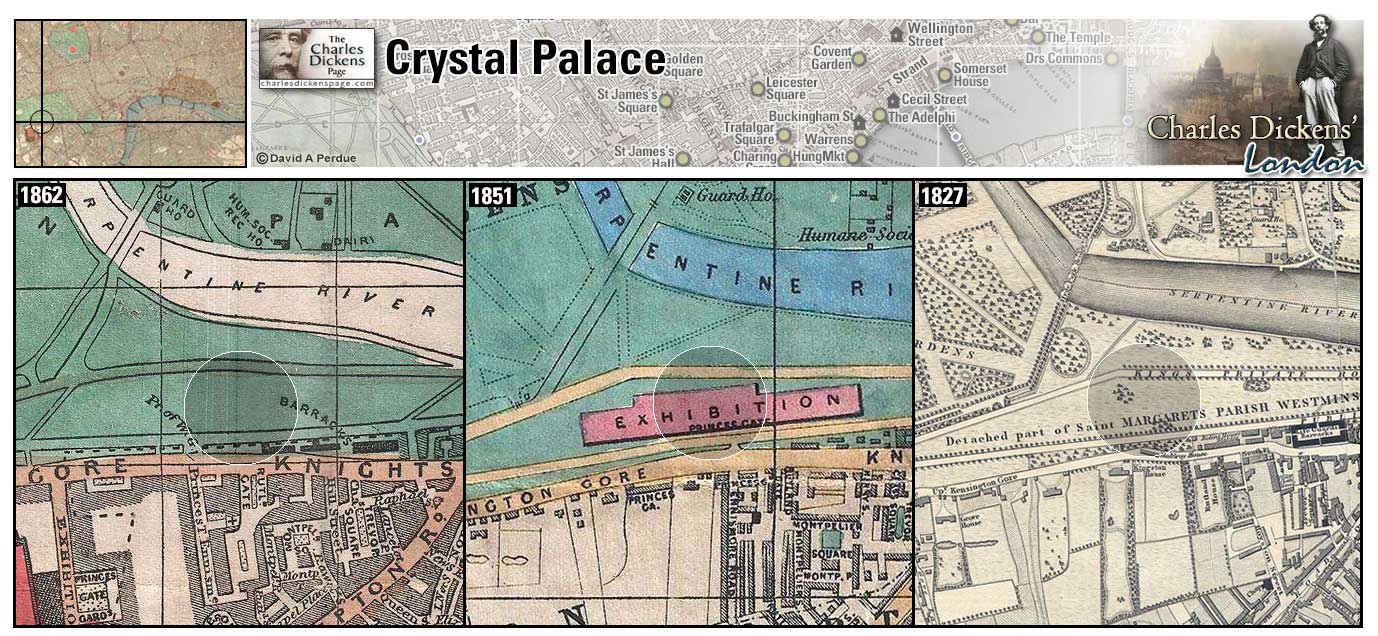
Crystal Palace (Map: F-3) - The exhibition hall built in Hyde Park by Joseph Paxton for the Great Exhibition of 1851. The exhibition was the idea of Prince Albert, who conceived it to celebrate the Industrial Revolution. The Crystal Palace was moved to Sydenham, in south London, in 1854 and accidentally burned down in 1936 (Weinreb et al, 2008, p. 225-226). Dickens and artist W.P. Frith were given a tour of the Palace by Paxton while it was under construction (Johnson, 1952, p. 728).
Zoom Dictionary Google Wikipedia Back
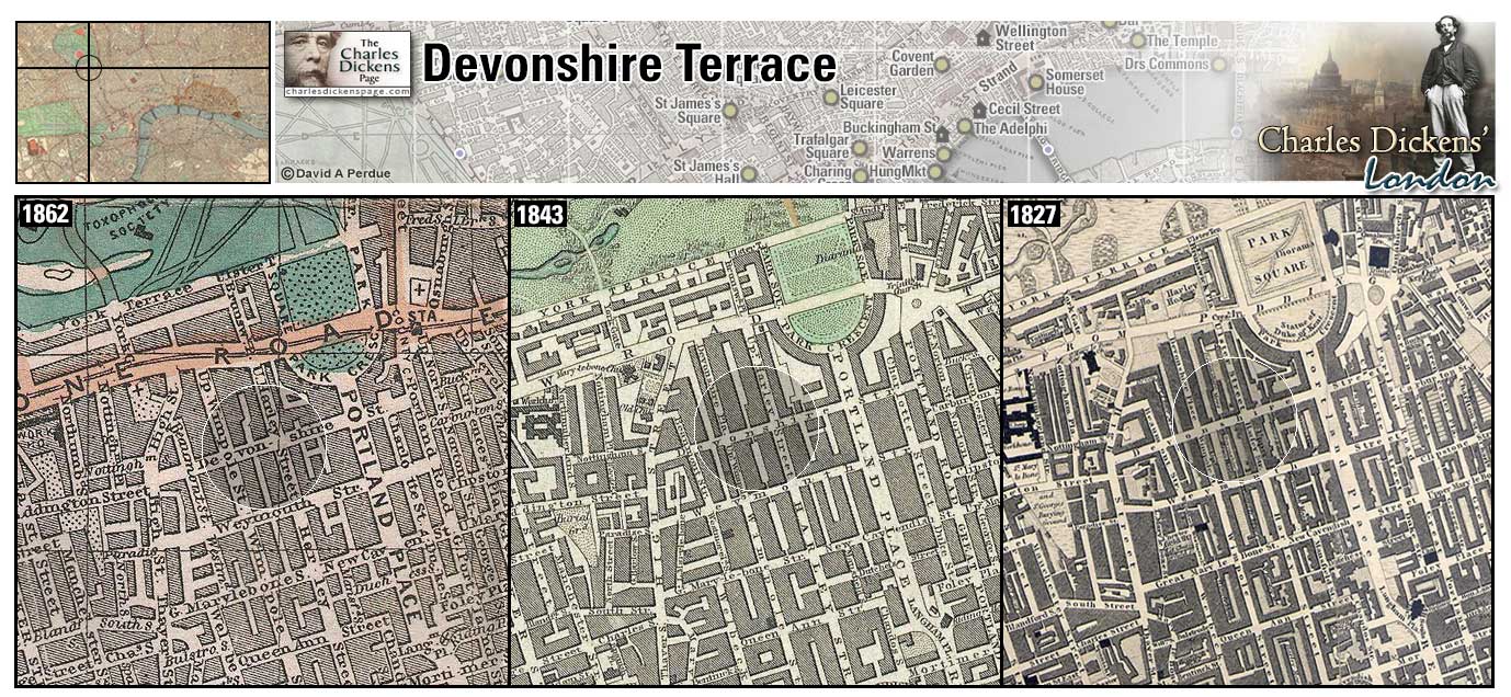
Devonshire Terrace (Map: C-5) - Dickens home from 1839 to 1851 located opposite the York Gate entrance to Regent's Park. The house was destroyed in 1962 (Hardwick et al, 1973, p. 277).
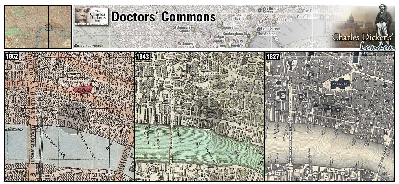
Doctors' Commons (Map: E-9) - The College of the Doctors of the Law, it received a Royal charter in 1768 with headquarters near St Paul's Cathedral. The College was abolished in 1857 and the building was demolished in 1867 (Hayward, 1924, p. 51). Dickens had an office here when he was a reporter in the early 1830s (Ackroyd, 1990, p. 132).
- Described in Doctors' Commons (Sketches by Boz).
- David Copperfield becomes an articled clerk here (David Copperfield).
- Alfred Jingle applies for his marriage license here when he elopes with Rachael Wardle (Pickwick Papers).
- Josiah Bounderby explains to Stephen Blackpool the unlikely process of getting out of his unhappy marriage: 'Why, you'd have to go to Doctors' Commons with a suit, and you'd have to go to a court of Common Law with a suit, and you'd have to go to the House of Lords with a suit, and you'd have to get an Act of Parliament to enable you to marry again, and it would cost you (if it was a case of very plain sailing), I suppose from a thousand to fifteen hundred pound...Perhaps twice the money' (Hard Times).
- While in the Fleet Prison Samuel Pickwick sends a messenger to the Horn Coffee-house in Doctors' Commons to fetch a bottle or two of very good wine (Pickwick Papers).
Zoom Google Wikipedia Aerial 2 Back
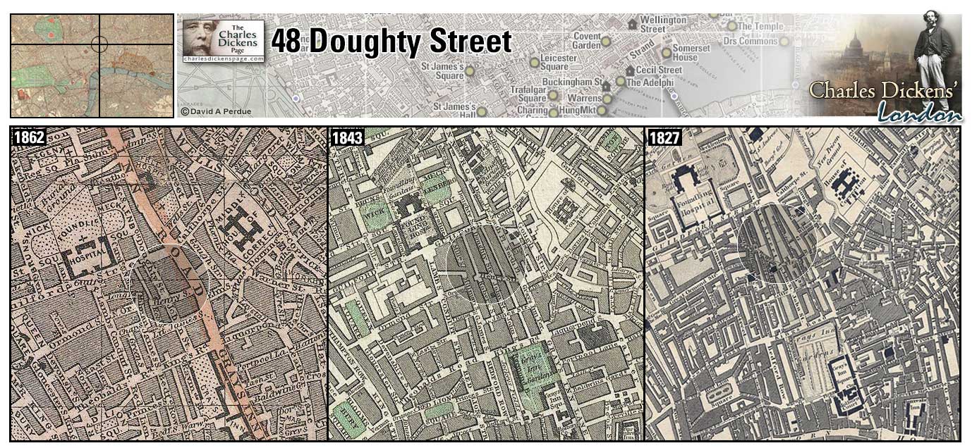
48 Doughty Street (Map: C-8) - Dickens' home from 1837 to 1839. Dickens' early fame allowed him to take a three year lease here. His beloved sister-in-law, Mary, died here. The home was purchased by The Dickens Fellowship and was opened to the public as the Dickens House Museum in 1925. It operates today as the Charles Dickens Museum (Schlicke, 1999, p. 176-178).
Zoom Photo Google Wikipedia Back
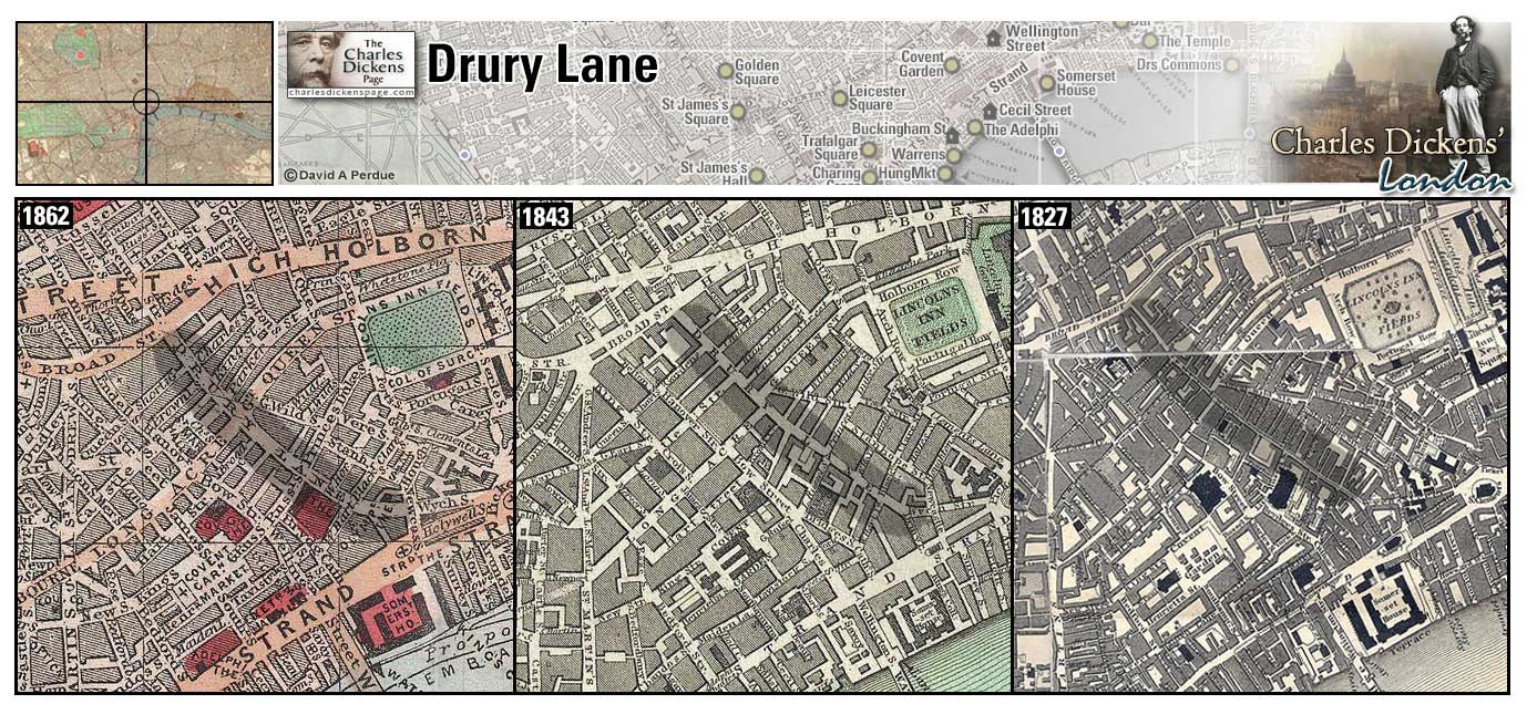
Drury Lane (Map: D-7) - London street named for Sir Robert Drury who built a mansion on the lane in 1500. The Drury Lane Theatre is located here. In Dickens' time Drury Lane was a slum known for prostitution and gin palaces (Weinreb et al, 2008, p. 250).
- In the sketch Gin-Shops Dickens reports that "the gin-shops in and near Drury-Lane, Holborn, St. Giles's, Covent-garden, and Clare-market, are the handsomest in London. There is more of filth and squalid misery near those great thorough-fares than in any part of this mighty city." (Sketches by Boz).
- Henrietta Petowker, of the Crummles touring stage company, performed at the Drury Lane Theatre (Nicholas Nickleby).
- David Copperfield orders beef in a restaurant here (David Copperfield).
- Dick Swiveller has lodgings over a tobacconist's shop here (Old Curiosity Shop).
- In the sketch The Pawnbroker's Shop Dickens describes a pawnbroker's shop near Drury Lane (Sketches by Boz).
Zoom Google Wikipedia Aerial 1 Aerial 3 Back
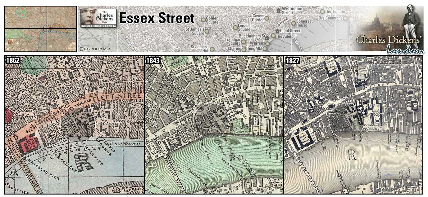
Essex Street (Map: E-8) - Street off of the Strand built about 1680 on the site of Essex House which was once the Outer Temple of the Knights Templar (Weinreb et al, 2008, p. 276-277).
- Pip houses Magwitch (posing as his uncle Mr Provis) in a "respectable lodging house in Essex Street, the back of which looked into the Temple, and was almost within hail of my windows" (Great Expectations).
Zoom Google Wikipedia Aerial 1 Back
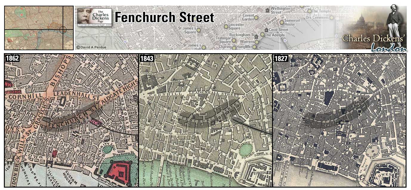
Fenchurch Street (Map: E-11) - Ancient street in the City of London. Three Roman pavements have been found in the vicinity (Weinreb et al, 2008, p. 288-289).
- Bella Wilfer meets her father in an elegant turn-out in Fenchurch Street (Our Mutual Friend).
Zoom Google Wikipedia Aerial 6 Aerial 9 Back
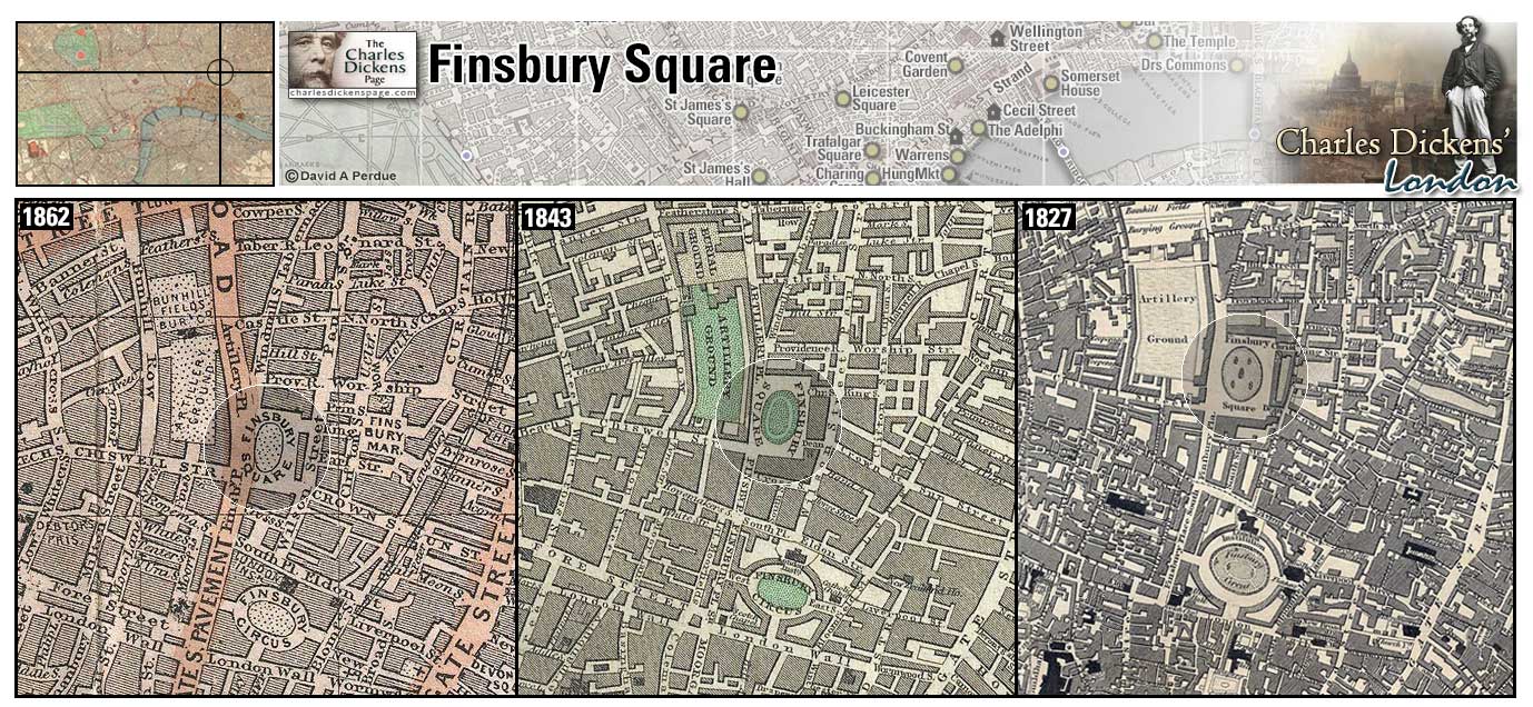
Finsbury Square (Map: C-11) - Square designed by George Dance the Younger and others 1777-91. Said to be the first public place where gas lighting was permanently installed (Weinreb et al, 2008, p. 292-293).
- Finsbury Square in mentioned in the sketch The Parlour Orator (Sketches by Boz).
- Bill Sikes, with Oliver Twist in tow, pass through Finsbury Square on the way to rob the Maylie house (Oliver Twist)
Zoom Google Wikipedia Aerial 6 Aerial 9 Back
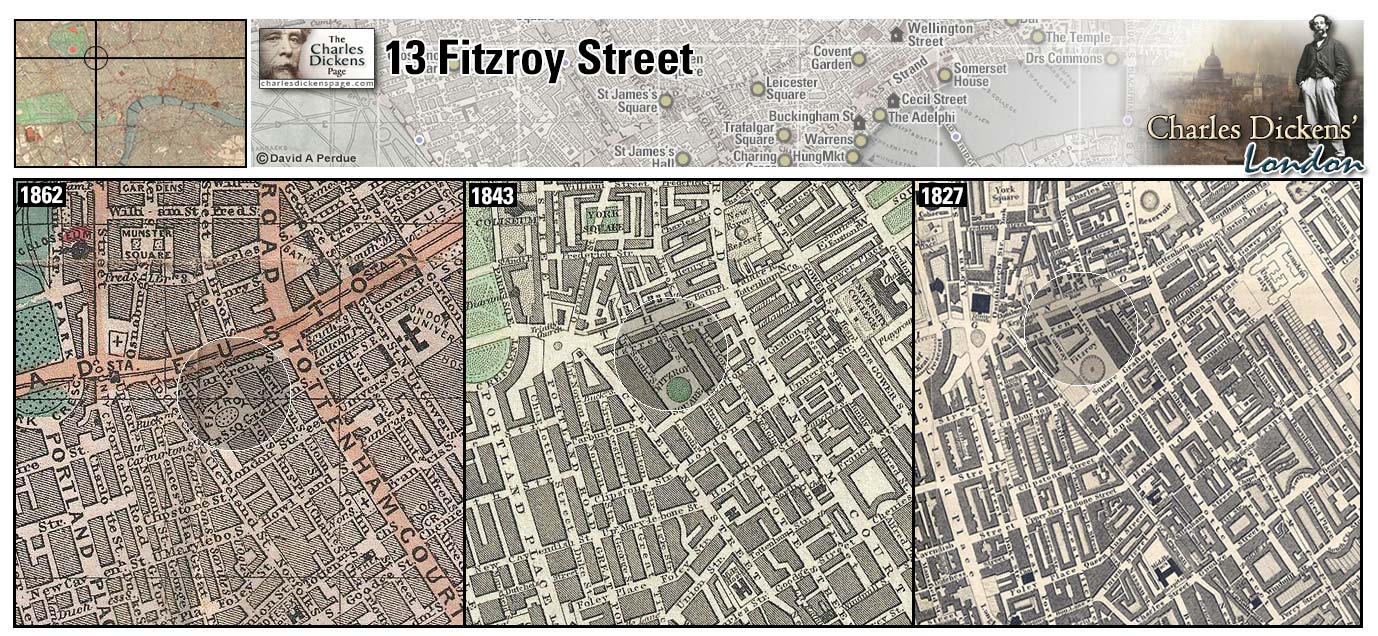
13 Fitzroy Street (Map: C-5) - Charles Dickens briefly moved back in with his parents here in 1834 after a brief period of living on his own at Cecil Street (Johnson, 1952, p. 65).
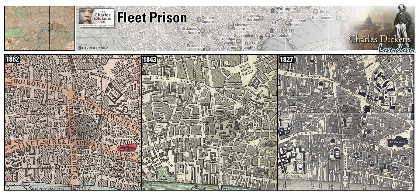
Fleet Prison (Map: D-8) - The oldest of London's prisons, it is said to have been built soon after the Norman Conquest but it is not recorded until 1170-71. It stood on the east bank of the Fleet river and was rebuilt several times, the last being after the Great Fire of 1666. Used as a debtor's prison in Dickens' time, it remained in use until 1842 and was demolished in 1846 (Weinreb et al, 2008, p. 297-298).
- Samuel Pickwick was imprisoned here until such time as damages and costs to Martha Bardell were paid, which Pickwick claimed would be "a good, long time" (Pickwick Papers).
- The mob burns the Fleet Prison during the Gordon Riots (Barnaby Rudge).
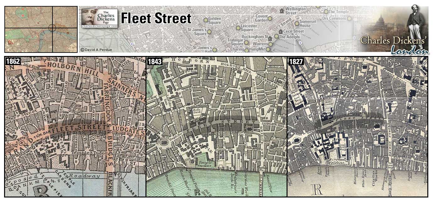
Fleet Street (Map: D-8) - Main thoroughfare running from Temple Bar into the City and named for the Fleet River which was covered and moved underground in the 18th century. Fleet Street was home to London's printing and publishing industry and, working as a young reporter, Dickens was well acquainted with this area (Weinreb et al, 2008, p. 298-300).
- David Copperfield, like Dickens, spent a lot of time in this street and takes Clara Peggotty to a Waxwork on Fleet Street (David Copperfield).
- Tom Pinch meets Mr Fips at the Temple Gate on Fleet Street to be escorted to his new place of business (Martin Chuzzlewit).
- Tellson's Bank was located in Fleet Street (A Tale of Two Cities).
Zoom Dictionary Photo Google Wikipedia Aerial 1 Aerial 2 Back
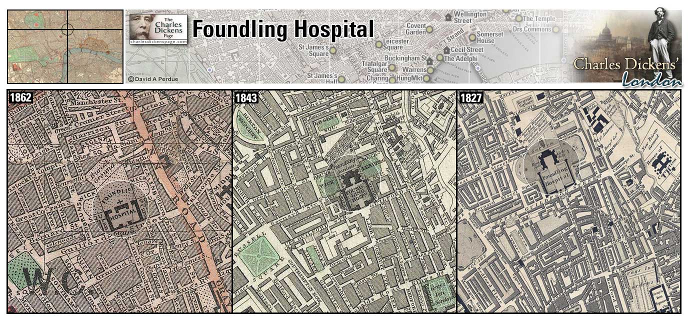
Foundling Hospital (Map: C-7) - Orphanage established in 1739 by Captain Thomas Coram, retired merchant seaman (Weinreb et al, 2008, p. 306-307).
- The Meagles adopt Tattycoram from here (Little Dorrit).
- The Boot, a tavern that served as headquarters for the Gordon rioters, was located in the fields behind the Foundling Hospital (Barnaby Rudge).
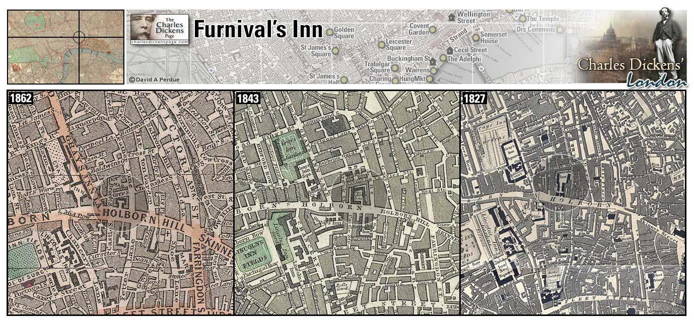
Furnival's Inn (Map: C-8) - One of the Inns of Chancery established in 1345, its use as a legal community was discontinued in 1817 and the buildings were demolished and rebuilt as a residential property retaining the name. Dickens moved into dilapidated chambers at 13 Furnival's Inn, with his younger brother Frederick, in December 1834. In anticipation of his marriage to Catherine Hogarth Dickens took larger quarters at 15 Furnival's Inn until the young couple, along with Frederick and sister-in-law Mary Hogarth, moved to 48 Doughty Street in April 1837. Most of Pickwick Papers was written here. The building was demolished in 1897 when the Prudential Assurance Company acquired the property (Weinreb et al, 2008, p. 432-433).
- Rosa Bud stays in rooms in the Inn and Grewgious takes his meals across Holborn from his lodging at Staple Inn at Wood's Hotel, within the arches of Furnival's Inn. (Edwin Drood).
- John Westlock has rooms here (Martin Chuzzlewit).
Zoom Google Wikipedia Aerial 3 Back
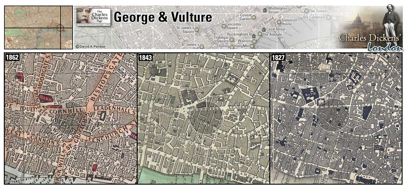
George and Vulture Inn (Map: D-11) Historic pub off Lombard Street and still operating today (Matz, 1921, p. 139).
- Samuel Pickwick and Sam Weller have rooms in very good, old-fashioned, and comfortable quarters, to wit, the George and Vulture Tavern and Hotel, George Yard, Lombard Street when Pickwick returns to London for the Martha Bardell trial. Nathaniel and Arabella Winkle (nee Allen) stay here after their marriage (Pickwick Papers).
Zoom Dictionary Google Wikipedia Aerial 6 Back
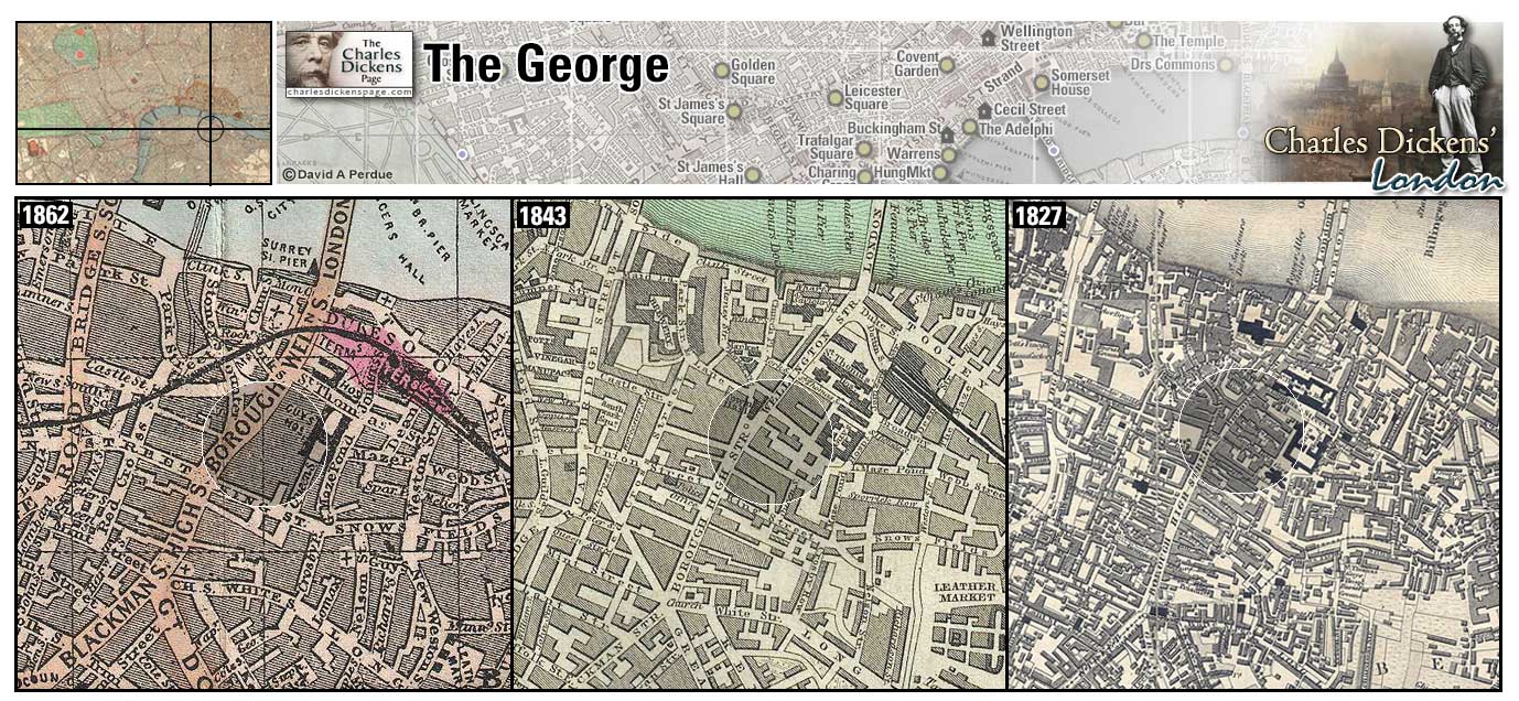
George Inn (Map: F-10) Last of the galleried coaching inns that dotted Borough High Street in Dickens' time. An inn has stood on this spot since medieval times and the present building dates from 1676. Parts of the inn were demolished in 1899 to make way for railway construction (Weinreb et al, 2008, p. 322). In the era before the coming of the railroad (1830s) coaching inns offered food, drink, and warmth to travellers coming into London by coach. It is supposed that Shakespeare appeared in plays which were a frequent attraction in the yards of these inns.
In Pickwick Papers Dickens describes these old coaching inns: "In the Borough especially, there still remain some half-dozen old inns, which have preserved their external features unchanged, and which have escaped alike the rage for public improvement and the encroachments of private speculation. Great, rambling queer old places they are, with galleries, and passages, and staircases, wide enough and antiquated enough to furnish materials for a hundred ghost stories, supposing we should ever be reduced to the lamentable necessity of inventing any, and that the world should exist long enough to exhaust the innumerable veracious legends connected with old London Bridge, and its adjacent neighbourhood on the Surrey side."
- Edward Dorrit goes into the George to write a letter to Arthur Clennam (Little Dorrit).
- Also in the area were the Tabard Inn, where the pilgrims depart for Canterbury in Chaucer's Canterbury Tales (demolished 1873), and the White Hart, where Samuel Pickwick and his friends depart on their own pilgrimage (Pickwick Papers).
Zoom Photo Google Wikipedia Aerial 4 Back
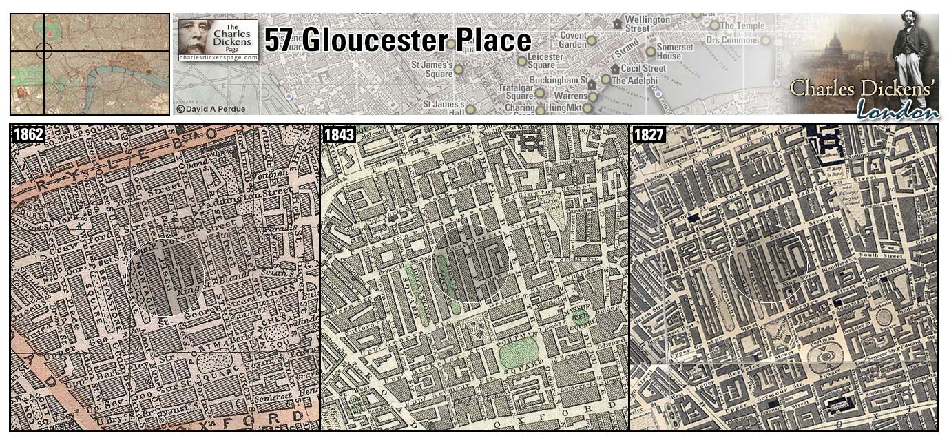
57 Gloucester Place (Map: D-3) Street built in 1810 and named for William, Duke of Gloucester, brother of George III (Weinreb et al, 2008, p. 327). Charles Dickens took lodgings here for the "London Season" in 1864 while working on Our Mutual Friend (Ackroyd, 1990, p. 943).
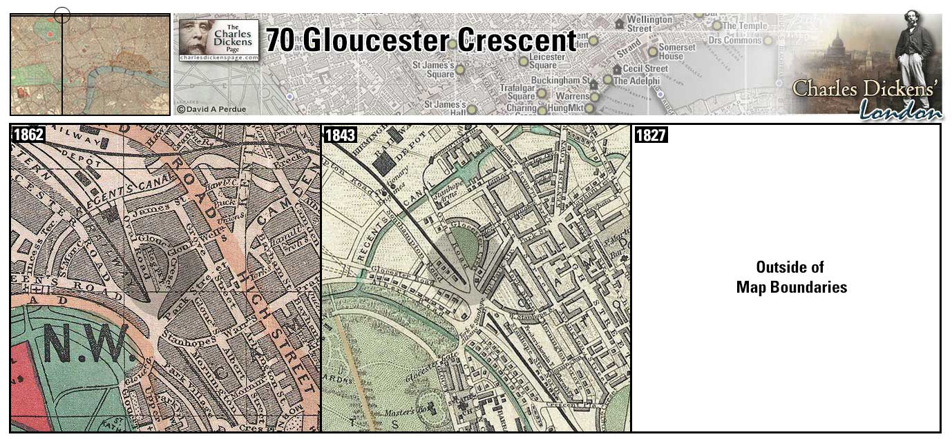
70 Gloucester Crescent (Map: A-5) House taken by Catherine Dickens after her separation from Charles in 1857. In her book The Other Dickens, Lillian Nayder describes it as "more modest than either Devonshire Terrace or Tavistock House, but for a middle class household of four—Catherine, Charley, and two live-in servants—it was spacious enough" (Nayder, 2011, p. 257).
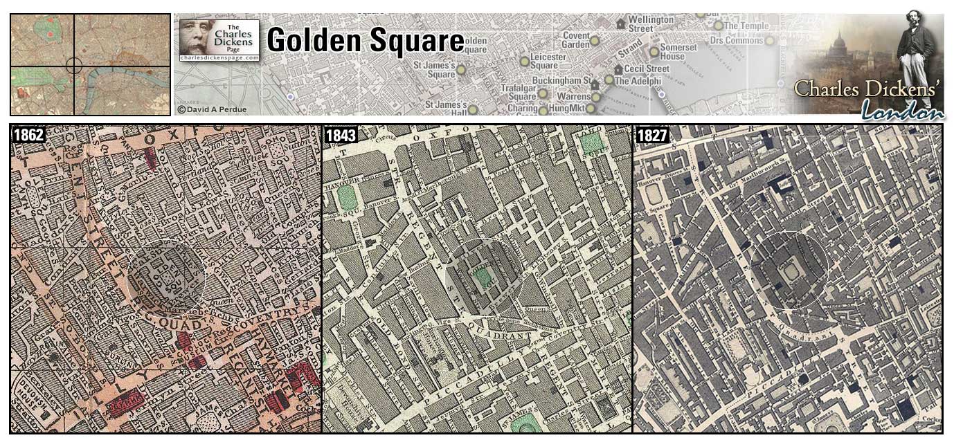
Golden Square (Map: E-5) Once fashionable square in London's West End developed in the late 1600s. The name is probably a corruption of gelding as the site was once used as a grazing ground for geldings. The square was in decline in Dickens' time (Weinreb et al, 2008, p. 328).
- Ralph Nickleby lives here, the Kenwigs and Newman Noggs live nearby (Nicholas Nickleby).
- David Copperfield and Martha Endell find little Emily in a part of Golden Square where the houses were once fair dwellings in the occupation of single families, but have, and had, long degenerated into poor lodgings let off in rooms. (David Copperfield).
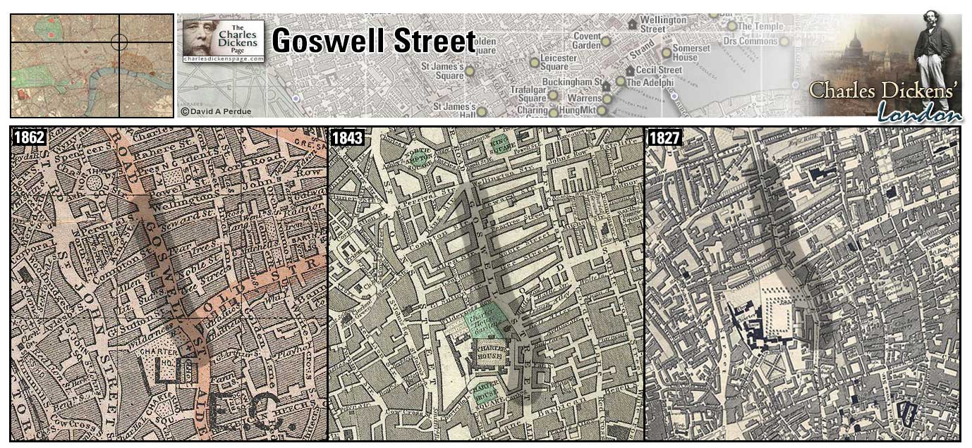
Goswell Street (Map: C-9) In Dickens' time Goswell Street was a part of Goswell Road, which follows the path of an ancient road leading from the City to the north (Weinreb et al, 2008, p. 334).
- Samuel Pickwick has "very neat and comfortable" lodgings at Mrs Bardell's boarding house here (Pickwick Papers).
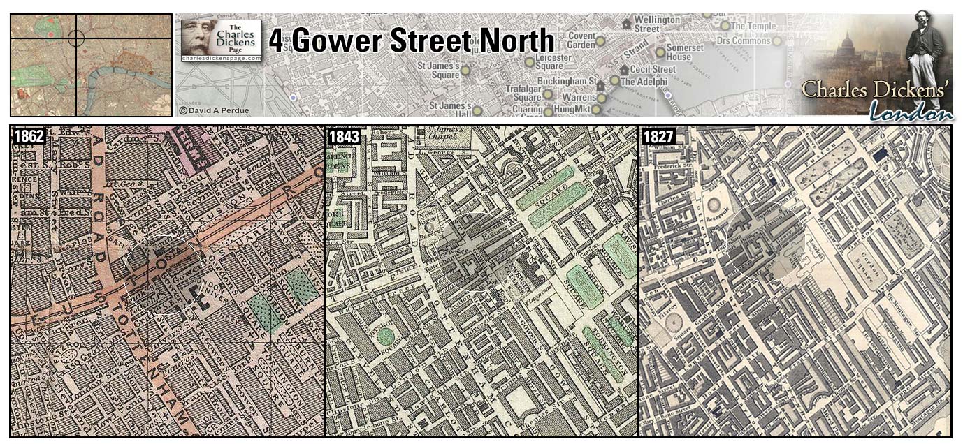
4 Gower Street North (Map: C-6) The Dickens family moved here just after Christmas 1823 when Charles was eleven years old. As John Dickens descent into debt continued his wife, Elizabeth, decided to open a school for girls here. Charles remembered a plaque being affixed to the street door that read "Mrs Dickens Establishment." He also recollected that ...nobody ever came to the school, nor do I recollect that anybody ever proposed to come, or that the least preparation was made to receive anybody. On February 9, 1824, two days after his twelfth birthday, Charles began work, pasting labels on bottles of boot-black, at Warren's Blacking Factory to help support the family.
Finally, John Dickens' financial difficulties came to a head and he was imprisoned in the Marshalsea debtors' prison on February 20, 1824. For a short while the rest of the family remained at Gower Street but in early April Elizabeth took the younger children and went to live her husband in the Marshalsea. Charles older sister, Fanny, was still enrolled at the Royal Academy of Music and Charles was sent to live with a family friend, Mrs Roylance, on Little College Street in Camden Town (Ackroyd, 1990, p. 64-74).
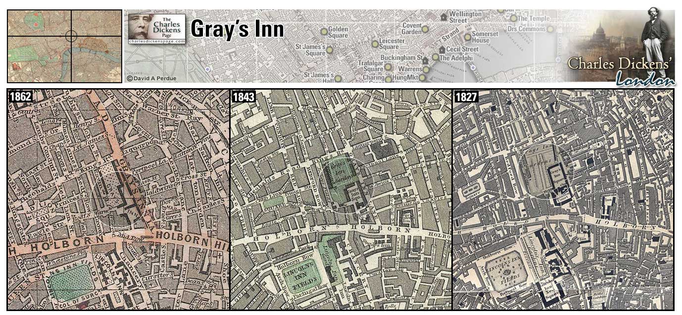
Gray's Inn (Map: C-8) - One of the four Inns of Court, Dickens was a solicitor's clerk here in the offices of Ellis and Blackmore from May 1827 to November 1828 (Hayward, 1924, p. 72).
- Mr Perker, solicitor for Wardle and Samuel Pickwick, has chambers at Gray's Inn (Pickwick Papers).
- Tommy Traddles has chambers at Gray's Inn (David Copperfield).
Zoom Dictionary Google Wikipedia Aerial 3 Back
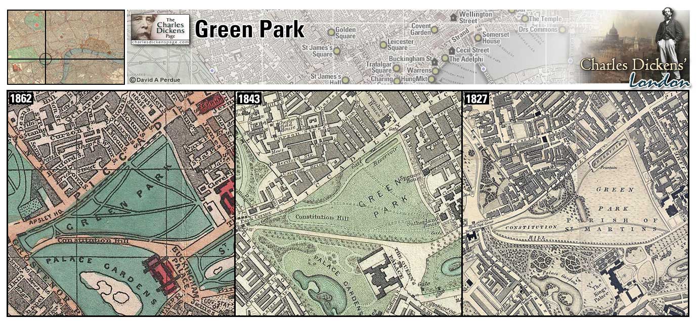
Green Park (Map: F-5) - One of the royal parks, officially the property of the Royal Family. Originally part of the grounds of St. James Palace. It was enclosed by Henry VIII and made a Royal Park by Charles II (Weinreb et al, 2008, p. 350-351).
Zoom Dictionary Photo Google Wikipedia Aerial 8 Back
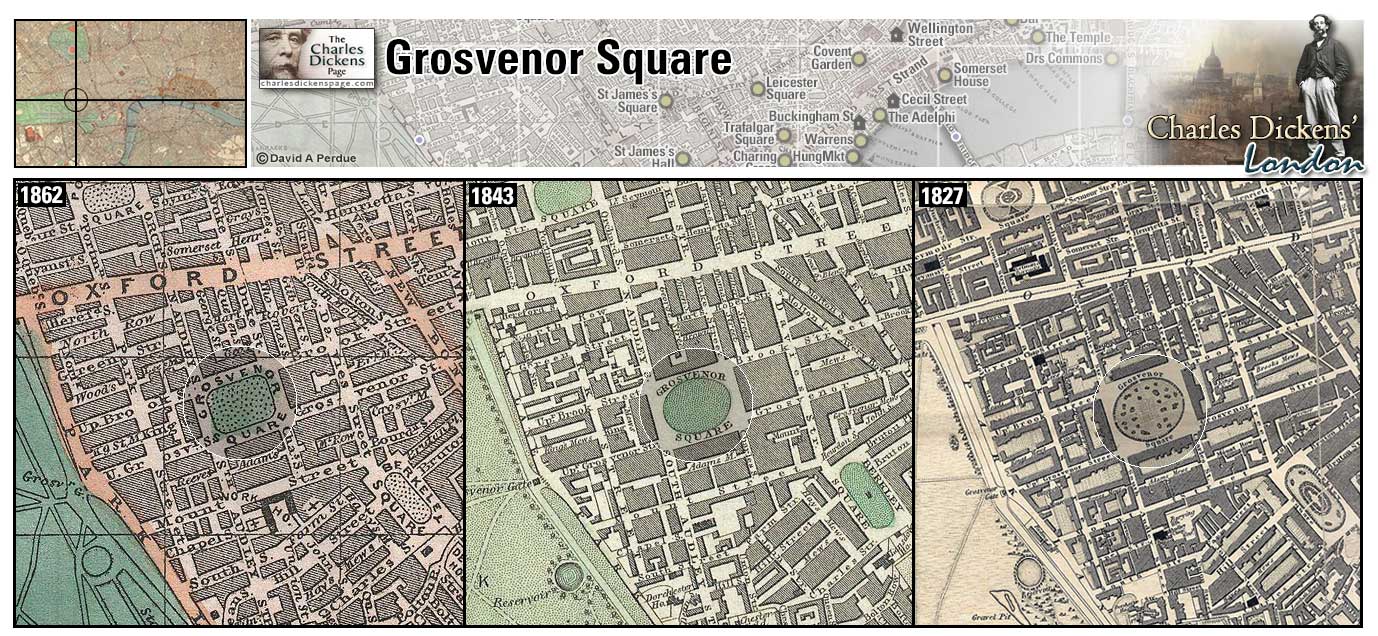
Grosvenor Square (Map: E-4) - The heart of the Grosvenor family's Mayfair Estate, it was built between 1725 and 1731. The largest square in London after Lincoln's Inn Fields. From its inception it has remained one of London's most prestigious addresses (Weinreb et al, 2008, p. 359-360).
- Lord Rockingham's house in Grosvenor Square is blockaded against the Gordon rioters (Barnaby Rudge).
- Mr Tite Barnacle lived in Grosvenor Square 'or very near it' (Little Dorrit).
- Mrs Skewton borrows a stately home in Brook Street, Grosvenor Square, to keep up appearances in anticipation of her daughter Edith's marriage to Paul Dombey (Dombey and Son).
Zoom Google Wikipedia Aerial 10 Back
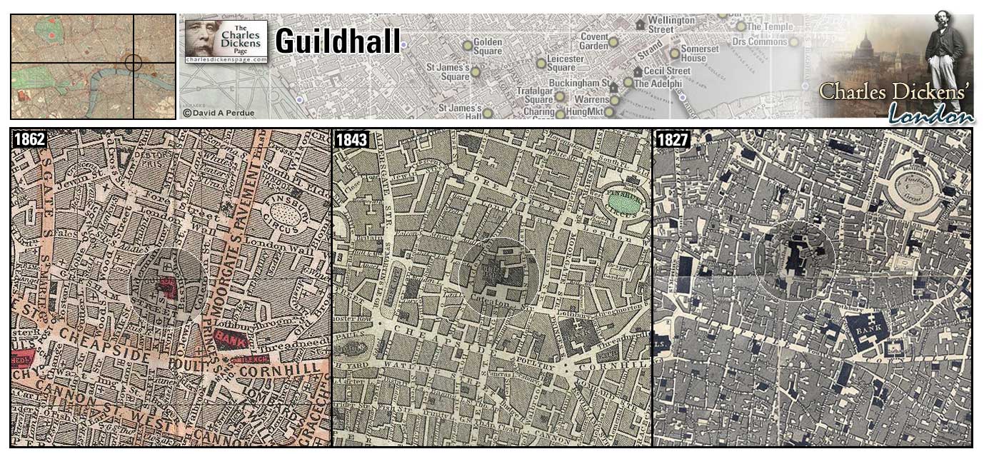
Guildhall (Map: D-10) - Ceremonial and administrative center of the City of London. The present building was completed in 1439. It was damaged in the Great Fire of London in 1666 and restored, it was damaged again during a Luftwaffe strike in 1940 and again restored (Weinreb et al, 2008, p. 362-363).
- The trial of Samuel Pickwick vs Martha Bardell took place here (Pickwick Papers).
- After the undoing of Uriah Heep, Tommy Traddles asks David Copperfield to go round to the Guildhall and bring back a couple of officers to arrest him (David Copperfield).
- During the Gordon Riots soldiers were posted to guard the Guildhall (Barnaby Rudge).
- In Public Dinners, Dickens mentions the Lord Mayor's annual banquet at Guildhall (Sketches by Boz).
Zoom Dictionary Google Wikipedia Aerial 2 Back
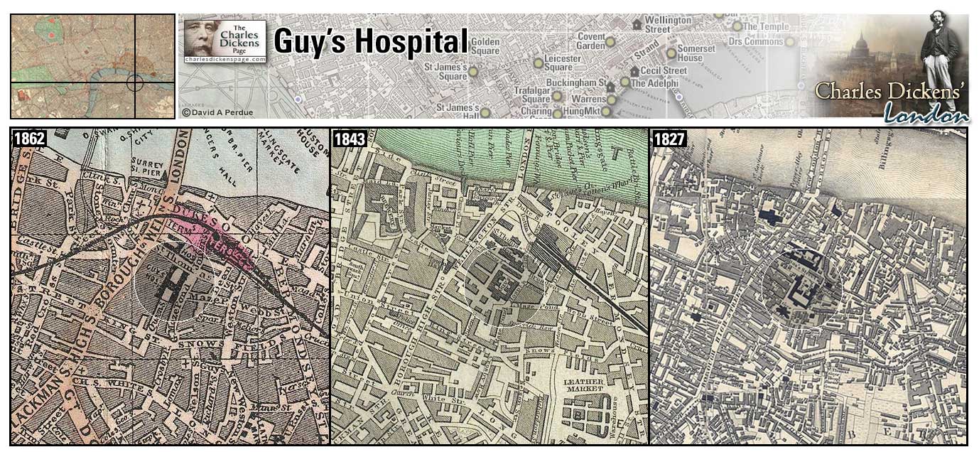
Guy's Hospital (Map: F-11) - Teaching hospital in Southwark endowed by wealthy printer and publisher Thomas Guy (1645-1724). Guy purchased the land, opposite St Thomas' Hospital in 1721 but did not live to see its first patients admitted to his hospital (Weinreb et al, 2008, p. 365-366).
- Bob Sawyer is a medical student here (Pickwick Papers).
- Sairey Gamp's husband died at the hospital (Martin Chuzzlewit).
Zoom Photo Google Wikipedia Aerial 4 Back
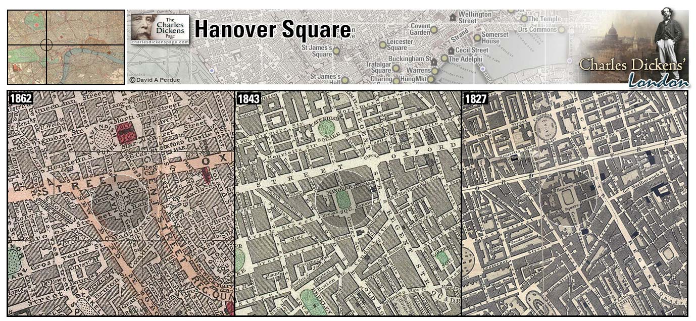
Hanover Square (Map: D-5) - Developed soon after the elector of Hanover (Germany) accended to the throne as George I in 1714. Development of the square was swift due to a building boom in London's West End in the 1720s. The fashionable church of St George is adjacent to the square (Weinreb et al, 2008, p. 381-382).
- Mrs Nickleby fantasizes about her daughter Kate marrying Sir Mulberry Hawk: Lady Mulberry Hawk--that was the prevalent idea. Lady Mulberry Hawk!--On Tuesday last, at St George's, Hanover Square, by the Right Reverend the Bishop of Llandaff, Sir Mulberry Hawk, of Mulberry Castle, North Wales, to Catherine, only daughter of the late Nicholas Nickleby, Esquire, of Devonshire. 'Upon my word!' cried Mrs Nicholas Nickleby, 'it sounds very well' (Nicholas Nickleby).
Zoom Google Wikipedia Aerial 10 Back
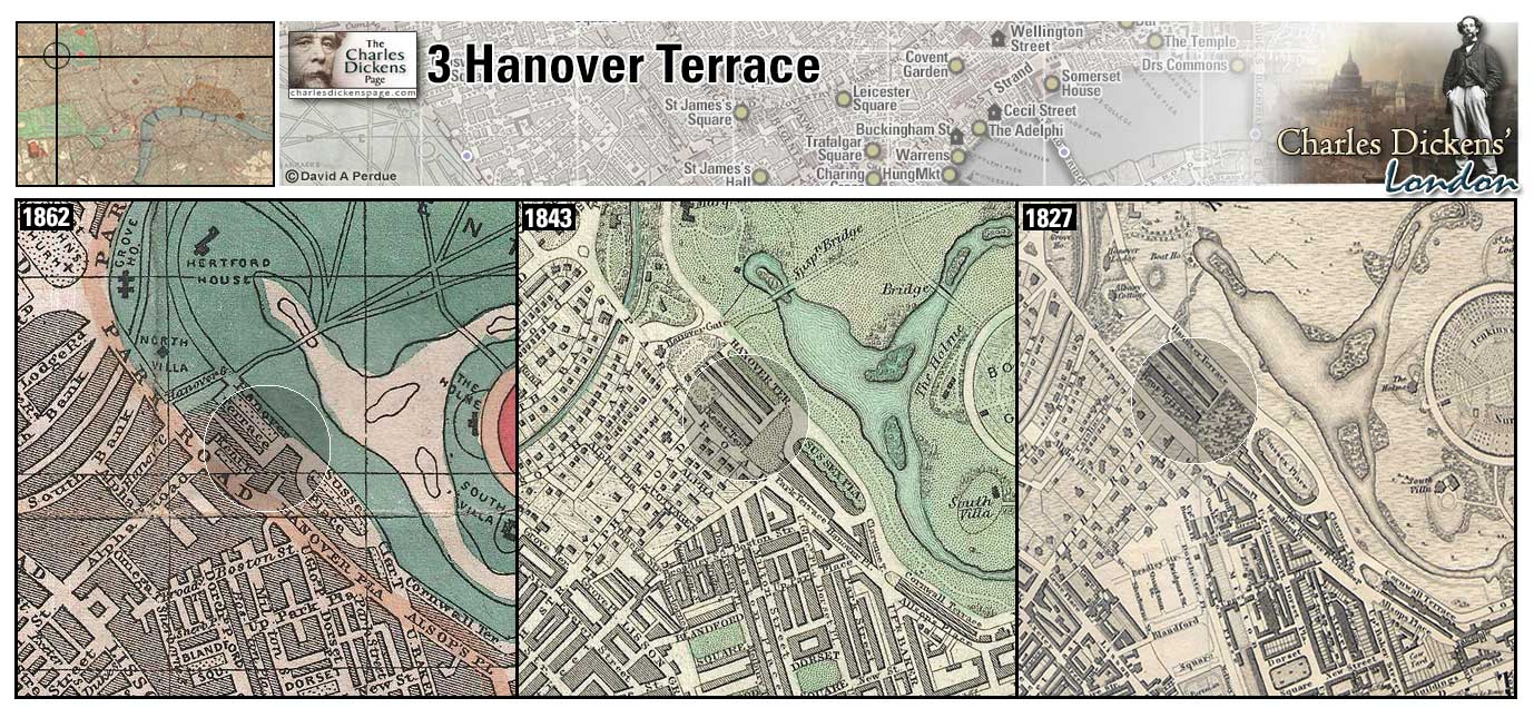
3 Hanover Terrace (Map: B-3) - Posh development overlooking Regent's Park and designed by John Nash in 1822 (Weinreb et al, 2008, p. 382). In early 1861 Dickens took number 3, a "really delightful house" for the London Season (Ackroyd, 1990, p. 888).
Zoom Google Wikipedia Photo Back
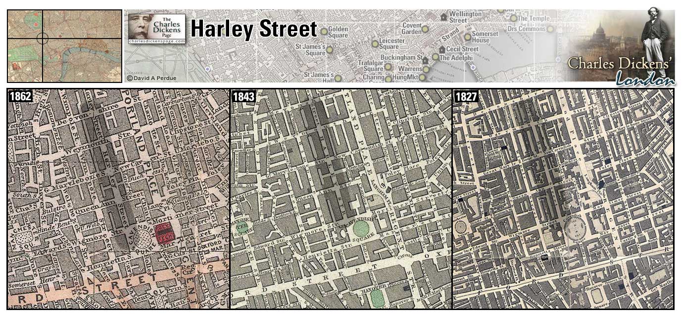
Harley Street (Map: C-4) - Known since the middle of the 19th century for its large number of medical offices (Weinreb et al, 2008, p. 384).
- The Merdles live in the "handsomest house" on Harley Street, Cavendish Square (Little Dorrit).
Zoom Google Wikipedia Aerial 10 Back
Hatton Garden (Map: C-8) - Named for Sir Christopher Hatton, Chancellor for Elizabeth I, the area is famous for being the center of London's jewelry, precious metal, and diamond trade (Weinreb et al, 2008, p. 388).
- Hatton Garden was on Phil Squod's beat as a travelling tinker and the Jellybys have furnished lodgings here (Bleak House).
- Numbers 52-53 Hatton Garden was the site of the notious police court of Mr Laing, on whom Dickens based Mr Fang (Oliver Twist).
Zoom Google Wikipedia Aerial 3 Back
Holborn (Map: C-8) - Area of London that includes Lincoln's Inn and Gray's Inn. First mentioned in a 10th century charter in which King Edgar granted land here to Westminster Abbey (Weinreb et al, 2008, p. 405).
- Langdale's wine and spirits warehouse on Holborn Hill is burned by the rioters and the Newgate prisoners escape up Holborn when the prison is taken (Barnaby Rudge).
- Sairey Gamp lived at Kingsgate Street, High Holborn (Martin Chuzzlewit).
- Tommy Traddles lived on Castle Street, Holborn (David Copperfield).
- The Three Cripples public house and Fagin's den of thieves at Saffron Hill, a notorious criminal district, is located in Holborn (Oliver Twist).
- Bleeding Heart Yard is located in Holborn (Little Dorrit).
Zoom Dictionary Google Wikipedia Aerial 3 Back
Horsemonger Lane Gaol (Map: G-10) - Prison in Southwark completed in 1799 and in use until 1878. Dickens witnessed the execution of the Mannings here in 1849 (Weinreb et al, 2008, p. 416).
- Dickens based the character of Hortense on hanged murderess Maria Manning (Bleak House).
- Mrs Chivery's tobacco shop is located on Horsemonger lane (Little Dorrit).
Zoom Google Wikipedia Aerial 4 Back
Houses of Parliament (Map: G-7) - The old Houses of Parliament burned down in 1834 and were housed in temporary structures until the present Houses were completed in 1860 (Weinreb et al, 2008, p. 617-619). Dickens worked as a parliamentary reporter for the Mirror of Parliament from 1832-1834, and for The Morning Chronicle from 1834-1836 (Davis, 1999, p. 244+247).
- During the Gordon Riots the mob storms the old House of Commons (Barnaby Rudge).
- In describing the Circumlocution Office, a fictional device he uses as an example of government inefficiency and red tape, Dickens gives the protracted deliberation of both Houses of Parliament as an example of How not to do it (Little Dorrit).
Zoom Dictionary Photo Google Wikipedia Aerial 5 Aerial 7 Back
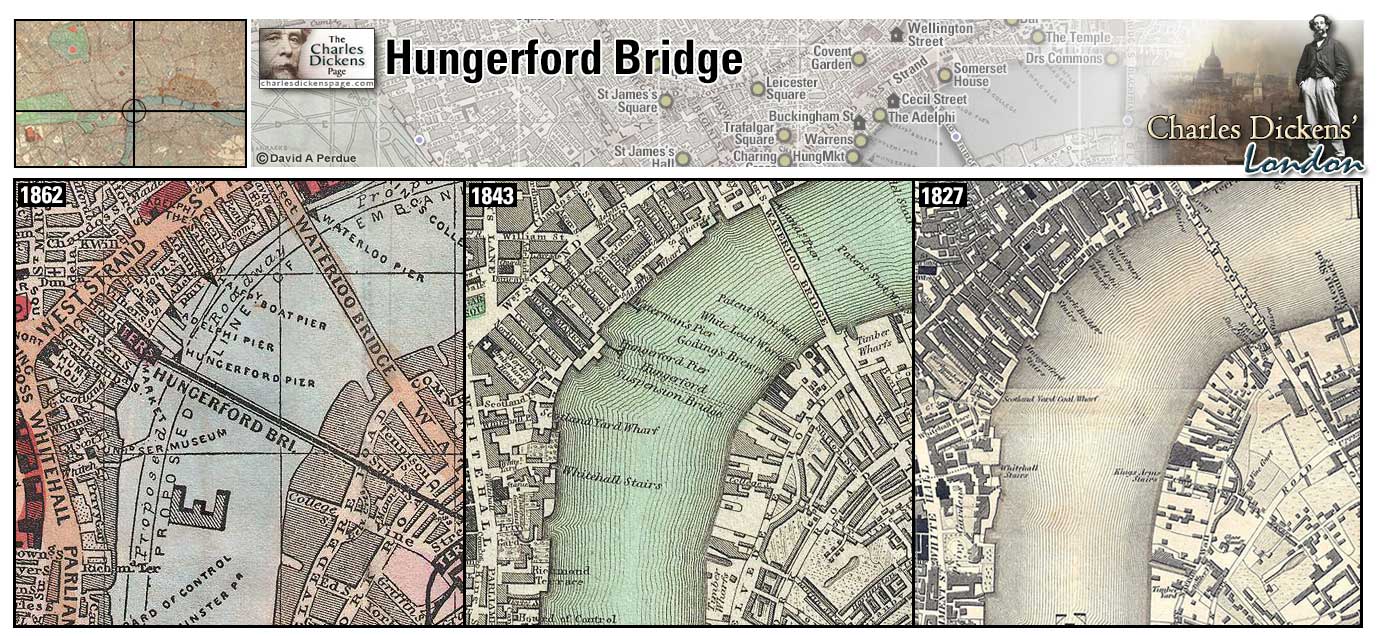
Hungerford Bridge (Map: E-7) - An elegant footbridge, designed by Isambard Kingdom Brunel, opened in 1845 to serve Hungerford Market. It was replaced by a railway bridge designed by Sir John Hawkshaw to serve the new station at Charing Cross. The new bridge, considered the worst eyesore in London, opened in 1864 (Weinreb et al, 2008, p. 420-421).
Zoom Google Wikipedia Aerial 10 Back
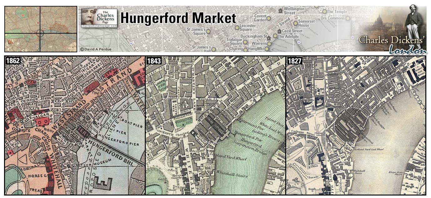
Hungerford Market (Map: E-7) - Built in 1682 by Sir Edward Hungerford the market was meant to rival Covent Garden. Hungerford Stairs led from the market down to the river. The market was rebuilt in 1833 and demolished in 1860 to make way for the Charing Cross Railway Station (Weinreb et al, 2008, p. 420).
- Hungerford Market is mentioned in the sketch Scotland-Yard (Sketches by Boz).
- Daniel Peggotty and later Mr Dick have lodging over a chandlers shop in Hungerford Market (David Copperfield).
Zoom Photo Google Wikipedia Back
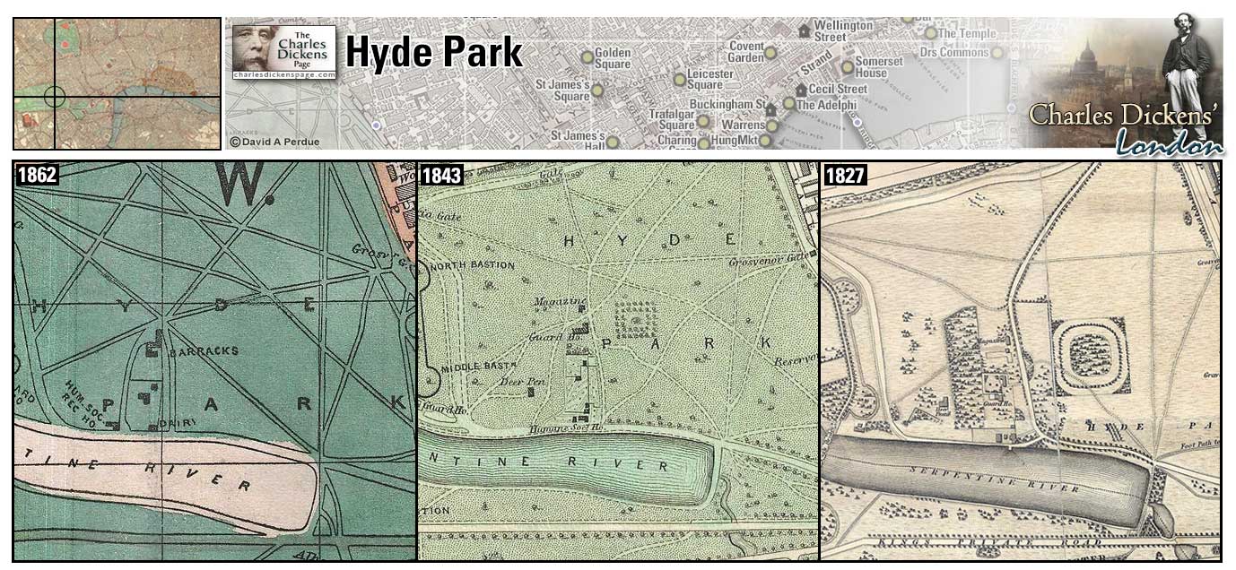
Hyde Park (Map: E-3) - The largest of the London parks, Hyde Park was once a royal deer park enclosed by Henry VIII. It was opened to the public in the early 17th century. Its famous bridle path, Rotten Row, and man-made lake, The Serpentine, are among its most popular attractions. The Great Exhibition was held here in 1851 (Weinreb et al, 2008, p. 423-425).
- Nicholas Nickleby passes through Hyde Park on his way to the chance confrontation with Sir Mulberry Hawk (Nicholas Nickleby).
- Wilkins Micawber dreams of moving to "a terrace at the western end of Oxford Street, fronting Hyde Park" (laughable as this would be an area far beyond his means) (David Copperfield).
Zoom Dictionary Google Wikipedia Aerial 10 Back
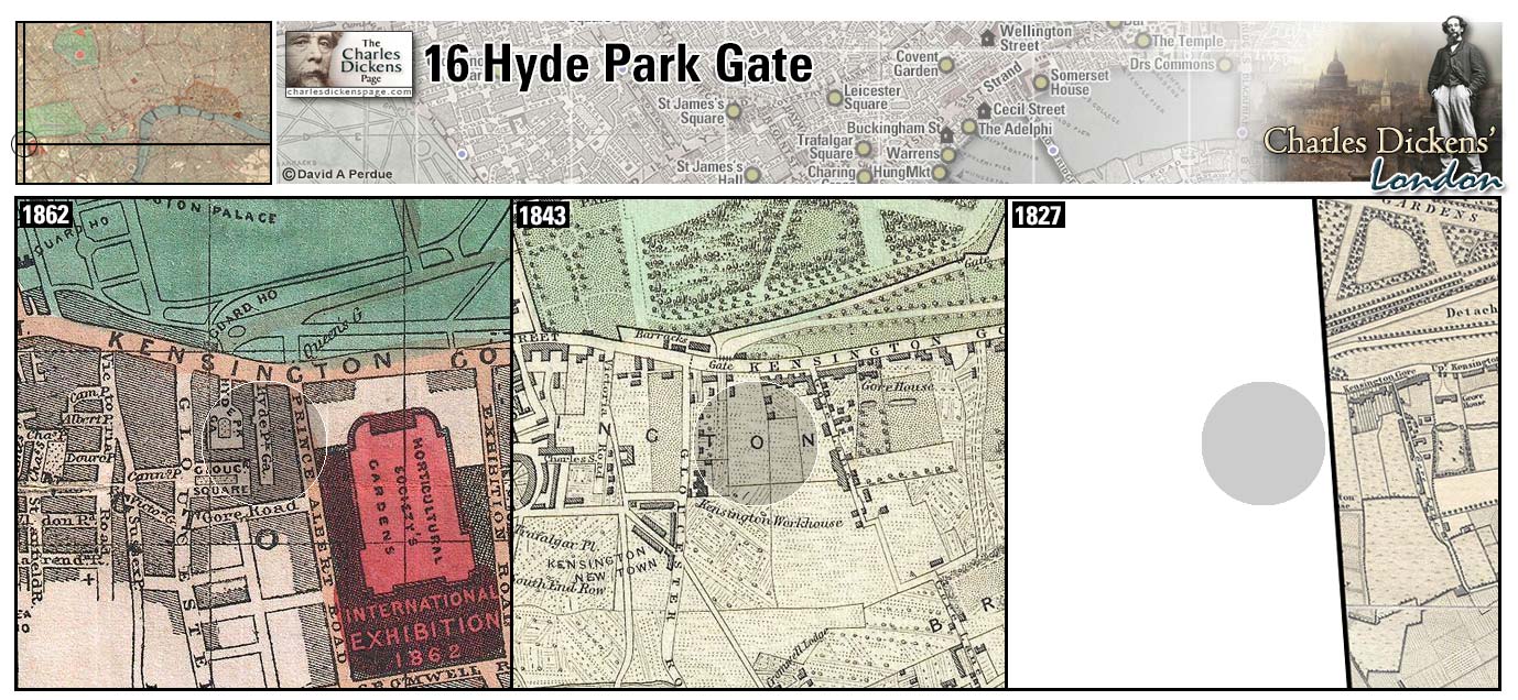
16 Hyde Park Gate (Map: F-1) - Fashionable address where Dickens took temporary residence in February 1862 while doing public readings in London so that his daughter Mamie and sister-in-law Georgina could be in town for the season (Ackroyd, 1990, p. 908-909). In a letter to his friend W.F. De Cerjat Dickens reveals his feelings for the house: "Behold me therefore, established in an odious little London box, which I so thoroughly detest abominate and abjure that I have not settled down to write one word until this very day" (Letters, 1998, v. 10, p. 52).
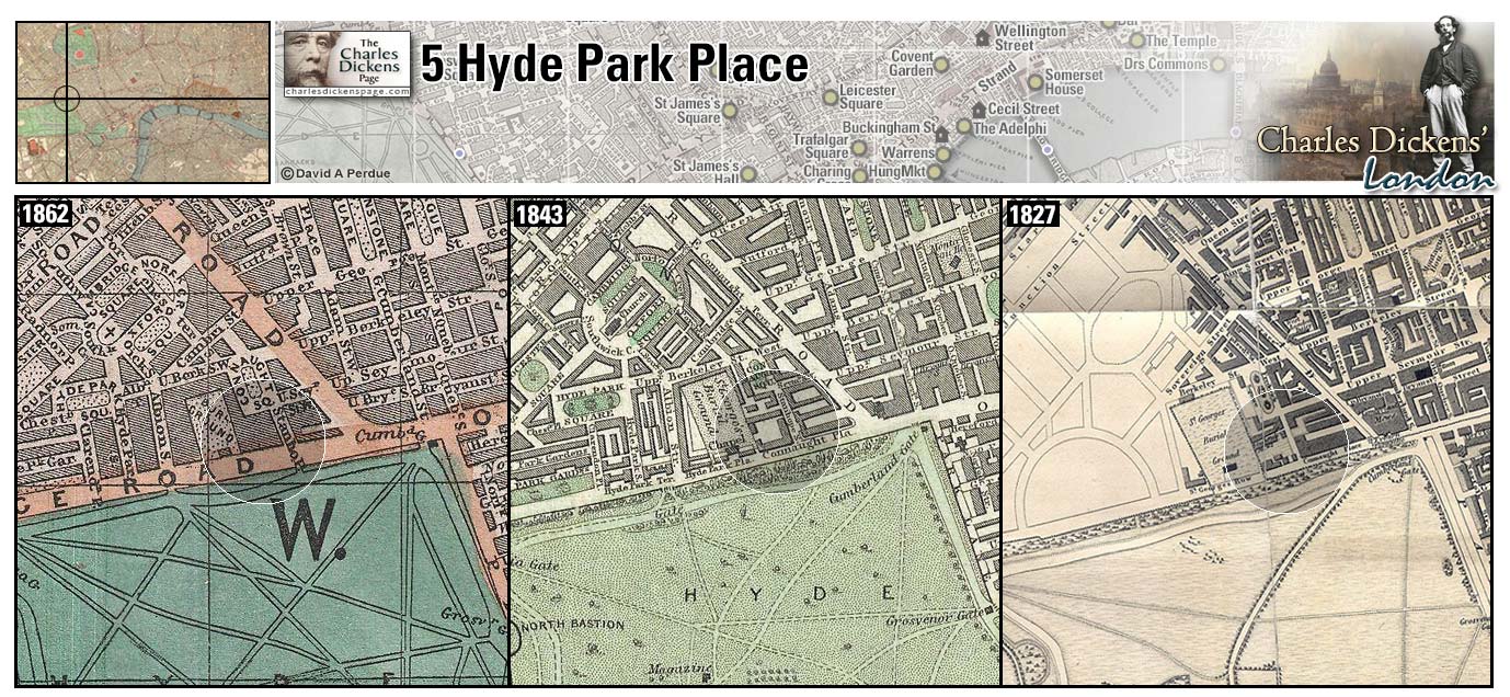
5 Hyde Park Place (Map: D-3) Charles Dickens took lodgings here overlooking Hyde Park in early 1870 so that his daughter Mary could be in town for the "London Season" and to prevent his having to travel by railroad between London and Gads Hill while he finished the last of his farewell readings at St James's Hall. With his health deteriorating rapidly he was writing The Mystery of Edwin Drood here (Ackroyd, 1990, p. 1063).
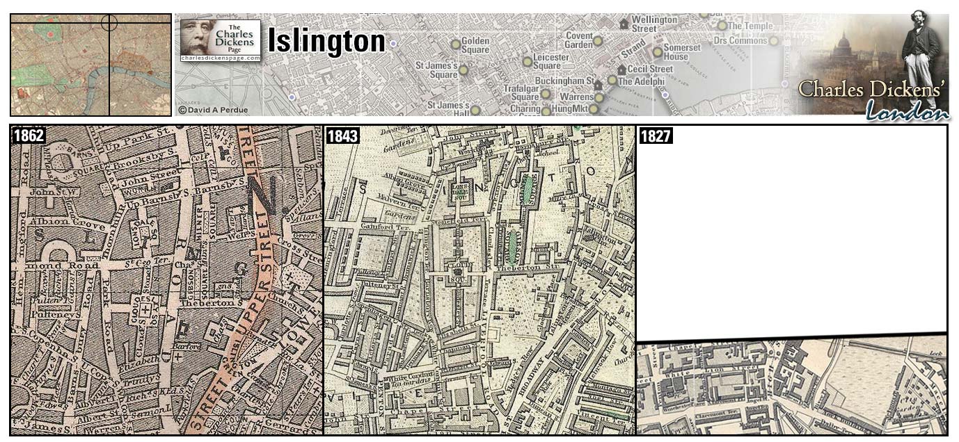
Islington (Map: A-9) - Suburb in north London which expanded greatly during the nineteenth century due in part to the railroad and Regent's Canal that passes through this area. Islington sits on a hill that has long supplied London with water from its springs (Weinreb et al, 2008, p. 437-438).
- In the sketch The Streets - Morning Islington is mentioned as one of the suburbs from which the City's clerks arrive each morning. Islington is also mentioned in the sketches Thoughts About People, Making a Night of it, A Passage in the Life of Mr Watkins Tottle, and The Bloomsbury Christening (Sketches by Boz).
- John Dawkins (The Artful Dodger) leads Oliver Twist through Islington on the way to Fagin's den when Oliver first arrives in London (Oliver Twist)
- The coach carrying Nicholas Nickleby and the new boys to Yorkshire stops at Islington where a new outside passenger gets on and agrees to help keep the boys from tumbling off the coach in the event that they fall asleep (Nicholas Nickleby).
- Joe Willet passes through Islington after enlisting in the army on his way to Clerkenwell to say goodbye to Dolly Varden (Barnaby Rudge).
- Tom and Ruth Pinch have a house here (Martin Chuzzlewit).
- Mr Morfin, an assistant manager in Paul Dombey's firm, lives in Islington (Dombey and Son).
- Esther Summerson and Inspector Bucket pass through Islington while searching for Lady Dedlock (Bleak House).
Zoom Google Wikipedia Aerial 11 Back
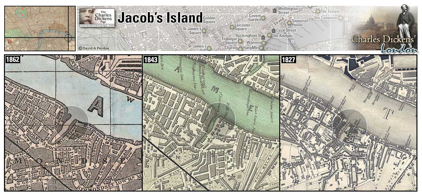
Jacob's Island (Map: F-12) - Notorious slum next to the river in Bermondsey, much of its slums were demolished in 1883. The site of the old island in now traversed by Jacob Street (Hayward, 1924, p. 87). In Oliver Twist Dickens describes the area: In such a neighborhood, beyond Dockhead in the Borough of Southwark, stands Jacob's Island, surrounded by a muddy ditch, six or eight feet deep and fifteen or twenty wide when the tide is in, once called Mill Pond, but known in the days of this story as Folly Ditch. It is a creek or inlet from the Thames, and can always be filled at high water by opening the sluices at the Lead Mills from which it took its old name.
- Toby Crackit's house is located here. Bill Sikes is chased here after killing Nancy and accidentally hangs himself (Oliver Twist).
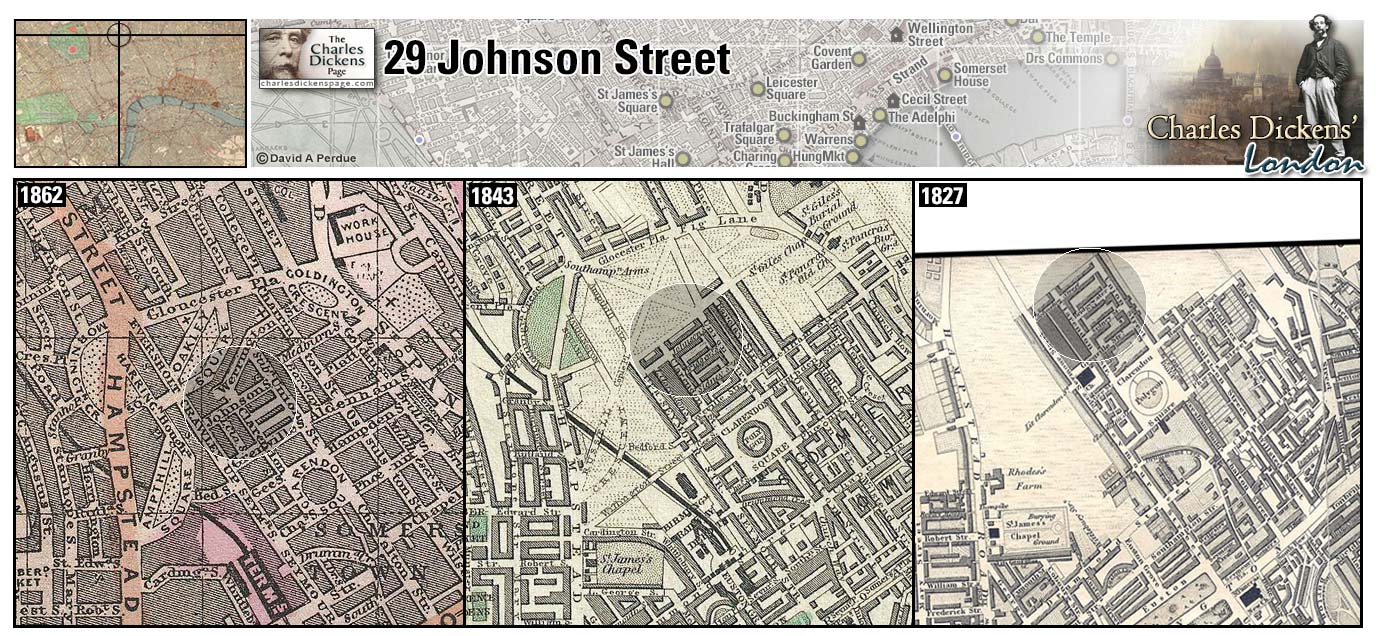
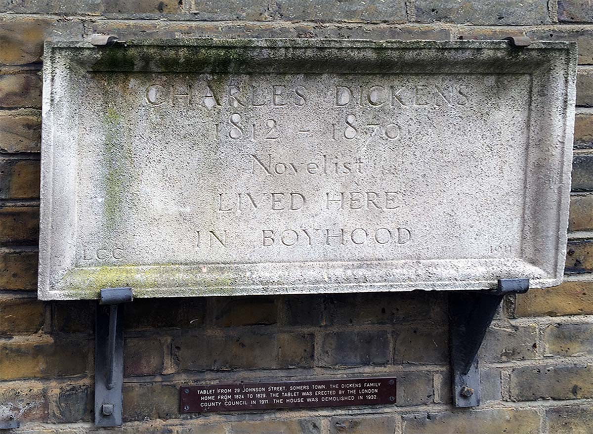
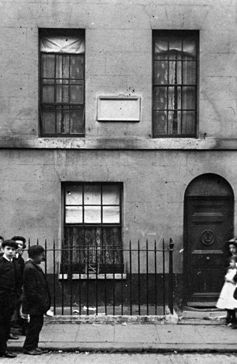
29 Johnson Street (Map: A-6) - House in Somers Town where the Dickens family moved in late 1824. Charles Dickens continued to work at Warren's Blacking Factory and later attended school at Wellington House Academy while living here. The family was evicted for nonpayment of rent in 1827 and lived briefly at The Polygon but were soon back in Johnson Street where they remained until 1829 (Ackroyd, 1990, p. 84+114). It was in this house, from 1922 to 1932, that John Langstaff established the David Copperfield Library, supplying books to the poor children in the area, in the early 1900s. The house was demolished in 1932 and the street is now named Cranleigh Street.
Kensington (Map: G-1) - Fashionable suburb in west London. During Dickens' time the area went from a rural parish of less than 10,000 people to a metropolitan borough of more than 175,000 by 1901 (Weinreb et al, 2008, p. 449).
- Prince Turveydrop teaches in a dance academy here (Bleak House).
- Bill Sikes and Oliver Twist pass Kensington on their way to Chertsey to rob the Maylie house (Oliver Twist).
The Kings Bench Prison (Map: F-10) - Debtor's prison in Southwark built 1755-58 to replace a medieval prison. It was burned during the Gordon Riots in 1780 and rebuilt. It was renamed the Queen's Bench Prison in the 1840s and, after imprisonment for debt was curtailed, became a military prison for a time. It was demolished in 1880 (Weinreb et al, 2008, p. 460-461).
Dickens describes the Rules of the King's Bench in Nicholas Nickleby: The place to which Mr Cheeryble had directed him was a row of mean and not over-cleanly houses, situated within 'the Rules' of the King's Bench Prison, and not many hundred paces distant from the obelisk in St George's Fields. The Rules are a certain liberty adjoining the prison, and comprising some dozen streets in which debtors who can raise money to pay large fees, from which their creditors do not derive any benefit, are permitted to reside by the wise provisions of the same enlightened laws which leave the debtor who can raise no money to starve in jail, without the food, clothing, lodging, or warmth, which are provided for felons convicted of the most atrocious crimes that can disgrace humanity. There are many pleasant fictions of the law in constant operation, but there is not one so pleasant or practically humorous as that which supposes every man to be of equal value in its impartial eye, and the benefits of all laws to be equally attainable by all men, without the smallest reference to the furniture of their pockets.
- The prison was badly damaged when the mob set fire to it during the Gordon Riots of 1780 (Barnaby Rudge).
- Wilkins Micawber was imprisoned for debt here (David Copperfield).
- Madeline Bray and her father, Walter Bray, lived in the Rules of the King's Bench where better off prisoners were kept (Nicholas Nickleby).
- Dickens walks by the King's Bench Prison during his nocturnal ambulations described in Night Walks (The Uncommercial Traveller).
- Mr Rugg tries to persuade Arthur Clennam to make himself an inmate of the newer and more spacious King's Bench rather than the Marshalsea (Little Dorrit).
Zoom Google Wikipedia Aerial 4 Back
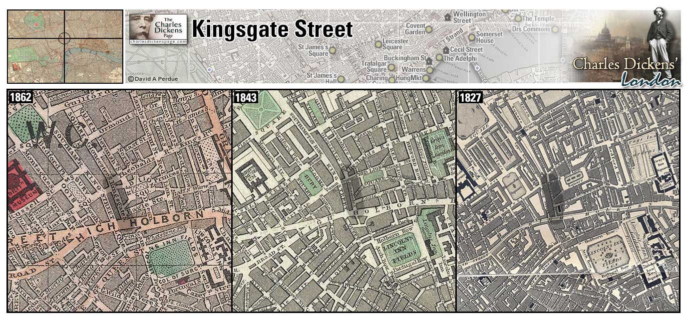
Kingsgate Street (Map: D-7) - Street in Holborn named after the King’s Gate barrier at its southern end, where King Charles’s coach famously overturned in 1669 (University College London, 2017). The street was demolished in 1902 to make way for Kingsway and Aldwych (Jackson, 2023, pp. 63-65)
- Sairey Gamp lives in Kingsgate Street above the shop of her landlord, barber and dealer in birds, Poll Sweedlepipe. (Martin Chuzzlewit).
Dickens decribes Sairey Gamp's residence:
This lady lodged at a bird-fancier's, next door but one to the celebrated mutton-pie shop, and directly opposite to the original cat's-meat warehouse; the renown of which establishments was duly heralded on their respective fronts. It was a little house, and this was the more convenient; for Mrs Gamp being, in her highest walk of art, a monthly nurse, or, as her sign-board boldly had it, 'Midwife,' and lodging in the first-floor front, was easily assailable at night by pebbles, walking-sticks, and fragments of tobacco-pipe; all much more efficacious than the street-door knocker, which was so constructed as to wake the street with ease, and even spread alarms of fire in Holborn, without making the smallest impression on the premises to which it was addressed.
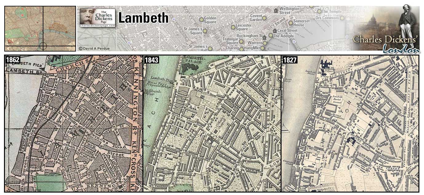
Lambeth (Map: H-7) - During Dickens' time a slum district of river warehouses across from Westminster (Leapman, 1989, p. 141).
- William Guppy intends to set himself up professionally in Walcot Square, Lambeth (Bleak House).
- Peg Sliderskew hides in Lambeth after stealing Arthur Gride's papers (Nicholas Nickleby).
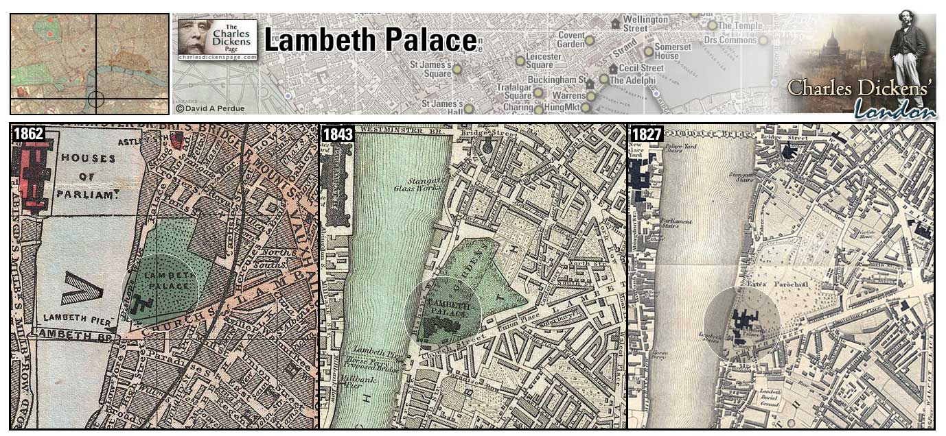
Lambeth Palace (Map: G-7) - The official residence of the archbishop of Canterbury. Extensively rebuilt and restored during the early 19th century (Weinreb et al, 2008, p. 471-472).
- The Gordon rioters attack Lambeth Palace (Barnaby Rudge).
Zoom Dictionary Google Wikipedia Back
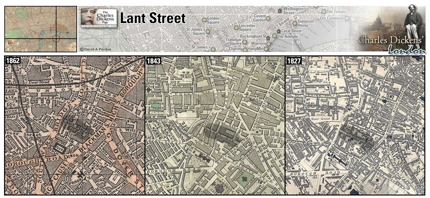
Lant Street (Map: F-10) - Street in the Borough where 12-year-old Dickens had lodgings in a rented attic while his father was in the Marshalsea prison for debt. The landlords of the house, Archibald Russell and his wife, were later imortalized by Dickens as the Garlands in The Old Curiosity Shop (Ackroyd, 1990, p. 76).
Dickens describes Lant Street in Pickwick Papers: There is a repose about Lant Street, in the Borough, which sheds a gentle melancholy upon the soul. There are always a good many houses to let in the street: it is a by-street too, and its dulness is soothing. A house in Lant Street would not come within the denomination of a first-rate residence, in the strict acceptation of the term; but it is a most desirable spot nevertheless. If a man wished to abstract himself from the world--to remove himself from within the reach of temptation--to place himself beyond the possibility of any inducement to look out of the window--we should recommend him by all means go to Lant Street.
Lant Street photographed in 1935 for MGM Studios in preparation for filming the 1935 film David Copperfield.
- Bob Sawyer, a medical student at nearby Guy's Hospital, has lodgings here (Pickwick Papers). "There’s my lodgings," said Mr. Bob Sawyer, producing a card, "Lant Street, Borough; it’s near Guy’s, and handy for me you know. Little distance after you've passed Saint George's Church–turns out of the High Street on the right hand side the way."
Zoom Google Wikipedia Aerial 4 Back
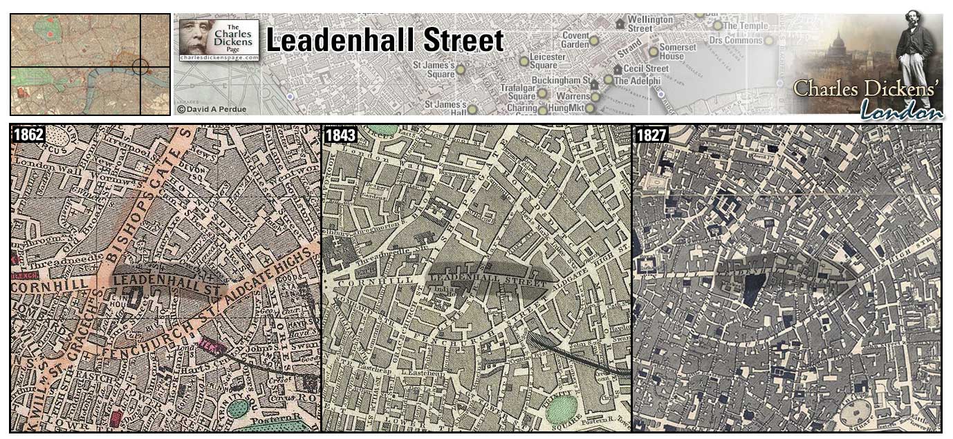
Leadenhall Street (Map: D-11) - Street and market in the City named for a mansion with a lead roof owned by the Neville family. This area contained extensive Roman ruins (Weinreb et al, 2008, p. 477).
- Tim Linkinwater tells Nicholas Nickleby, when comparing London to the countryside, that he can buy new-laid eggs in Leadenhall Market any morning before breakfast (Nicholas Nickleby).
- The offices of Dombey and Son are thought to be in Leadenhall Street (Dombey and Son).
- Sam Weller meets his father, Tony Weller, at the Blue Boar Inn in Leadenhall Market (Pickwick Papers).
- Charley Hexam and the schoolmaster Bradley Headstone look for Lizzie Hexam in the Leadenhall Street area (Our Mutual Friend).
Zoom Google Wikipedia Aerial 9 Back
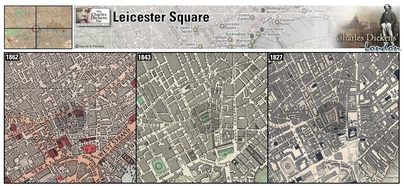
Leicester Square (Map: E-6) - Square laid out in the late 17th century (pronounced les-ter square). In Dickens' time private residences in the square gave way to public buildings as traffic increased. An equestrian statue of George I was erected in the square in 1748, it was removed in 1872 after being vandalized (Weinreb et al, 2008, p. 479+870).
- George Rouncewell's shooting gallery was near here (Bleak House).
Zoom Dictionary Google Wikipedia Back
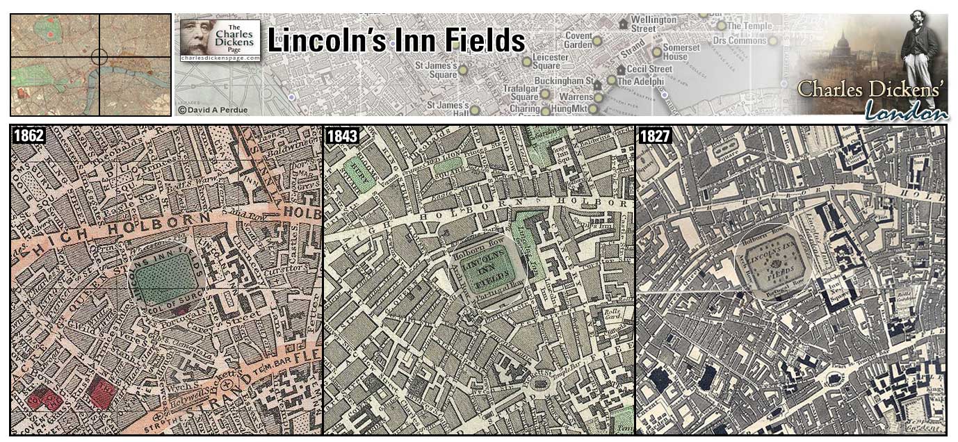
Lincolns Inn Fields (Map: D-8) - Designed by William Newton in the early 1600's as a compromise between the lawyers of Lincoln's Inn and developers wanting to build in the area. Newton was allowed to build around the perimeter of the Fields as long as the central part remained forever open (Weinreb et al, 2008, p. 486-487).
- The Insolvent Court, where Samuel Weller arranges with Solomon Pell to have himself committed to the Fleet Prison in order to be with his employer, Samuel Pickwick, is in Portugal Street, Lincoln's Inn Fields (Pickwick Papers).
- During the Gordon Riots the mob gathers in Lincoln's Inn Fields before heading off to burn Newgate Prison (Barnaby Rudge).
- Jarndyce and Jarndyce begins at the Court of Chancery at Lincoln's Inn and the lawyer Tulkinghorn has a home in the Fields (Bleak House).
- David Copperfield's aunt, Betsy Trotwood, has lodgings in Lincoln's Inn Fields in a hotel where there was a stone staircase, and a convenient door in the roof; my aunt being firmly persuaded that every house in London was going to be burnt down every night. (David Copperfield).
- In the sketch Omnibuses, Dickens describes a stop at Lincoln's Inn Fields to discharge passengers and take on new ones who are met with a very sulky reception remarking "It is rather remarkable, that the people already in an omnibus, always look at newcomers, as if they entertained some undefined idea that they have no business to come in at all" (Sketches by Boz).
Zoom Dictionary Photo Google Wikipedia Aerial 1 Aerial 3 Back
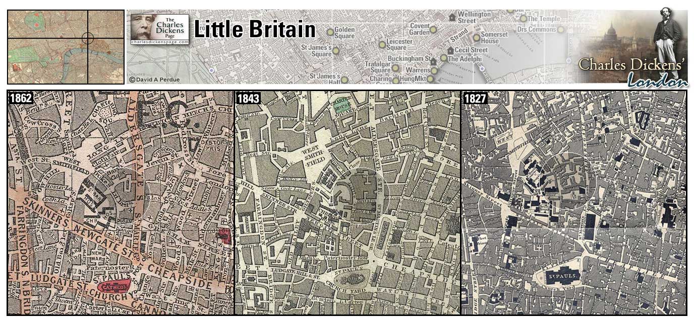
Little Britain (Map: D-9) - Narrow, winding London street, named for the Dukes of Brittany who resided here in the 16th century (Weinreb et al, 2008, p. 489).
- Mr Jaggers has an office in Little Britain (Great Expectations).
Zoom Google Wikipedia Aerial 3 Back
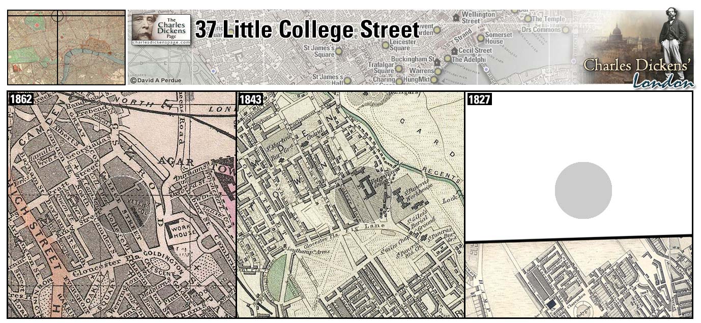
37 Little College Street (Map: A-6) - Street in Camden Town. In 1824 twelve-year-old Charles Dickens lived here with Mrs Roylance, a friend of the family, while his father, John Dickens, was imprisoned for debt at the Marshalsea Prison and Charles worked at Warren's Blacking Factory. He spent Sundays with the family in the Marshalsea. For a time after John Dickens' release from prison the entire family lived here. Mrs Roylance became the model for Mrs Pipchin in Dombey and Son (Johnson, 1952, p. 38+42).
- Dickens describes Little College Street as a desolate place enough, surrounded by little else than fields and ditches (Pickwick Papers).
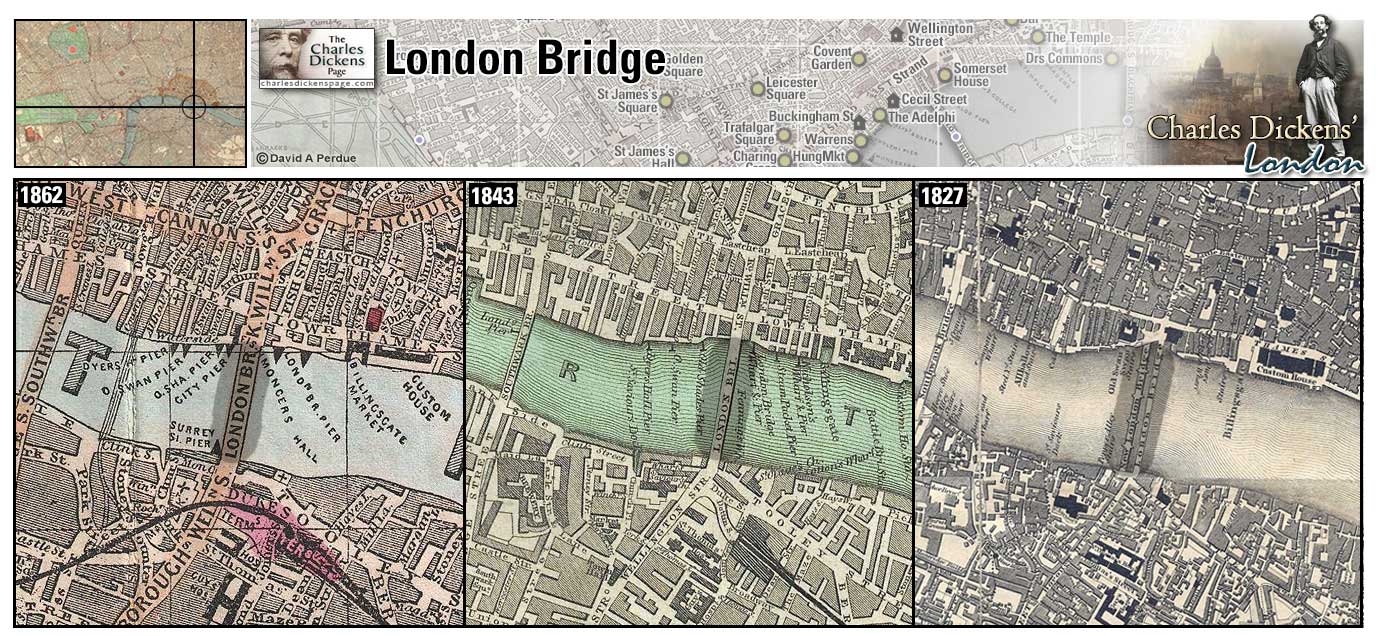
London Bridge (Map: E-11) - Until 1750 London Bridge was the only bridge over the Thames in London. A bridge at this site dates from Roman times. The first stone London Bridge was built in 1176. This bridge eventually had houses, shops, and a church built upon it until they were removed from 1758-1762. In 1831 it was replaced by a granite bridge designed by John Rennie. The Rennie London Bridge was replaced in 1972 and Rennie's bridge was dismantled and rebuilt in Lake Havasu, Arizona (Weinreb et al, 2008, p. 496-497).
London Bridge is one of the most often-mentioned locations in Dickens' work. We will list a few examples:
- In the sketch The Tuggses at Ramsgate Joseph Tuggs lives on the Surrey side of the Thames within a three minute walk of London Bridge (Sketches by Boz).
- Trying to save Oliver Twist, Nancy meets Rose Maylie and Mr Brownlow on the steps of London Bridge. She is observed by Noah Claypole which leads to her murder (Oliver Twist).
- David Copperfield, like Dickens, liked to sit on London Bridge and watch the people go by (David Copperfield).
- Gabriel Varden, the locksmith, crosses London Bridge to visit Mary Rudge in Southwark (Barnaby Rudge).
- Jonas Chuzzlewit sinks the clothes he wore to murder Tigg Montague in the river from below the steps on London Bridge (Martin Chuzzlewit).
- Much of the action in Little Dorrit involves the characters crossing and recrossing London and Southwark (Iron Bridge) Bridges to pass between the City and the Marshalsea Prison in the Borough (Little Dorrit).
- Pip, in practicing his boating skills in preparation of getting Magwitch out of England, speaks of the difficulty of rowing near Old London Bridge caused by certain states of the tide. He finally learned to "shoot the bridge" after seeing it done (Great Expectations).
- Gaffer and Lizzie Hexam ply their trade in "a boat of dirty and disreputable appearance...between Southwark bridge which is of iron, and London Bridge which is of stone" (Our Mutual Friend).
Zoom Dictionary Photo Google Wikipedia Aerial 4 Aerial 7 Back
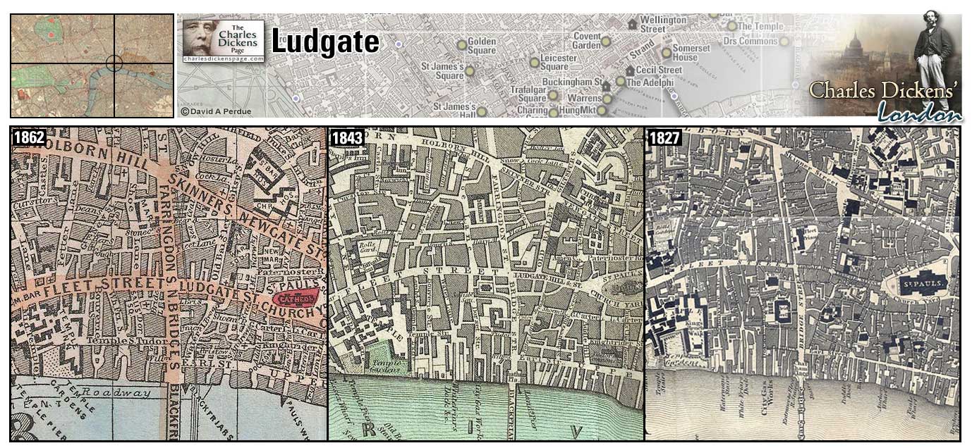
Ludgate (Map: D-9) - Hill and street named for a gate in the medieval city's wall (removed in 1760) where Fleet Street joins the City (Weinreb et al, 2008, p. 517-518). London's first daily newspaper, the Daily Courant, began publication near Ludgate in 1702 thus Fleet Street became the home of London's press (London Remembers).
- Smike is walking down Ludgate Hill into the City when he is captured by Wackford Squeers (Nicholas Nickleby).
- Mary Jones, a young woman of nineteen, is hung by Ned Dennis for attempting to steal a piece of cloth from a shop in Ludgate Hill (Barnaby Rudge).
- David Copperfield and Betsy Trotwood are walking towards Ludgate Hill when they are followed by Betsy's husband (David Copperfield).
- Arthur Clennam is sitting in a coffee-house on Ludgate Hill when the bells of neighboring church seem to speak to him (Little Dorrit).
- Charles Darnay and Sydney Carton go arm-in-arm down Ludgate Hill to a little tavern (Ye Olde Cheshire Cheese) off Fleet Street (A Tale of Two Cities).
Zoom Dictionary Photo Google Wikipedia Back
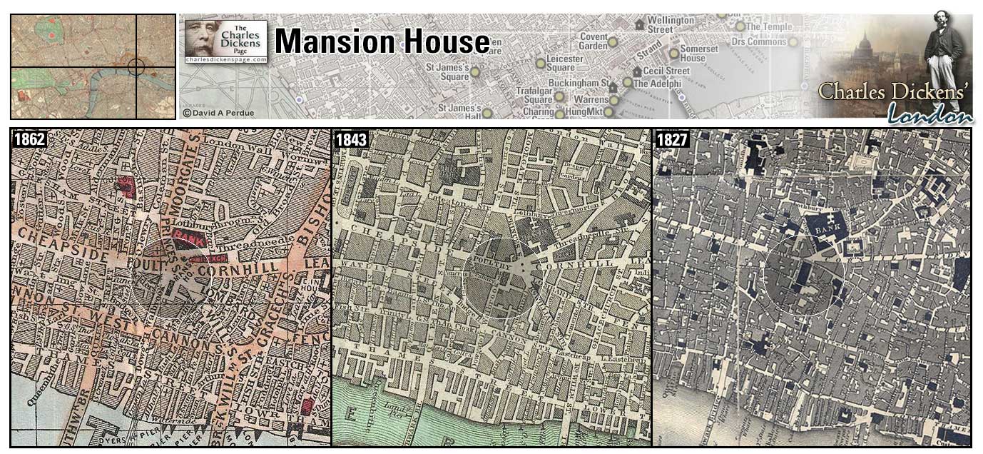
Mansion House (Map: D-10) - Official residence of London's Lord Mayor. Built in the mid 18th century by George Dance the Elder. In Dickens' time it also housed a police court over which, as chief magistrate, the Lord Mayor presided and contained holding cells for prisoners (Weinreb et al, 2008, p. 525-526).
- Samuel Pickwick and Sam Weller pass the Mansion House on the way to see Mr Perker (Pickwick Papers).
- Kit Nubbles, after being suspected of theft, is to be taken to the Mansion House by a constable (Old Curiosity Shop).
- Mark Tapley, while with Martin Chuzzlewit in America, and praying on the ignorance of Americans generally, explains to General Choke that Queen Victoria doesn't live in the Tower of London and wryly adds: 'The Queen of England, gentlemen,' observed Mr Tapley, affecting the greatest politeness, and regarding them with an immovable face, 'usually lives in the Mint to take care of the money. She HAS lodgings, in virtue of her office, with the Lord Mayor at the Mansion House; but don't often occupy them, in consequence of the parlour chimney smoking' (Martin Chuzzlewit).
- In describing the preparation for the celebration of Christmas, from the lowliest tailor to the Lord Mayor himself Dickens states: The Lord Mayor, in the stronghold of the mighty Mansion House, gave orders to his fifty cooks and butlers to keep Christmas as a Lord Mayor's household should (A Christmas Carol).
- Geoffrey Haredale appeals unsuccessfully to the Lord Mayor at the Mansion House to imprison Rudge Sr (Barnaby Rudge).
Zoom Dictionary Photo Google Wikipedia Aerial 6 Aerial 9 Back
The Marshalsea (Map: F-10) - Debtor's prison in Southwark where Dickens' father was imprisoned in 1824. The prison dates from medieval times and was closed in 1842 (Weinreb et al, 2008, p. 532).
- The Old Man's Tale About the Queer Client, a story told to Samuel Pickwick in the Magpie and Stump public house, is about a young family in the Marshalsea (Pickwick Papers).
- William Dorrit was imprisoned at the Marshalsea, cared for there by his daughter Amy Dorrit. Arthur Clennam is also imprisoned here. St. George's church, where Amy Dorrit was christened and where she married Arthur Clennam, is adjacent to the Marshalsea (Little Dorrit).
Zoom Photo Google Wikipedia Aerial 4 Back
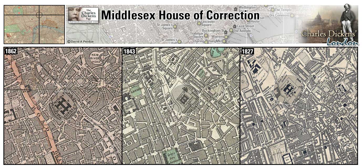
Middlesex House of Correction (Map: C-8) - Also known as Cold Bath Fields Prison, it was built in 1794. The prison closed in 1877 and was demolished in 1889 (Weinreb et al, 2008, p. 199-200).
- Tom Chitling. does time at the prison (Oliver Twist).
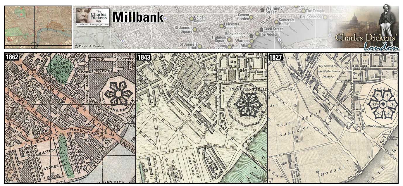
Millbank (Map: H-6) - Area along the north side of the Thames south of Westminster. It was named for the Westminster Abbey mill which once stood at the end of what is now Great College Street, just south of Westminster Abbey (Weinreb et al, 2008, p. 551).
- David Copperfield and Daniel Peggotty follow Martha Endell to this area (David Copperfield).
- Jenny Wren's home, at Smith Square, is in this area (Our Mutual Friend).
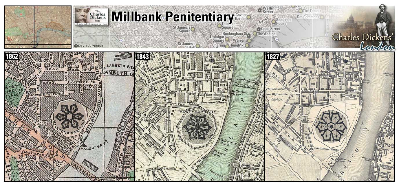
Millbank Penitentiary (Map: H-6) - The Millbank Peniteniary was built between 1813 and 1821 and was the largest prison in London. It closed in 1890 and today the Tate Gallery museum stands on this spot (Weinreb et al, 2008, p. 551-552).
- Millbank Prison is referred to when David Copperfield and Daniel Peggotty follow Martha Endell to Millbank in search of Emily. (David Copperfield).
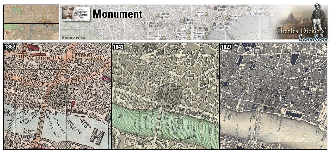
The Monument (Map: E-11) - 200 foot high Doric column on Fish Street Hill, designed by Christopher Wren, marking the site of the origin of the devastating fire that destroyed much of London in September 1666 (Weinreb et al, 2008, p. 559).
- John Willet tells his son Joe Willet that climbing to the top of the Monument is the preferred diversion when visiting London (Barnaby Rudge).
- David Copperfield passes time by stopping on old London Bridge and gazing at the flame atop the Monument (David Copperfield).
- M. Todgers's Commercial Boarding-House is located near the Monument (Martin Chuzzlewit).
- Mr Twemlow has his hair treated with an egg yolk concoction that makes it stick up like the Monument on Fish Street Hill (Our Mutual Friend).
- One of the nonsensical outbursts of Mr F's Aunt: 'The Monument near London Bridge,' that lady instantly proclaimed, 'was put up arter the Great Fire of London; and the Great Fire of London was not the fire in which your uncle George's workshops was burned down.' (Little Dorrit).
- Messrs Peddle and Pool, solicitors for Edward Dorrit, have offices at Monument Yard (Little Dorrit).
Zoom Dictionary Photo Google Wikipedia Aerial 6 Aerial 7 Back
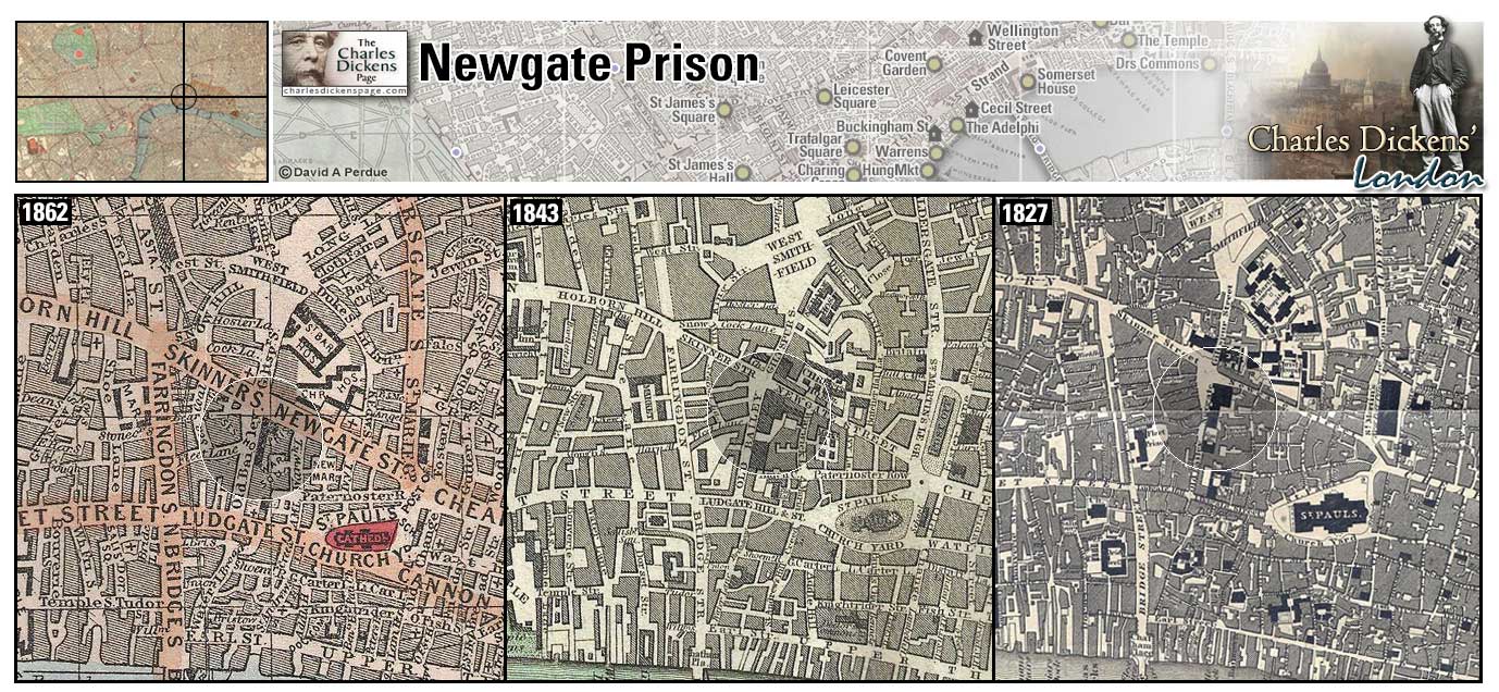
Newgate Prison (Map: D-9) - Notorious London prison originally built at the new gate in the Medieval city's wall (Halliday, 2006, p. 3-4). Public executions were moved from Tyburn to Newgate in 1783 and continued until 1868 when executions were moved inside the prison walls (Halliday, 2006, p. 174). The prison was destroyed in the Great Fire of 1666 and rebuilt. It was destroyed again during the Gordon Riots of 1780 and rebuilt (Weinreb et al, 2008, p. 584-586). New developments in the field of prison reform in the early nineteenth century spelled the decline of Newgate. From 1850 it was used primarily to hold prisoners awaiting trial or execution (Halliday, 2006, p. 232-233). Newgate was sold to the City of London in 1898 for £40,000 and was demolished in 1902. The Old Bailey, London's Central Criminal Court located next door to the prison, was expanded on the site (Halliday, 2006, p. 279-281).
- Oliver Twist visits Fagin in Newgate and witnesses his hanging (Oliver Twist).
- Hugh, Ned Dennis, and Barnaby Rudge are imprisoned at Newgate in cells refitted after the prison was burned in the riots (Barnaby Rudge).
- Wemmick and Pip visit the prison while Pip is awaiting the arrival in London of Estella (Great Expectations).
- Dickens described Newgate in the sketch A visit to Newgate (Sketches by Boz).
- Dickens describes Newgate in the sketch Criminal Courts: We shall never forget the mingled feelings of awe and respect with which we used to gaze on the exterior of Newgate in our schoolboy days. How dreadful its rough heavy walls, and low massive doors, appeared to us - the latter looking as if they were made for the express purpose of letting people in, and never letting them out again. Then the fetters over the debtors' door, which we used to think were a BONA FIDE set of irons, just hung up there, for convenience' sake, ready to be taken down at a moment's notice, and riveted on the limbs of some refractory felon! We were never tired of wondering how the hackney-coachmen on the opposite stand could cut jokes in the presence of such horrors, and drink pots of half- and-half so near the last drop (Sketches by Boz).
Zoom Dictionary Photo Google Wikipedia Aerial 2 Aerial 3 Back
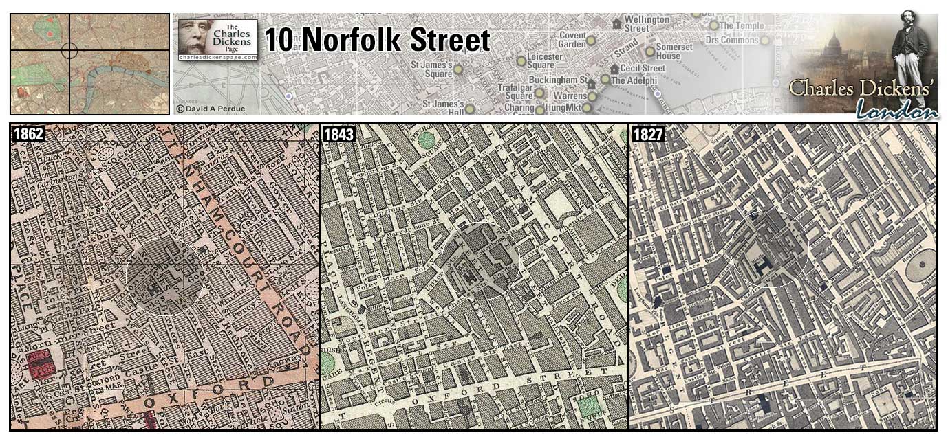
10 Norfolk Street (Now Cleveland Street) (Map: C-5) - The Dickens family lived here from 1815 to 1817, while Charles was from three to five years old. The family lived here, over a greengrocer's shop, a second time from 1829 to 1831 (Richardson, 2012, p. 85). Charles gave this as his residence when he applied for a reader's ticket at the British Museum in 1830 (Richardson, 2012, p. 190). The building survives as 22 Cleveland Street.
- The Cleveland Street Workhouse nearby is said to be the inspiration for the story of Oliver Twist (Oliver Twist)
Zoom Photo Google Wikipedia Aerial 10 Back
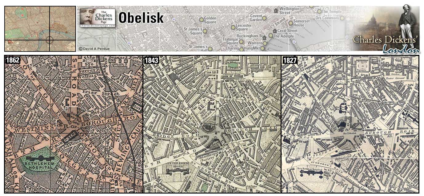
The Obelisk (Map: G-9) - London landmark which stands in the center of St. George's Circus in Southwark. It was moved to a park in front of the Imperial War Museum in 1905 but was returned to its original location in the late 1990s (Wikipedia).
- David Copperfield has his box and money stolen by a young man with a donkey-cart near the Obelisk as he is running away from Murdstone and Grinby's to his aunt's home in Dover (David Copperfield).
Zoom Google Wikipedia Aerial 4 Back
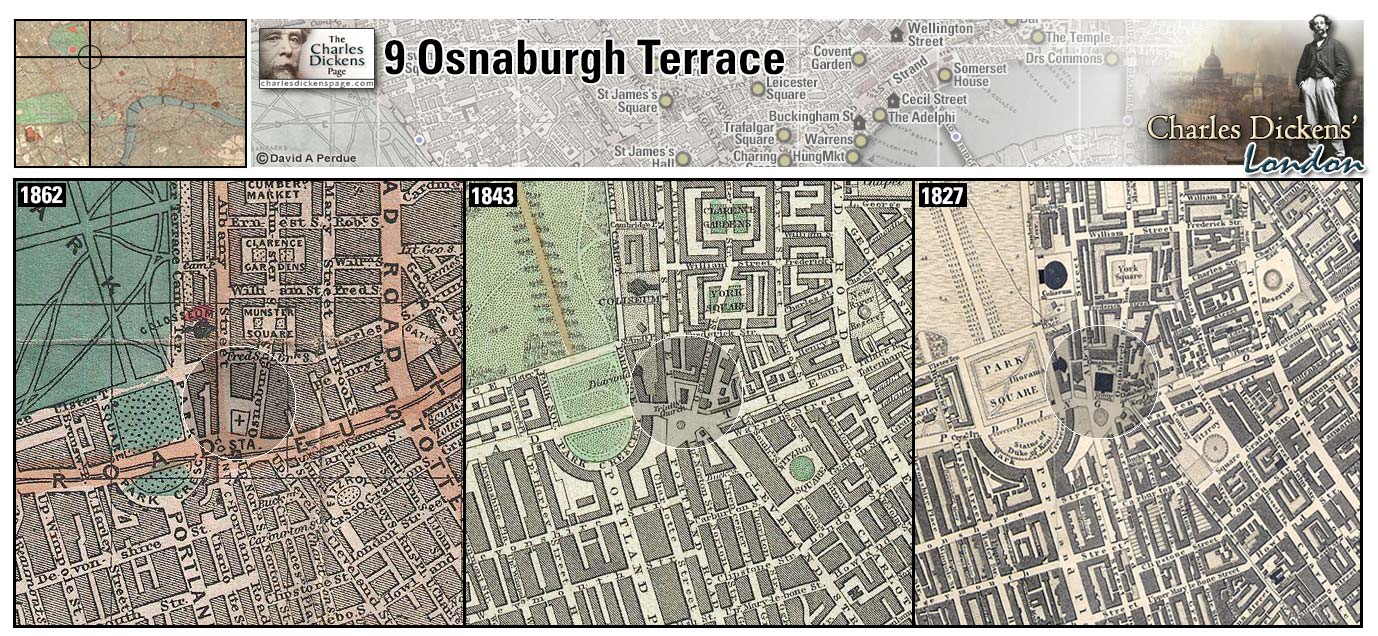
9 Osnaburgh Terrace (Map: B-5) - In anticipation of the family's year-long trip to Italy Dickens rented out his home at Devonshire Terrace and took temporary lodgings here from the end of May until the departure for Italy in early July 1844 (Johnson, 1952, p. 504-505).
Oxford Street (Map: D-4) - A residential street in Dickens' time, development beginning in the early 18th century when fields in the area were purchased by the Earl of Oxford (Weinreb et al, 2008, p. 610-611).
- John Jarndyce, Esther Summerson, Richard Carstone, and Ada Clare have "cheerful lodging over an upholsterer's shop" near Oxford Street (Bleak House).
- In New York Dickens notes that The streets and shops are lighted now; and as the eye travels down the long thoroughfare, dotted with bright jets of gas, it is reminded of Oxford Street or Piccadilly (American Notes).
Zoom Dictionary Google Wikipedia Aerial 3 Aerial 10 Back
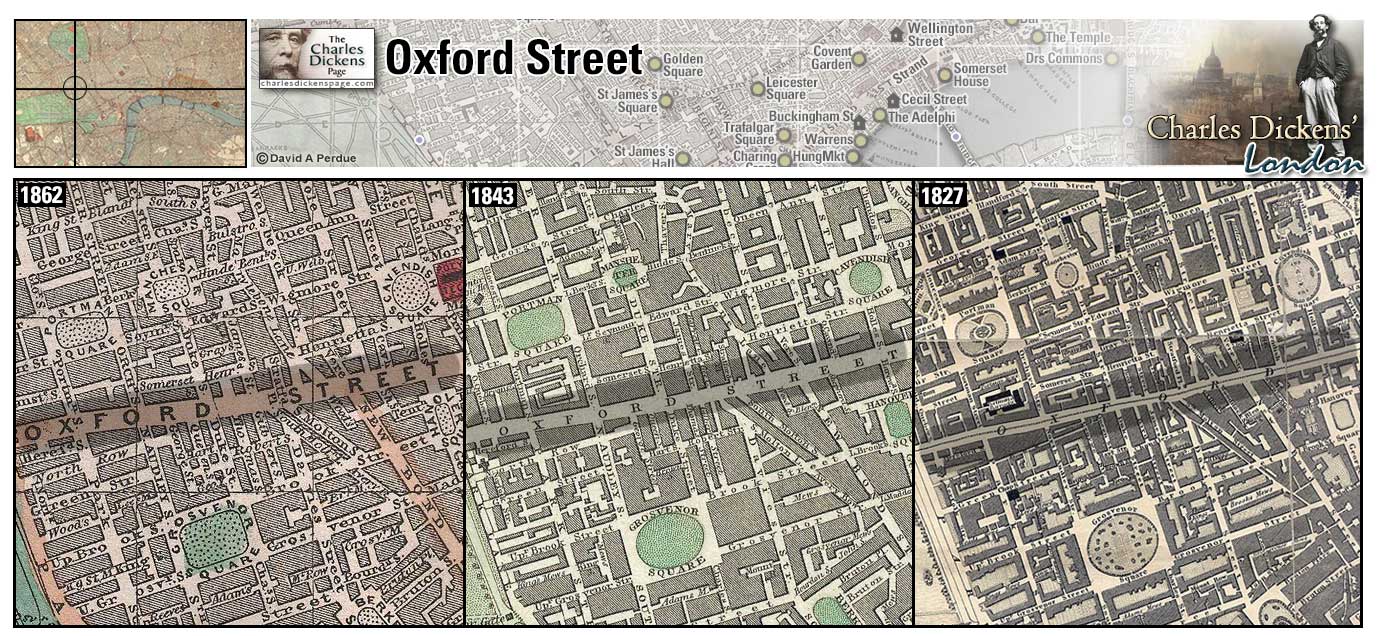
Paddington (Map: C-1) - Area of west London which saw a surge in development after the opening of the Grand Junction Canal in 1801. Paddington Railway Station opened in 1838 and the first underground line, the Metropolitan, opened in 1863 (Weinreb et al, 2008, p. 614).
- In the sketch The Last Cab Driver, and the First Omnibus Cad Dickens remarks on the talents of cab driver, William Barker: His cabriolet was gorgeously painted - a bright red; and wherever we went, City or West End, Paddington or Holloway, North, East, West, or South, there was the red cab, bumping up against the posts at the street corners, and turning in and out, among hackney-coaches, and drays, and carts, and waggons, and omnibuses, and contriving by some strange means or other, to get out of places which no other vehicle but the red cab could ever by any possibility have contrived to get into at all (Sketches by Boz).
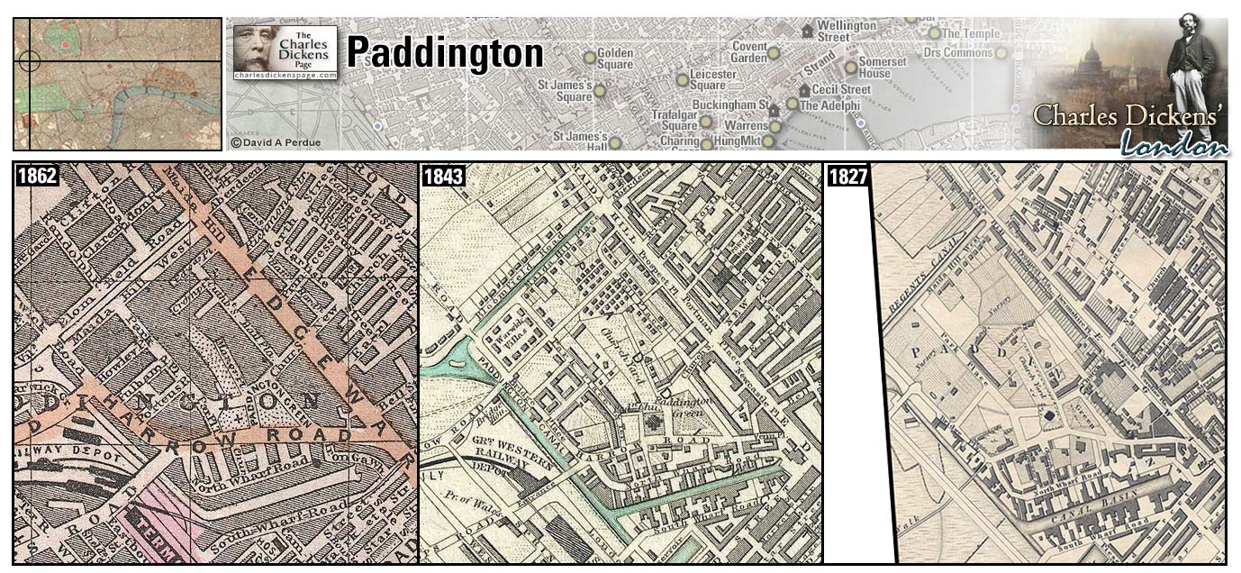
Pall Mall (Map: E-6) - Broad, elegant street known for fashionable residences and gentlemen's clubs. It derives its name from the Italian croquet-like ball games enjoyed by Charles II (Weinreb et al, 2008, p. 619-621).
- Tigg Montague has elegant lodgings in Pall Mall while director of the Anglo-Bengalee Disinterested Loan and Life Assurance Company (Martin Chuzzlewit).
- Mr Twemlow stumps for his friend Hamilton Veneering at his club in Pall Mall (Our Mutual Friend).
Zoom Dictionary Google Wikipedia Aerial 8 Back
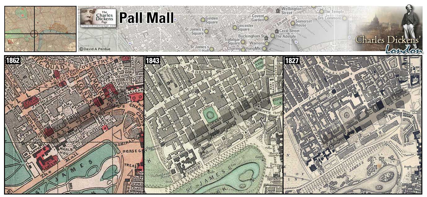
Park Lane (Map: E-4) - Unremarkable street along Hyde Park's east edge until the 1820s when a high brick wall along the park was replaced with iron railings and old terrace houses were remodeled or replaced making the street one of the most fashionable in London (Weinreb et al, 2008, p. 624-625).
- Nicholas Nickleby defends the honor of his sister against Sir Mulberry Hawk at a hotel near Park Lane (Nicholas Nickleby).
- Arthur Clennam and Mr Meagles search the area near Park Lane when looking for Miss Wade (Little Dorrit).
- Montague Tigg claims to a shopman at a pawn shop to have moved from Mayfair to Park Lane (Martin Chuzzlewit).
Zoom Google Wikipedia Aerial 10 Back
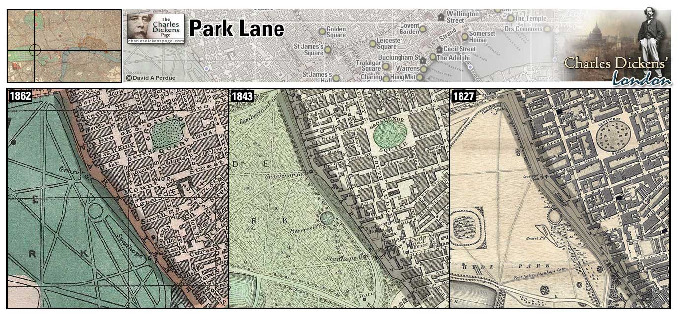
Paternoster Row (Map: D-9) - Long the center of London's publishing and bookselling trade. The street was heavily bombed during the Blitz of WWII (Weinreb et al, 2008, p. 628).
Zoom Google Wikipedia Aerial 2 Aerial 3 Back
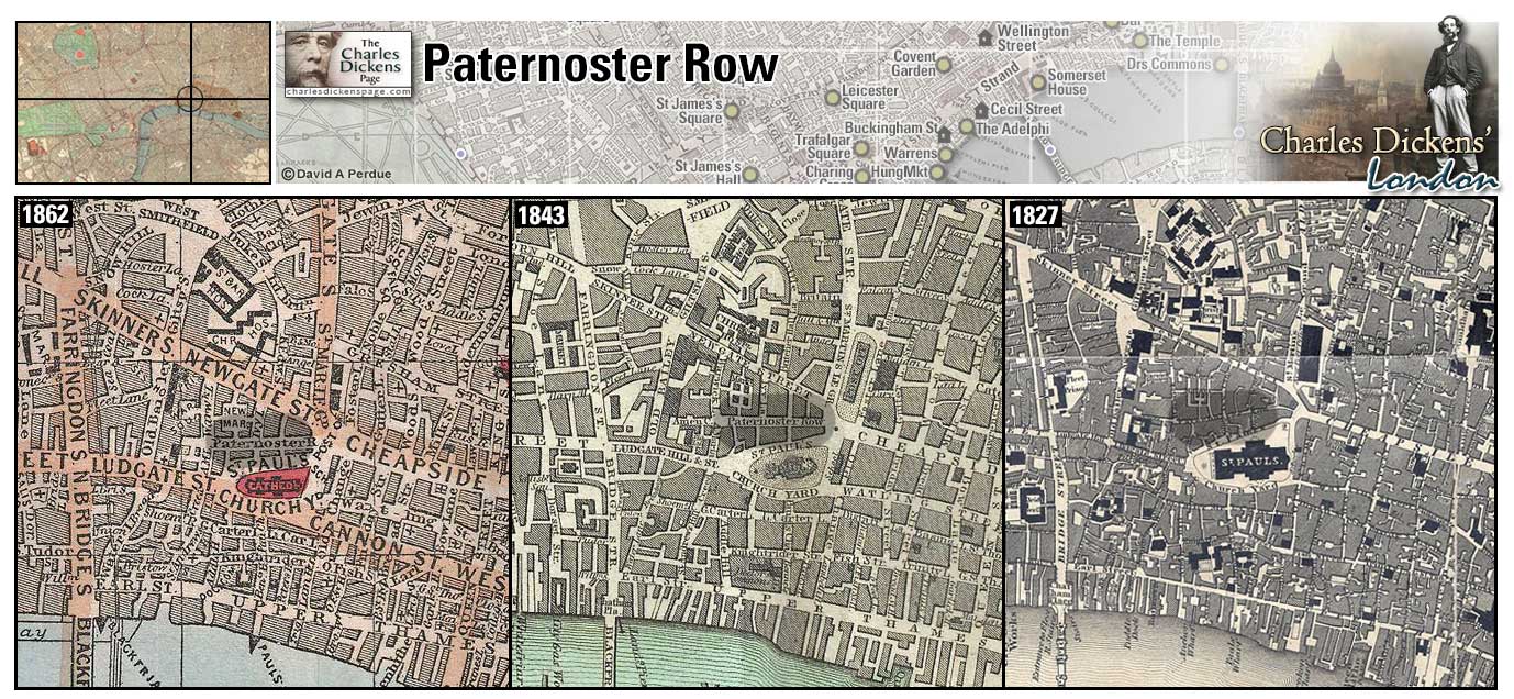
Pentonville (Map: A-7) - During Dickens' time a new and fashionable area of north London. Developed by Henry Penton, a member of the House of Commons who owned an estate in the area (Weinreb et al, 2008, p. 633-634).
- Mr Brownlow lives in Pentonville (Oliver Twist).
- Pancks, rent collector for Mr Casby, lives in Pentonville (Little Dorrit).
- William Guppy, clerk in the law firm of Kenge and Carboy, lives in Pentonville (Bleak House).
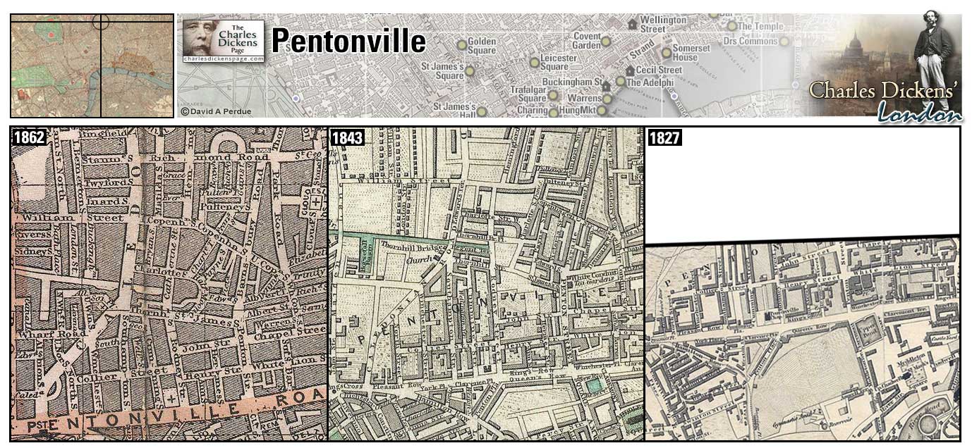
Piccadilly (Map: F-4) - London street in the West End. Named for a 17th century tailor, Robert Baker, who had a shop in the Strand that made high stiff collars called picadils. These collars were very popular at Court and Baker made a fortune which he used to buy land in what is now Piccadilly Circus. In 1612 he built an estate there he called Piccadilly after the collars that made him rich (Weinreb et al, 2008, p. 638-640).
- Wilkins Micawber fancies his family living in the upper part of a house, over some respectable business, in Piccadilly (David Copperfield).
- The Lammles reside in Sackville Street in Piccadilly and Fascination Fledgeby has chambers at the Albany in Piccadilly (Our Mutual Friend).
Zoom Dictionary Google Wikipedia Back
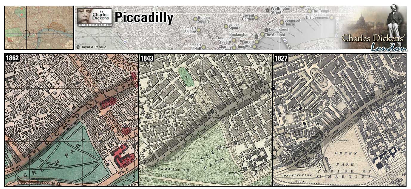
The Polygon (Map: B-6) - Fifteen-sided three-story building comprising 32 homes in Somers Town (Weinreb et al, 2008, p. 652). The Dickens family had lodgings at number 17 briefly in 1827 after being evicted from 29 Johnson Street (Ackroyd, 1990, p. 114).
- Harold Skimpole lives in the Polygon (Bleak House).
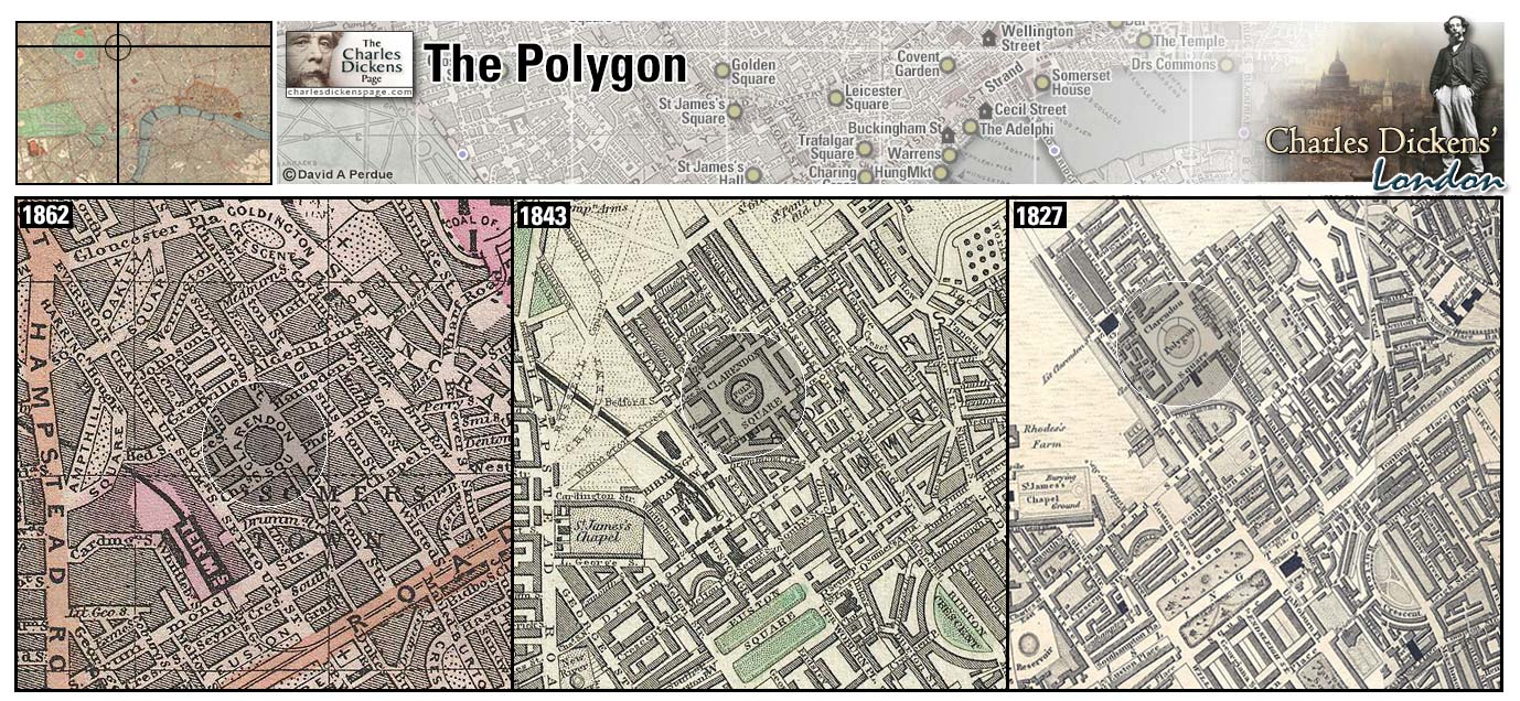
Pool of London (Map: E-11) - Dock area below London Bridge, farthest point upriver navigable by large ships (Leapman, 1989, p. 46).
Zoom Google Wikipedia Aerial 6 Back
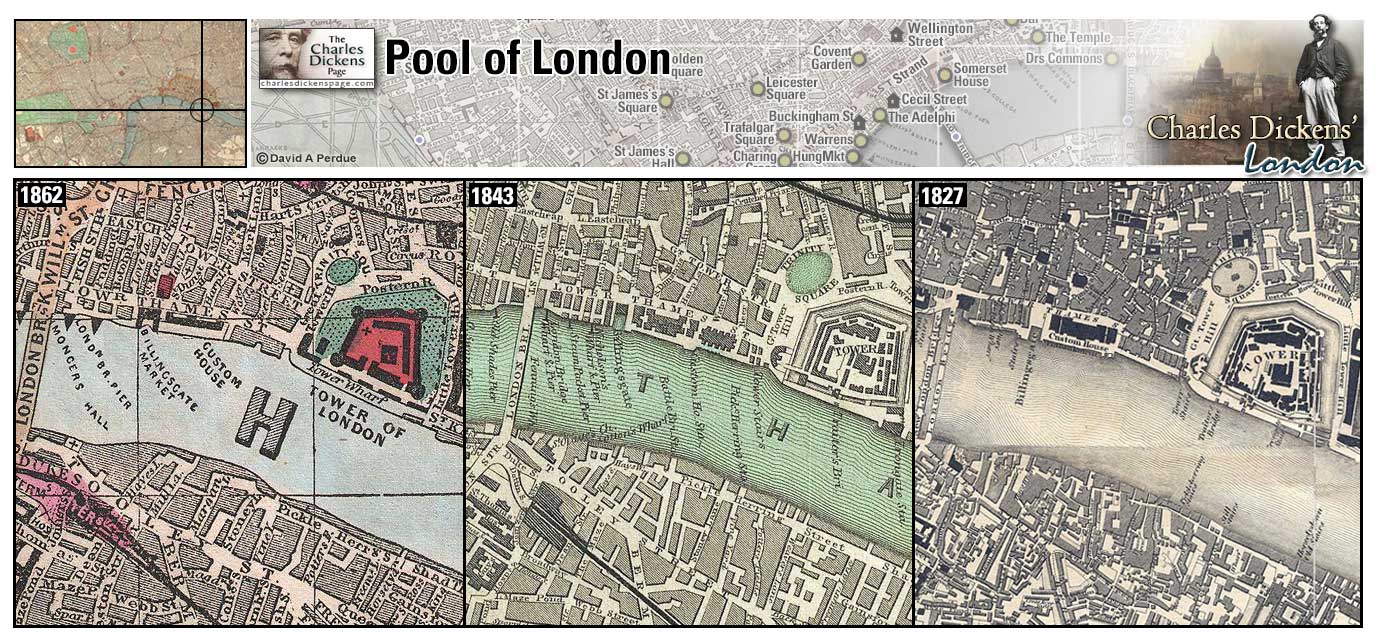
Portland Place (Map: C-5) - Wide, grand street laid out by Robert and James Adam about 1778 and named for the Duke of Portland (Weinreb et al, 2008, p. 658-659).
- Paul Dombey's house is located between Portland Place and Bryanstone Square (Dombey and Son).
- The Tapkins family lives in Portland Place (Our Mutual Friend).
Zoom Google Wikipedia Aerial 10 Back
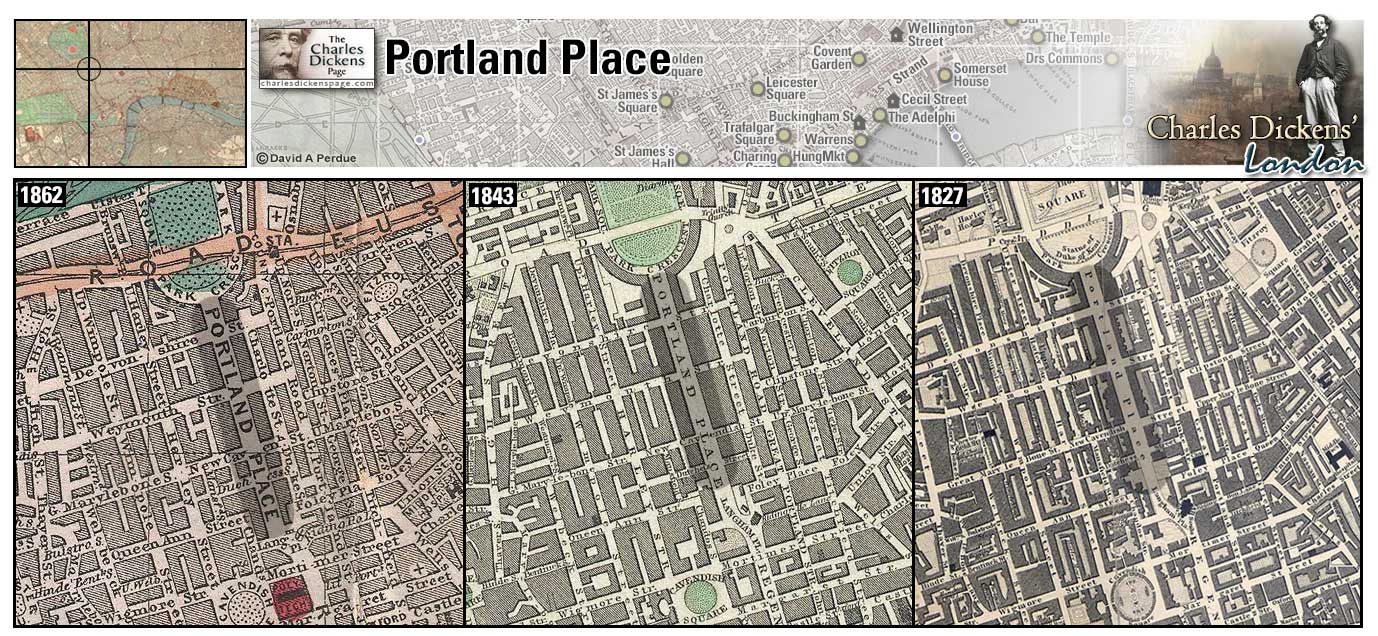
Portman Square (Map: D-4) - Square built between 1765 and 1784 on land belonging to Henry William Portman (Weinreb et al, 2008, p. 659).
- The Podsnaps live in a shady angle adjoining Portman Square (Our Mutual Friend).
Zoom Google Wikipedia Aerial 10 Back
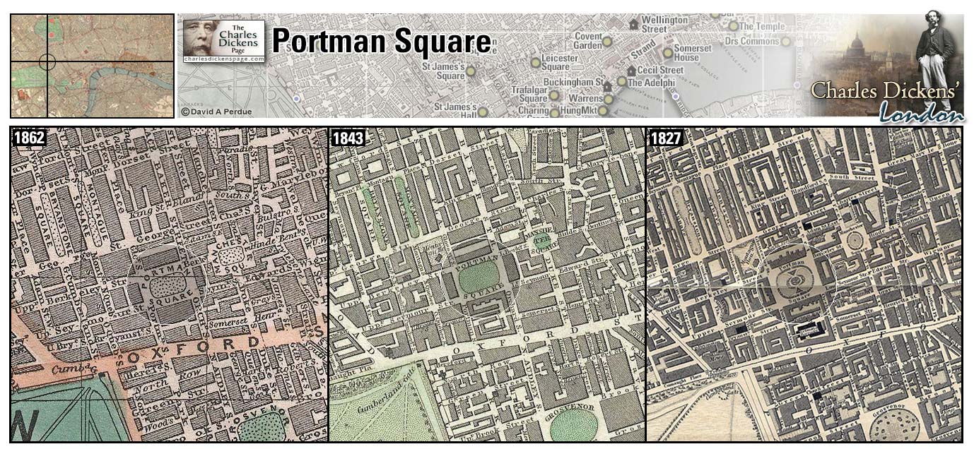
Regent's Park (Map: B-4) - Fashionable north London park and suburb built by John Nash (1752-1835) beginning in 1812 and named for the Prince Regent who supported Nash's plan (Leapman, 1989, p. 124) (Weinreb et al, 2008, p. 689). George III, incapacitated by mental illness in 1811, was replaced by his son (called the prince regent), later George IV. The period between 1811 and 1820, when George III died, became known as the Regency period (Fry, 1990, p. 167-175). The Zoological Gardens opened in Regent's Park in 1828 (Leapman, 1989, p. 124).
- Charles Dickens lived at 3 Hanover Terrace and at 1 Devonshire Terrace (1839-1851) near Regent's Park.
Zoom Dictionary Google Wikipedia Back
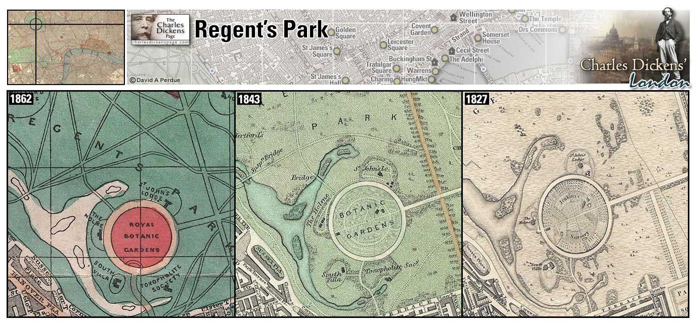
Regent Street (Map: D-5)- Fashionable street built between 1813 and 1820, during the Regency period and designed by John Nash (Hayward, 1924, p. 132).
- Lord Frederick Verisopht lives in a handsome suite of private apartments in Regent Street (Nicholas Nickleby).
- Regent Street is mentioned in the sketches Omnibuses, Thoughts About People, The Misplaced Attachment of Mr John Dounce, and The Boarding House (Sketches by Boz).
Zoom Dictionary Google Wikipedia Aerial 8 Aerial 10 Back
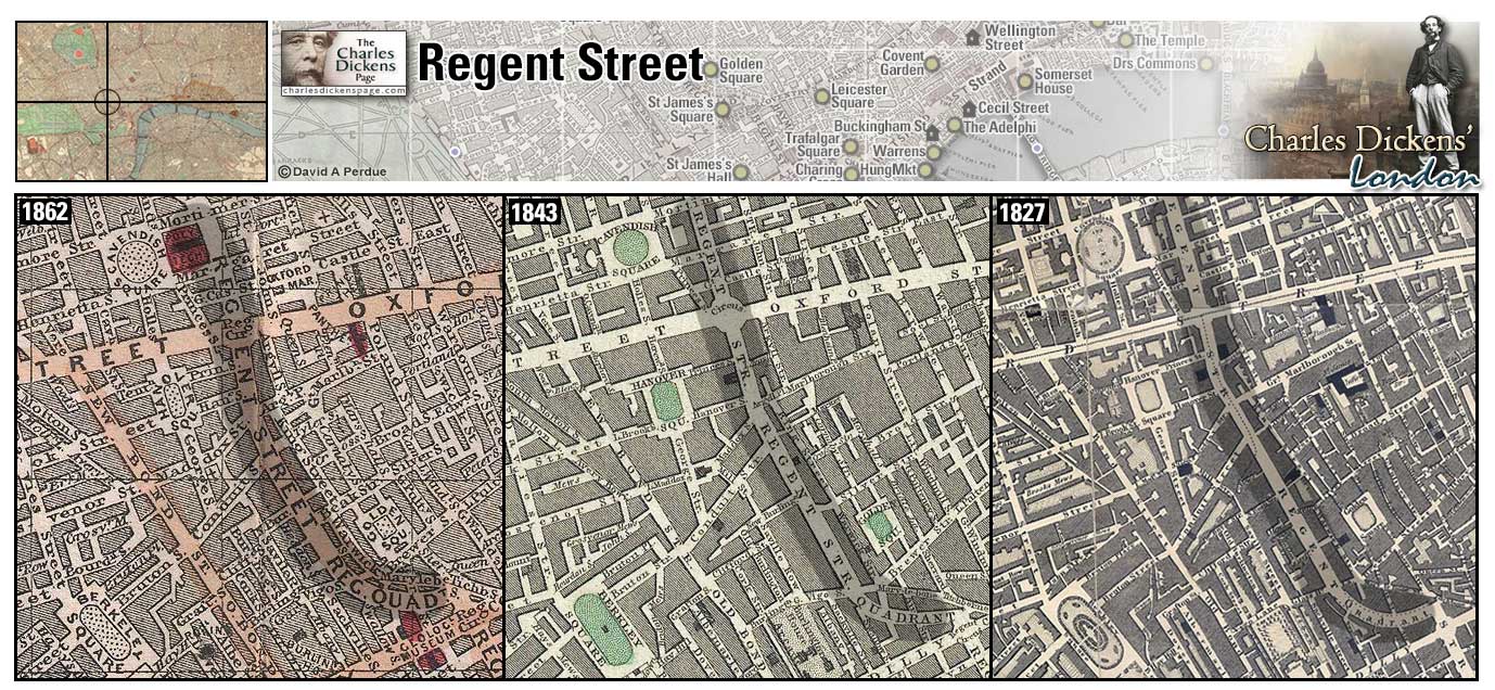
Royal Exchange (Map: D-11) - The meeting and bartering place for the merchants in the City. During Dickens' time the second Exchange building burned down in 1838 and the present building was opened on 28 October 1844 by Queen Victoria. The building ceased to function as an exchange in 1939 and in 2001, after extensive renovation, was reopened to house shops and restaurants on the ground floor with office space above (Weinreb et al, 2008, p. 717-719).
- Ebenezer Scrooge did business at the Exchange (A Christmas Carol).
- Paul Dombey would have frequented the Royal Exchange (Dombey and Son).
- Soldiers were posted to guard the Exchange during the Gordon Riots (Barnaby Rudge).
Zoom Dictionary Photo Google Wikipedia Aerial 9 Back
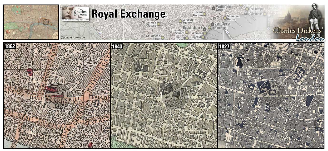
St Bartholomew's Hospital (Map: D-9) - Founded in 1123, "St Bart's" is London's oldest hospital. Threatened with closure in the 1990s, it was saved and is still in operation today operating as a specialist cancer and cardiac hospital (Weinreb et al, 2008, p. 746-747).
- Sairey Gamp's friend, Betsy Prig, is a nurse at St. Bartholomew's (Martin Chuzzlewit).
- John Baptist Cavalletto is taken there after being hit by the mail coach (Little Dorrit).
Zoom Google Wikipedia Aerial 3 Back
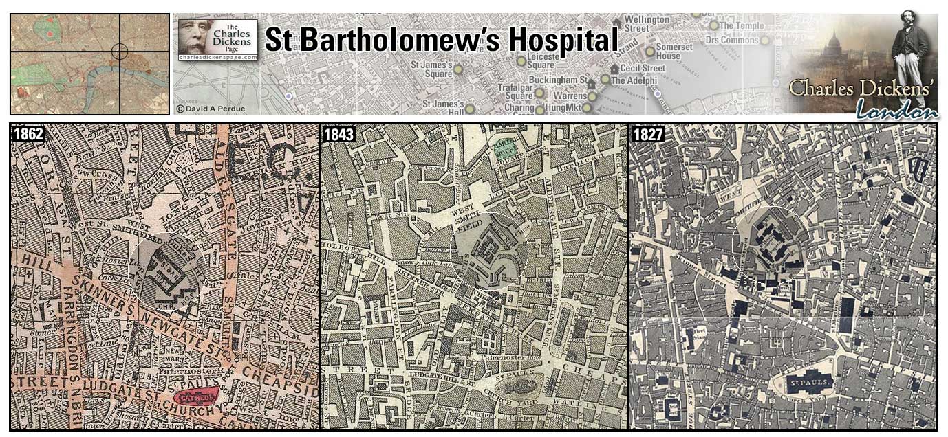
St George's Church (Map: F-10) - Officially St. George the Martyr, this is believed to be the third church built on this site. The present building dates from the 1730s and includes a stained glass window featuring a kneeling figure of Amy Dorrit (Weinreb et al, 2008, p. 759).
- Amy Dorrit is christened and later marries Arthur Clennam in the church which is near the Marshalsea prison where her father was a prisoner (Little Dorrit).
Zoom Photo Google Wikipedia Aerial 4 Back
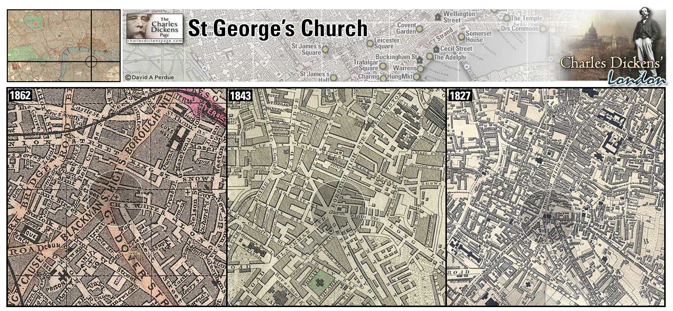
St James's Hall (Map: E-6) - Concert hall designed by Owen Jones and opened in March 1858. It became the premier concert hall in London during the 1870s and 80s before competition caused it to close. The hall was demolished in 1905 (Weinreb et al, 2008, p. 766).
- Charles Dickens gave public readings from his works here throughout the 1860s and ending with his last public performance on March 15, 1870. He died on June 9, 1870.
Zoom Google Wikipedia Aerial 12 Back
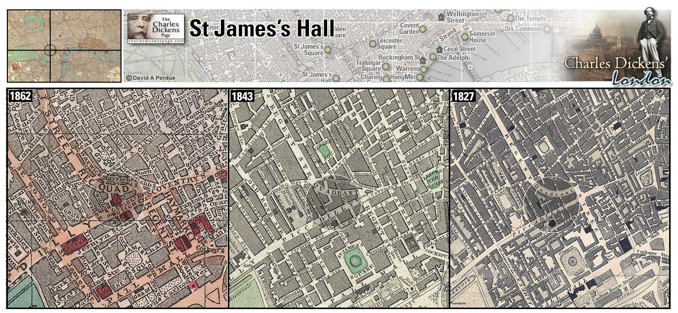
St James's Palace (Map: F-5) - Built during the reign of Henry VIII, it became the official residence of the monarchy after a fire destroyed Whitehall palace in 1698. It remained the official royal residence until Queen Victoria moved to Buckingham Palace at the start of her reign (Weinreb et al, 2008, p. 767-768).
Zoom Dictionary Photo Google Wikipedia Aerial 8 Back
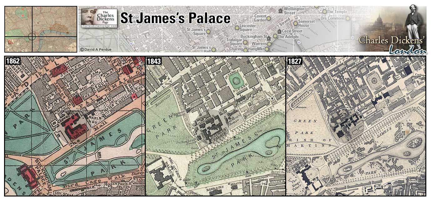
St James's Park (Map: F-6) - The oldest of London's royal parks, it was once a swampy field. Henry VIII had the field drained and used the area for recreation. Charles II extended the park and had several small ponds converted into a waterway called the Canal. After a period of decay, the park was revitalized during the reign of George IV in the 1820s, and improvements continued throughout the 19th century (Weinreb et al, 2008, p. 768-769).
- Young Martin Chuzzlewit meets Mary Graham in the park before leaving for America (Martin Chuzzlewit).
Zoom Dictionary Photo Google Wikipedia Aerial 5 Aerial 7 Aerial 8 Back
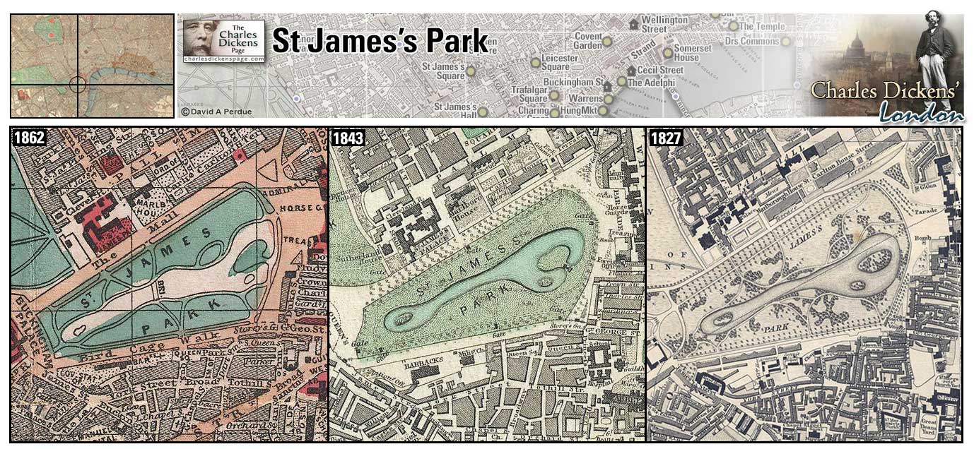
St James's Square (Map: E-6) - Laid out in the 1660's on land owned by Henry Jermyn, Earl of St. Albans. It became a fashionable residential area until the middle of the 1800s when businesses and clubs started to replace private houses (Weinreb et al, 2008, p. 770).
- Ned Dennis plans to finance the removal of Dolly Varden with loot that the rioters had thrown into "the convenient piece of water in the midst" of St. James's Square (Barnaby Rudge).
- Mr Twemlow contemplates his relationship with Veneering "in the cold gloom, favourable to meditation, of Saint James's Square" (Our Mutual Friend).
Zoom Google Wikipedia Aerial 8 Back
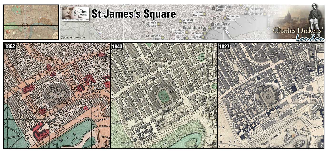
St Lukes (Map: B-10) - St Luke's Lunatic Asylum was founded in 1751. The patients were transferred to other institutions in 1916 and the buildings sold to the Bank of England and used to print bank notes. The building was demolished in 1963 (Wikipedia).
- Dickens attended a holiday celebration with the inmates there on the day after Christmas 1851 and described the visit in the article, co-written with William Henry Wills, A Curious Dance Round a Curious Tree in January 1852 (Household Words).
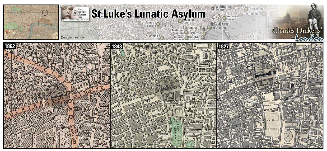
St Luke's Church (Map: H-2) - Stone church built in the 1820s and designed by James Savage. A spire was planned but never built (Weinreb et al, 2008, p. 781).
- Charles Dickens married Catherine Hogarth at St Luke's on April 2, 1836.
Zoom Photo Google Wikipedia Back
St Paul's Cathedral (Map: D-9) - Long the focal point of the London skyline, the present St. Paul's Cathedral, built by Sir Christopher Wren from 1675 to 1711, replaced the old gothic cathedral which burned in the Great Fire of 1666. Excavation work done after the Great Fire revealed that a Roman temple dedicated to Diana once stood upon the spot (Weinreb et al, 2008, p. 807). St. Paul's is part of the background scenery in many of Dickens' works.
- David Copperfield takes Clara Peggotty to the top of St. Paul's (David Copperfield).
- Ralph Nickleby meets Newman Noggs when he stops to set his watch by the clock of St Paul's (Nicholas Nickleby).
- Captain Cuttle installs Florence Dombey in Sol Gills's chamber and tells her that she is "as safe here as if you was at the top of St Paul's Cathedral, with the ladder cast off" (Dombey and Son).
- Arthur Clennam passes St Paul's on the way to his mother's house in Thames Street (Little Dorrit).
- In A Visit to Newgate the condemned prisoner hears the deep bell of St Paul's strike one and knew that he had seven hours left to live (Sketches by Boz).
- Nancy hears the heavy bell of St Paul's toll midnight on her way to meet Rose Maylie and Mr Brownlow on London Bridge (Oliver Twist).
- Jo enjoys a scanty meal on Blackfriars Bridge and studies the great cross on the summit of St Paul's (Bleak House).
Zoom Dictionary Photo Google Aerial 2 Aerial 3 Back
St Saviour's Church (Map: E-10) - Fourth church built upon this spot, the present gothic church dates from 1220. The church achieved cathedral status, becoming Southwark Cathedral, in 1905. William Shakespeare's brother Edmund is buried here (Weinreb et al, 2008, p. 857-858).
- The tower of St Saviour's is visible in the gloom as Nancy rushes to meet Rose Maylie and Mr Brownlow on London Bridge (Oliver Twist).
Zoom Photo Google Wikipedia Aerial 4 Aerial 7 Back
Scotland Yard (Map: E-7) - Home of the London's Metropolitan Police, created by Sir Robert Peel in 1829. Named for a medieval palace on this site in Whitehall reserved for visiting kings and queens of Scotland (Weinreb et al, 2008, p. 582-583).
- Dickens describes the area in the sketch Scotland-Yard (Sketches by Boz).
Zoom Google Wikipedia Aerial 5 Aerial 7 Back
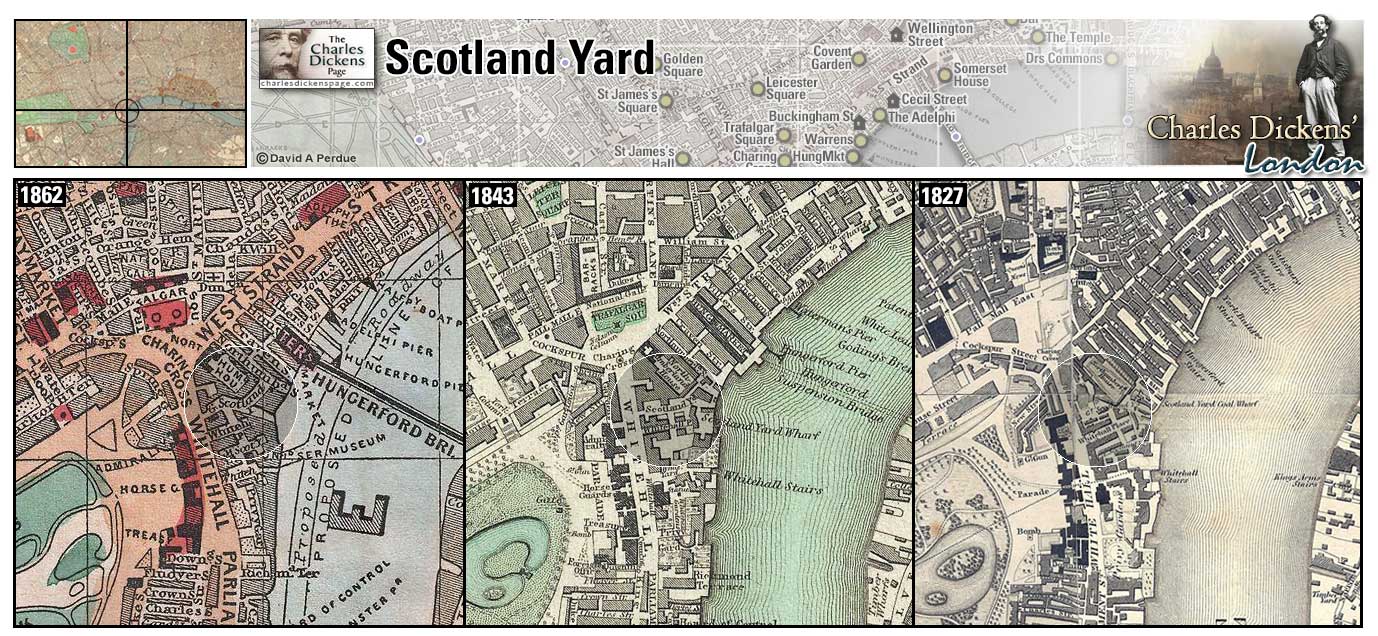
11 Selwood Terrace (Map: H-1) - Dickens took lodgings here for six months in 1835 to be near his fiance Catherine Hogarth, paying rents both here and at Furnival's Inn (Ackroyd, 1990, p. 171).
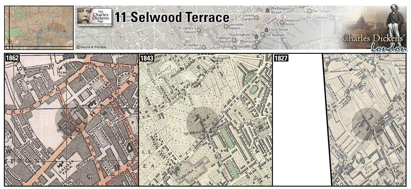
Seven Dials (Map: D-7) - Infamous slum and criminal district where seven streets converge at St. Giles (Weinreb et al, 2008, p. 831-831).
- In the sketch Seven Dials Dickens notes that a stranger who finds himself in The Dials for the first time will see enough around him to keep his curiosity and attention awake for no inconsiderable time (Sketches by Boz).
- In the article On Duty with Inspector Field from June 1851, Dickens describes a visit to a miserable lodging house in St. Giles where the poor, mostly Irish emigrants, are "heaped upon the floor like maggots in cheese" (Household Words).
Zoom Dictionary Google Wikipedia Back
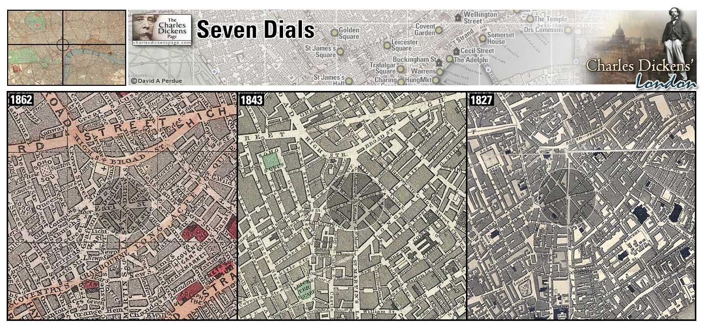
Smithfield (Map: C-9) - London's live cattle market. Cattle were driven through the streets until the mid 19th century. The market was moved to slaughterhouses in Islington in 1855. Smithfield was also the site of the annual Bartholomew's Fair from medieval times until it was forced to close due to rowdiness and debauchery in 1855 (Weinreb et al, 2008, p. 842-843).
- Oliver Twist and Bill Sikes pass through Smithfield Market on their way to burglarize the Maylie home noting that It was market-morning. The ground was covered, nearly ankle-deep, with filth and mire; a thick steam, perpetually rising from the reeking bodies of the cattle (Oliver Twist).
- In A Parliamentary Sketch Dickens describes the noise and confusion, [in the House of Commons] to be met with in no other place in existence, not even excepting Smithfield on a market-day (Sketches by Boz).
- Rudge Sr, after leaving his wife's house, attempts to lose himself in the backways, lanes, and courts, between Cornhill and Smithfield (Barnaby Rudge).
- While waiting for Mr Jaggers, Pip goes to Smithfield ...and the shameful place, being all asmear with filth and fat and blood and foam, seemed to stick to me. So I rubbed it off with all possible speed... (Great Expectations).
Zoom Photo Google Wikipedia Aerial 3 Back
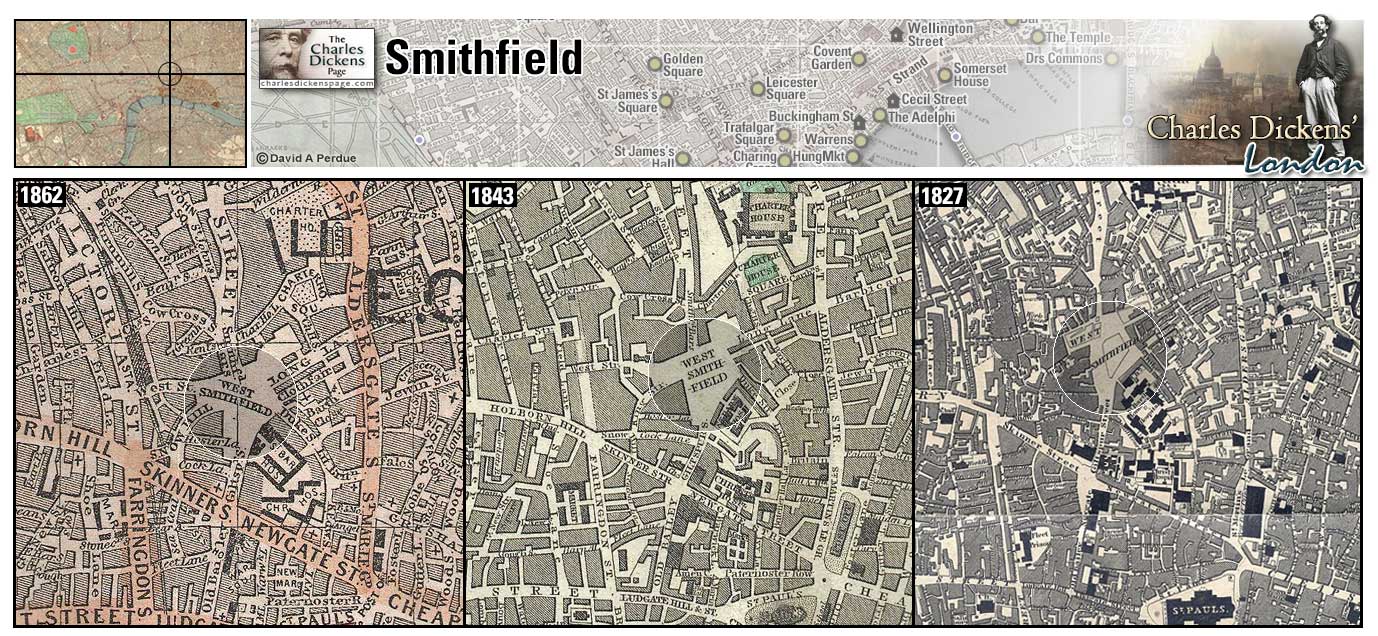
Snow Hill (Map: D-9) - Steep and busy street leading from Holborn down to Farringdon Street (Hayward, 1924, p. 144-145).
- The Saracen's Head Inn, where Wackford Squeers headquartered when in London to advertise for pupils for Dotheboys Hall, was in Snow Hill (Nicholas Nickleby).
- Fagin's den is located in Saffron Hill near Snow Hill (Oliver Twist).
- Arthur Clennam, after seeing John Baptist Cavalletto safely at St Bart's Hospital walks through Snow Hill to his lodgings at Covent Garden (Little Dorrit).
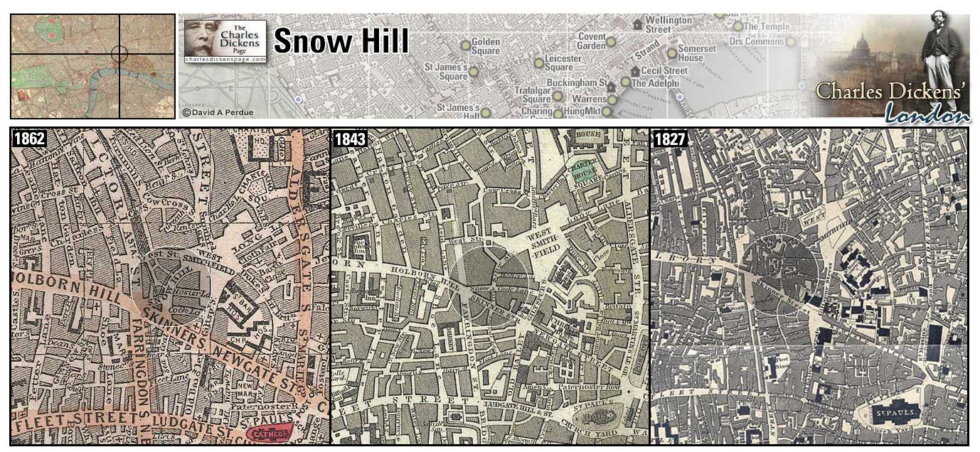
Soho Square (Map: D-6) - Area in West London that changed from farmland into a royal park during the reign of Henry VIII and developed into an area of fashionable homes in the late 1600s. During Dickens' time the square housed professional men; doctors, lawyers, architects, and publishing houses (Weinreb et al, 2008, p. 846-847).
- Dr Alexandre Manette and his daughter Lucie Manette lived in a quiet street corner near Soho Square (A Tale of Two Cities).
- Caddy Jellyby meets Esther Summerson here (Bleak House).
- Emma Haredale encounters Gabriel Vardon at a masquerade at Carlisle House in Soho Square (Barnaby Rudge).
- Kate and Nicholas Nickleby get lost near Soho Square on a trip to pick up a few necessaries for Nicholas's journey to Greta Bridge (Nicholas Nickleby).
Zoom Google Wikipedia Aerial 10 Back
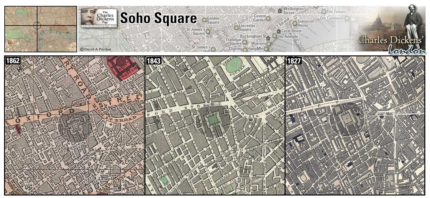
16 Somers Place (Map: D-2) Charles Dickens took lodgings here in March 1865 for the London Season while working on Our Mutual Friend and suffering from severe pain in his left leg and foot that would plague him for the rest of his life (Ackroyd, 1990, p. 957).
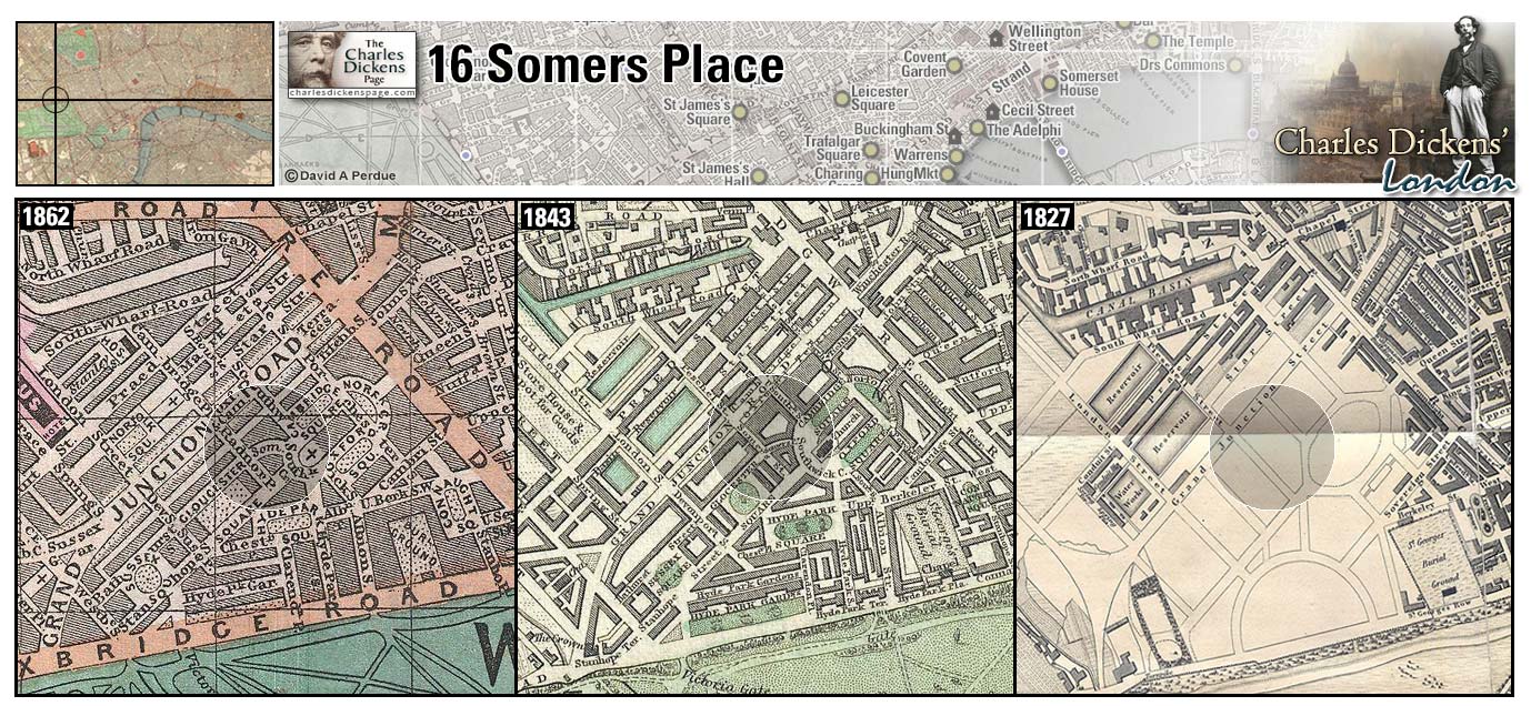
Somerset House (Map: E-8) - Originally completed in 1550 and was once a royal residence used by Elizabeth I. It was demolished in 1775 and rebuilt to house government offices (Weinreb et al, 2008, p. 849-850).
- Dickens' father, John Dickens, and uncle, Thomas Culliford Barrow, were employed at Somerset House.
Zoom Dictionary Photo Google Wikipedia Aerial 1 Aerial 7 Back
Somers Town (Map: B-6) - Suburb in the north of London where a large population of Spanish refugees settled the early 1800s. The Dickens family lived on Johnson Street and in The Polygon in Somers Town in the 1820s (Weinreb et al, 2008, p. 848).
- Harold Skimpole lives in a house in a state of dilapidation in The Polygon in Somers Town (Bleak House).
- Mr Snawley lives on the extreme borders of some new settlements adjoining Somers Town (Nicholas Nickleby).
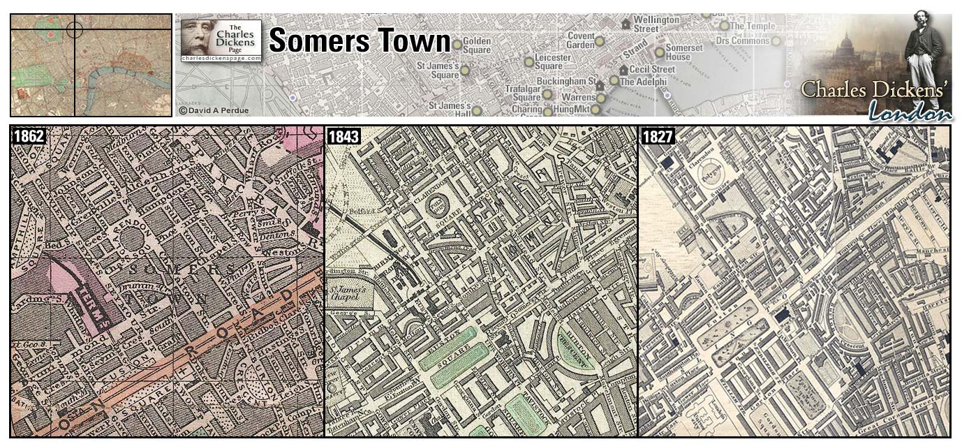
Southwark (Map: F-9) - District south of the Thames which includes the Borough. Southwark (pronounced suth-uck) was the main entry into London from the south and included many coaching inns along Borough High Street (Weinreb et al, 2008, p. 855-857).
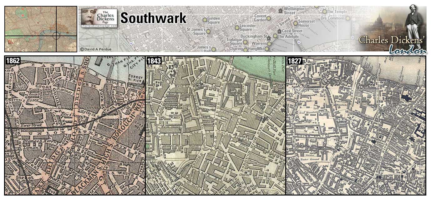
Southwark Bridge (Map: E-10) - Designed by John Rennie, built in 1814-1819 and was replaced in 1921 (Weinreb et al, 2008, p. 857). Sometimes referred to as Iron Bridge, the bridge was mentioned in Dickens as a quiet place due to the fact that crossing required payment of a penny toll (Little Dorrit, p. 281) whereas nearby London and Blackfriars bridges had no toll.
- Amy Dorrit liked to walk on Southwark Bridge and John Chivery proposed to her on the bridge (Little Dorrit).
- Gaffer Hexam's eyes, while searching for bodies in the river, catch on anything that impedes the current including the piers of Southwark Bridge (Our Mutual Friend).
Zoom Dictionary Photo Google Wikipedia Aerial 7 Back
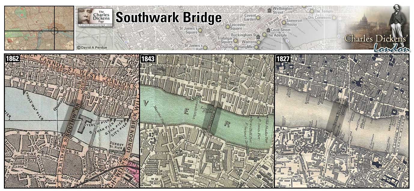
6 Southwark Place (Map: D-2) Charles Dickens took lodgings here in the spring of 1866 for the London Season. According to Peter Ackroyd, in his biography Dickens, it was no coincidence that Southwark Place was just around the corner from Somers Place where he had rented the year before. This area, know as Tybernia because of its proximity to the old Tyburn gallows, was considered to be one of the healthiest parts of London (Ackroyd, 1990, p. 973).
Spitalfields (Map: D-12) - Area east of the city named for the Priory and hospital of St Mary Spital. The area was resettled in the 17th century by French Huguenot refugees (protestants persecuted in France) who established a silk weaving industry there (Weinreb et al, 2008, p. 861).
- The silk weaving industry in the area was in decline when Dickens described it in the April 1851 article Spitalfields co-authored with William Henry Wills (Household Words).
Staple Inn (Map: D-8) - One of the medieval Inns of Chancery dating back to the 12th century. Although heavily damaged during WWII the building survives to the present day (Weinreb et al, 2008, p. 433). Dickens describes Staple Inn in The Mystery of Edwin Drood: Behind the most ancient part of Holborn, London, where certain gabled houses some centuries of age still stand looking on the public way, as if disconsolately looking for the Old Bourne that has long run dry, is a little nook composed of two irregular quadrangles, called Staple Inn. It is one of those nooks, the turning into which out of the clashing street, imparts to the relieved pedestrian the sensation of having put cotton in his ears, and velvet soles on his boots. It is one of those nooks where a few smoky sparrows twitter in smoky trees, as though they called to one another, ‘Let us play at country,’ and where a few feet of garden-mould and a few yards of gravel enable them to do that refreshing violence to their tiny understandings. Moreover, it is one of those nooks which are legal nooks; and it contains a little Hall, with a little lantern in its roof: to what obstructive purposes devoted, and at whose expense, this history knoweth not (The Mystery of Edwin Drood, p. 112).
- Mr Snagsby loves to walk in Staple Inn in the summertime to observe how countrified the sparrows and the leaves are (Bleak House).
- Mr Grewgious has chambers here and Neville Landless takes quarters here after the disappearance of Edwin Drood (The Mystery of Edwin Drood).
Zoom Google Wikipedia Aerial 3 Back
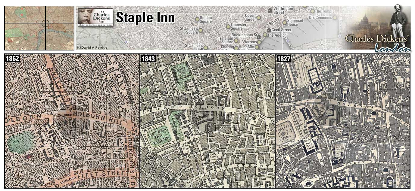
Strand (Map: E-7) - Wide thoroughfare that connects Westminster to Fleet Street and the City (Weinreb et al, 2008, p. 882-884). As a child Dickens worked at Warren's Blacking factory at Hungerford stairs in the west side of the Strand (Ackroyd, 1990, p. 67-68). The offices of the Morning Chronicle, where Dickens worked as a reporter, was in the Strand (Davis, 1999, p. 369). Later the offices of Household Words and All the Year Round, his weekly journals, were located in Wellington Street in the Strand (Davis, 1999, p. 405).
- Geoffrey Haredale walks along the Strand after his house is burned and no one will give him shelter (Barnaby Rudge).
- David Copperfield finds a good shop to buy pudding in the Strand (David Copperfield).
- Martin Chuzzlewit, after great trouble, finds lodging for himself and Mark Tapley at a court in the Strand, not far from Temple Bar (Martin Chuzzlewit).
- The Nickleby's have lodging in the Strand at the home of miniature portrait painter Miss La Creevy. La Creevy loves living along this great thoroughfare because When I want a nose or an eye for any particular sitter, I have only to look out of window and wait till I get one. (Nicholas Nickleby).
- Rose Maylie and Oliver Twist meet Mr Brownlow and Mr Grimwig at a lodging house on Craven Street in the Strand (Oliver Twist).
- Arthur Clennam is following the lamplighter down the Strand when he chances upon Tattycoram and Rigaud (Little Dorrit).
- Roger Cly's fake funeral procession proceeds down the Strand with a multitude of odd characters being recruited along the way (A Tale of Two Cities).
- Riah makes a stately journey in the fog down the Strand to the chambers of Fascination Fledgeby (Our Mutual Friend).
- Emma Lirriper's boarding house is located at number eighty-one Norfolk Street, Strand (Mrs Lirriper's Lodging, Mrs Lirriper's Legacy).
Zoom Dictionary Google Wikipedia Aerial 1 Aerial 5 Aerial 7 Back
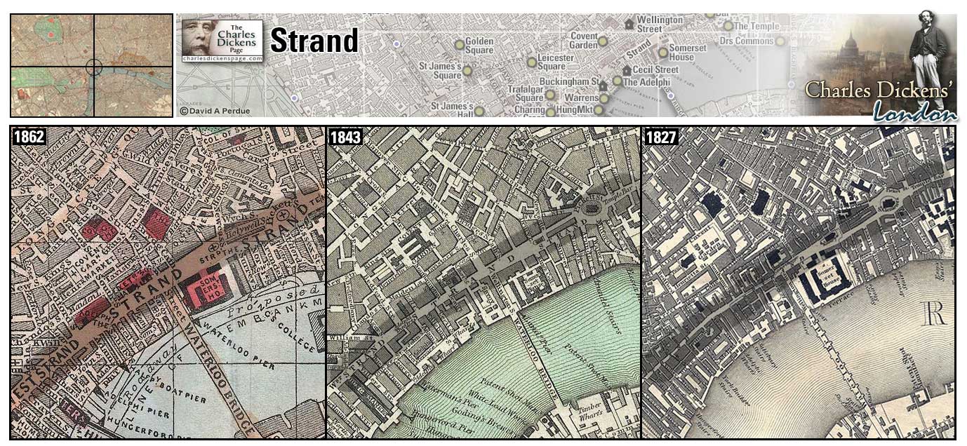
Tavistock House (Map:B-6) - Dickens' home from 1851 to 1860 located at Tavistock Square (Davis, 1999, p. 383). While living here Dickens and his wife, Catherine, separated (Johnson, 1952, p. 918). He purchased Gads Hill Place, near Rochester, in 1856 and for four years maintained both residences (Davis, 1999, p. 144). Tavistock House was demolished in 1900 (Hardwick et al, 1973, p. 292).
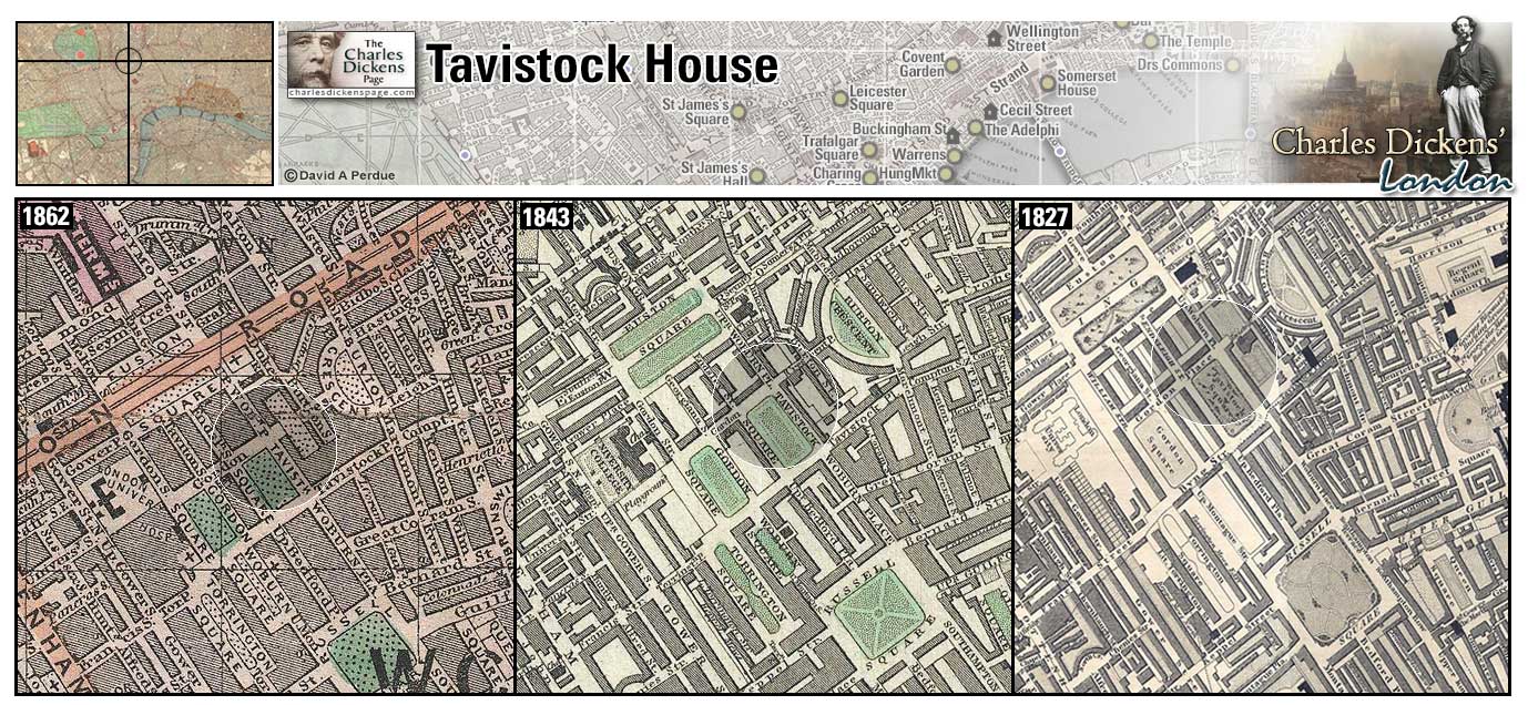
The Temple (Map: D-8) - Legal district in London originally occupied by the Knights Templar, who protected pilgrims on their journey to the Holy Land. The Temple consists of two Inns of Court, Inner Temple and Middle Temple, with Temple Church between them (Davis, 1999, p. 383). In Dickens' time the Temple included residential accommodation.
- Pip has chambers at the Temple (in Garden-court, down by the river) when he is visited by Abel Magwitch (Great Expectations).
- Sir John Chester has chambers in the Temple (Barnaby Rudge).
- Mortimer Lightwood has chambers in the Temple (Our Mutual Friend).
- Stryver, lawyer who defends Charles Darnay, has chambers there (A Tale of Two Cities).
- Tom Pinch works for an unknown employer in The Temple (Martin Chuzzlewit).
Zoom Dictionary Photo Google Wikipedia Aerial 1 Aerial 2 Aerial 7 Back
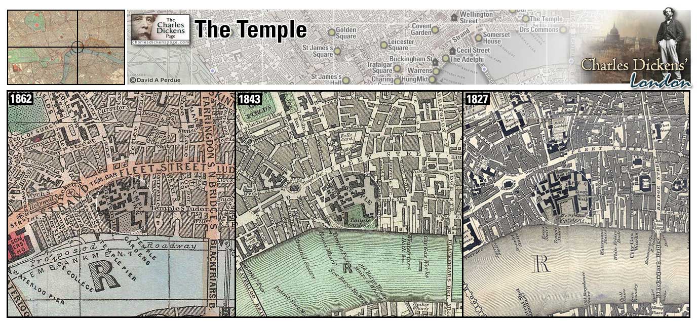
Temple Bar (Map: D-8) - Archway, designed by Wren, used to mark the border between the City and Westminster where Fleet Street becomes the Strand. The heads of executed criminals once announced their example from pikes on Temple Bar. The archway caused major traffic congestion and was removed in 1878. It now stands in Paternoster Square near St Paul's Cathedral (Weinreb et al, 2008, p. 909-910).
- Simon Tappertit has the 'prentices vow that in case of violence, Temple Bar will not be harmed (Barnaby Rudge).
- Jarvis Lorry and Jerry Cruncher work for Tellson's Bank near Temple Bar (A Tale of Two Cities).
- Tom Pinch is knocked about by traffic when he stops to laugh at his sister Ruth at Temple Bar (Martin Chuzzlewit).
- Martin Chuzzlewit, after great trouble, finds lodging for himself and Mark Tapley at a court in the Strand, not far from Temple Bar (Martin Chuzzlewit).
- David Copperfield and Daniel Peggotty pass Temple Bar and enter the City in their pursuit of Martha Endell (David Copperfield).
- Temple Bar is a player in the metaphoric fog at the beginning of Bleak House: The raw afternoon is rawest, and the dense fog is densest, and the muddy streets are muddiest near that leaden-headed old obstruction, appropriate ornament for the threshold of a leaden-headed old corporation, Temple Bar. And hard by Temple Bar, in Lincoln's Inn Hall, at the very heart of the fog, sits the Lord High Chancellor in his High Court of Chancery. (Bleak House).
Zoom Photo Google Wikipedia Aerial 1 Aerial 2 Back
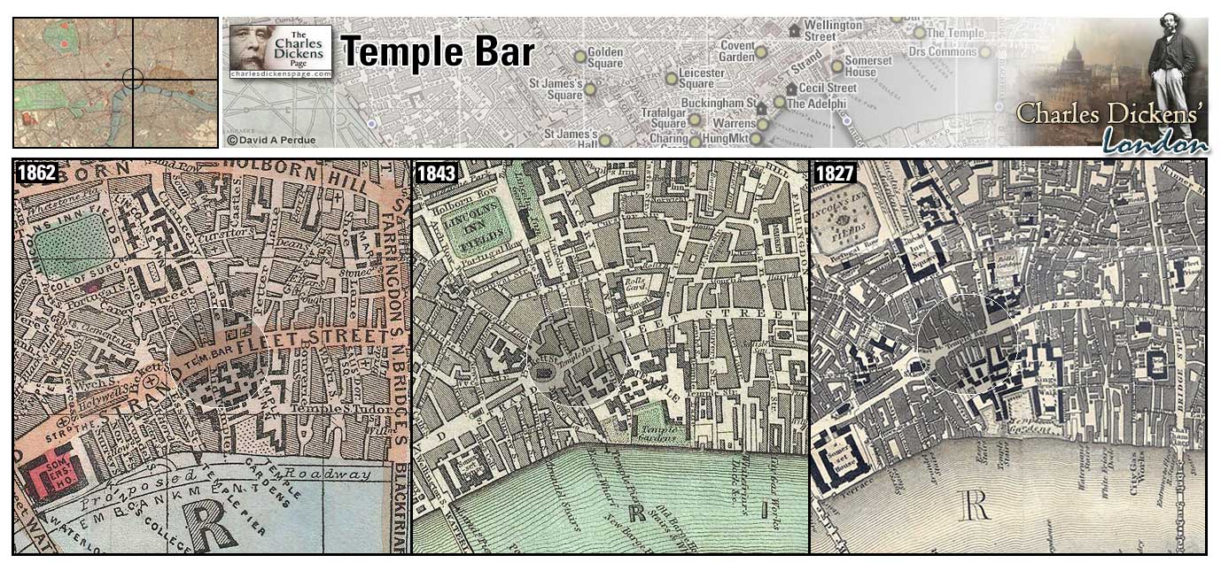
Thames Street (Map: E-10) - Street running along the river in the City from Blackfriars Bridge to the Tower of London (Hayward, 1924, p. 153).
- Mrs Clennam's house is in Thames Street or nearby (Little Dorrit).
- Ralph Nickleby arranges lodging for Mrs Nickleby and Kate Nickleby in an "old and gloomy" vacant house in Thames Street (Nicholas Nickleby).
- Joe Willet settles his father's quarterly account with a vintner "down in some deep cellars hard by Thames Street" (Barnaby Rudge).
- Tom Pinch gets lost on his way to Furnival's Inn and finds himself in Thames Street (Martin Chuzzlewit).
- Walter Gay finds Florence Dombey wandering in the City after having her clothes stolen and takes her to Sol Gills's shop by way of the "mud and grease of Thames Street" (Dombey and Son).
Zoom Google Wikipedia Aerial 6 Aerial 7 Back
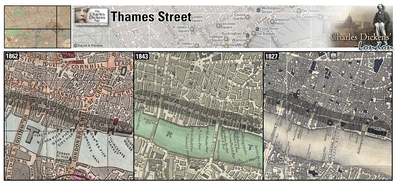
Threadneedle Street (Map: D-11) - Street in The City whose main feature is the Bank of England, known as "The Old Lady of Threadneedle Street" (Weinreb et al, 2008, p. 916-917).
- Charles and Edwin Cheeryble's business is "in a quiet, shady little square" off Threadneedle Street (Nicholas Nickleby).
Zoom Photo Google Wikipedia Aerial 9 Back
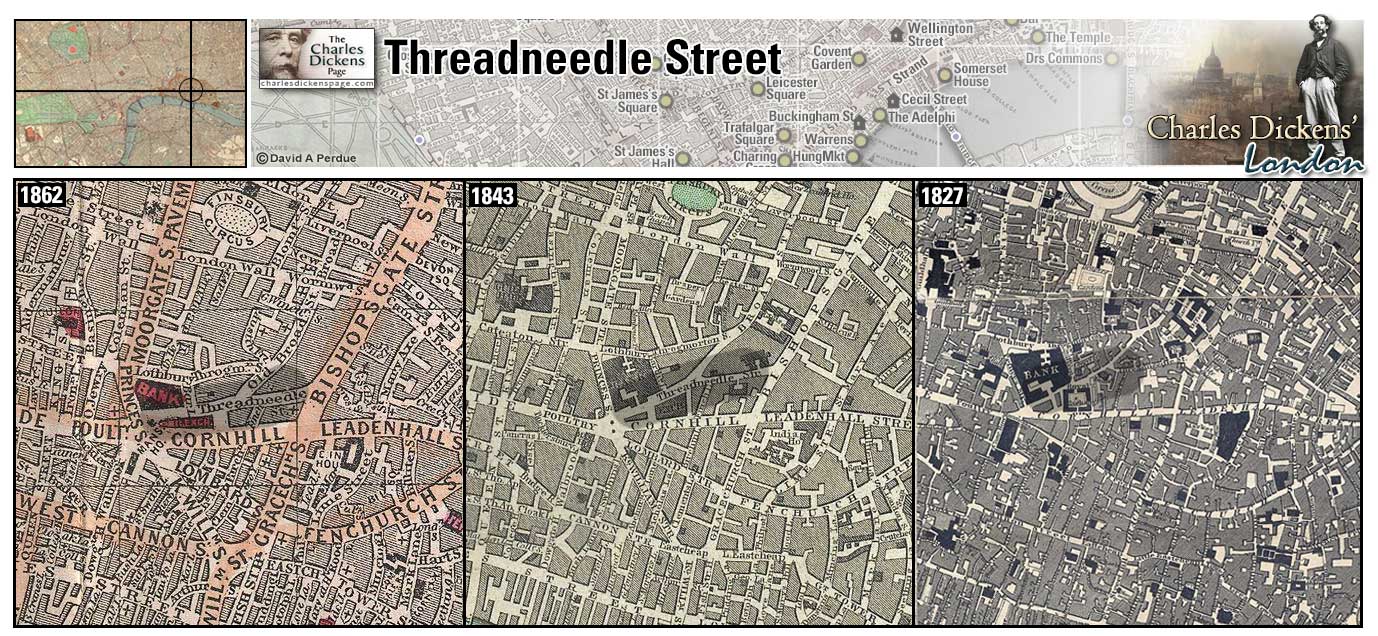
Tottenham Court Road (Map: D-6) - Street running north from St Giles Circus. A market street in Dickens' time, home to many drapers shops (Davis, 1999, p. 391).
- Mortimer Knag has a small circulating library and stationer's shop here (Nicholas Nickleby).
- Clara Peggotty helps Tommy Traddles recover his property from a broker's shop here (David Copperfield).
Zoom Google Wikipedia Aerial 3 Aerial 10 Back
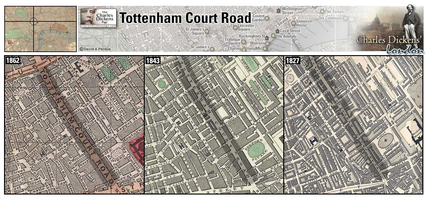
Tower of London (Map: E-12) - The original central tower, now known as the White Tower, was built shortly after the Norman conquest by William the Conqueror who ruled England as William I. Subsequent rings of fortification were added later. It was used as a royal residence as well as a prison and place of execution until Elizabethan times. England's child king, Edward V, and his brother were murdered in the Tower in 1483 supposedly by their uncle, Richard III. The crown jewels are guarded here by the Beefeaters (Weinreb et al, 2008, p. 924-933).
- Sam Weller refers to the killing of Edward V in the Tower (Pickwick Papers).
- Betsy and Daniel Quilp live on Tower Hill (The Old Curiosity Shop).
- David Copperfield takes Clara Peggotty sightseeing to the Tower (David Copperfield).
- Pip, Herbert Pocket, and Startop row past the Tower while attempting to help Abel Magwitch escape England (Great Expectations).
- Lord George Gordon is held in the Tower awaiting trial after the riots (Barnaby Rudge).
- Seth Pecksniff, in typical melodramatic fashion, refers to the smothering of the children in the Tower in a speech to Mrs Todgers (Martin Chuzzlewit).
Zoom Dictionary Photo Google Wikipedia Aerial 6 Aerial 7 Back
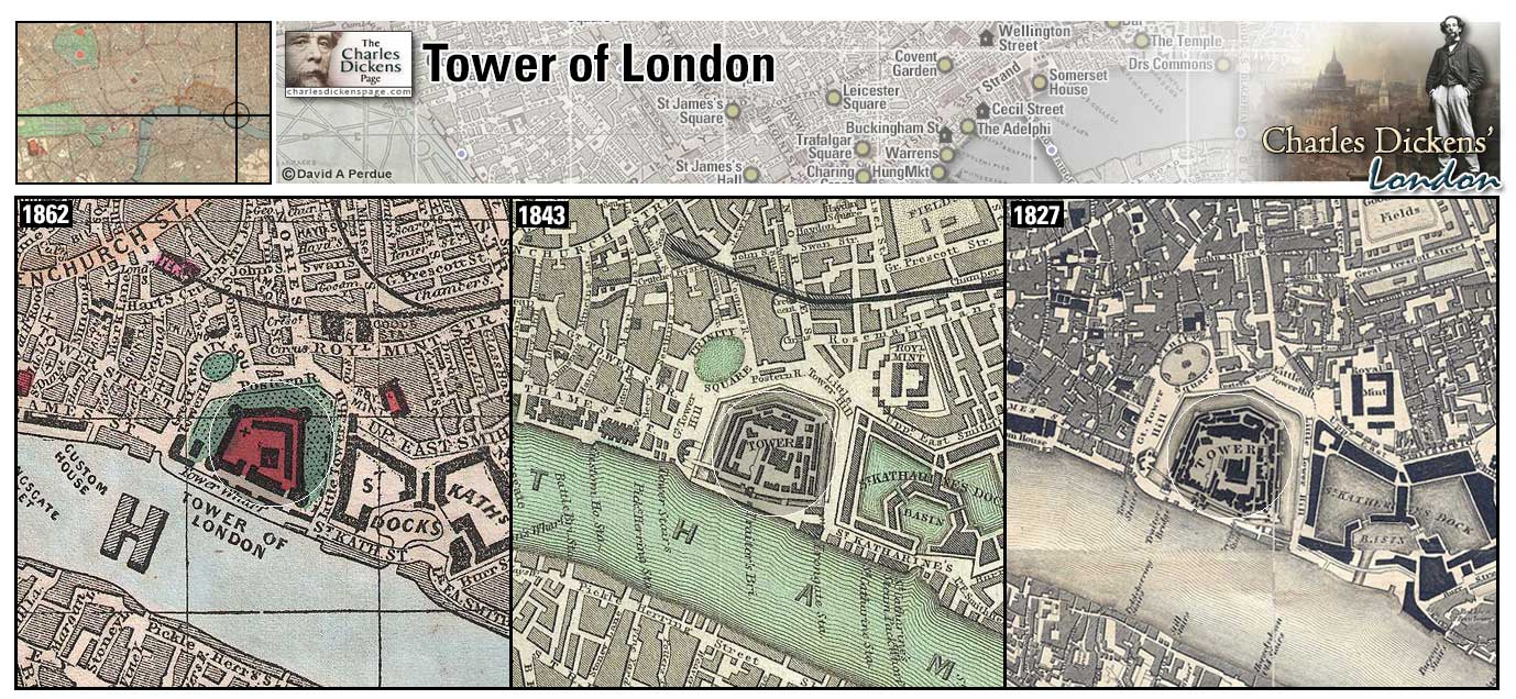
Trafalgar Square (Map: E-6) - Created during the 1830's and 1840's the Square replaced the royal stables. It is named for the Spanish cape Trafalgar. It was off this cape that Admiral Nelson defeated the Spanish and French fleets in 1805. Nelson's Column, at the Square, commemorates this victory (Weinreb et al, 2008, p. 934-936).
- Londoners generally expressed doubt as to whether Trafalgar Square was an improvement as evidenced by Dickens' articles "Bill Sticking" (Reprinted Pieces) and "The Boiled Beef of New England" (The Uncommercial Traveller).
Zoom Dictionary Photo Google Wikipedia Aerial 1 Aerial 5 Aerial 7 Aerial 8 Back
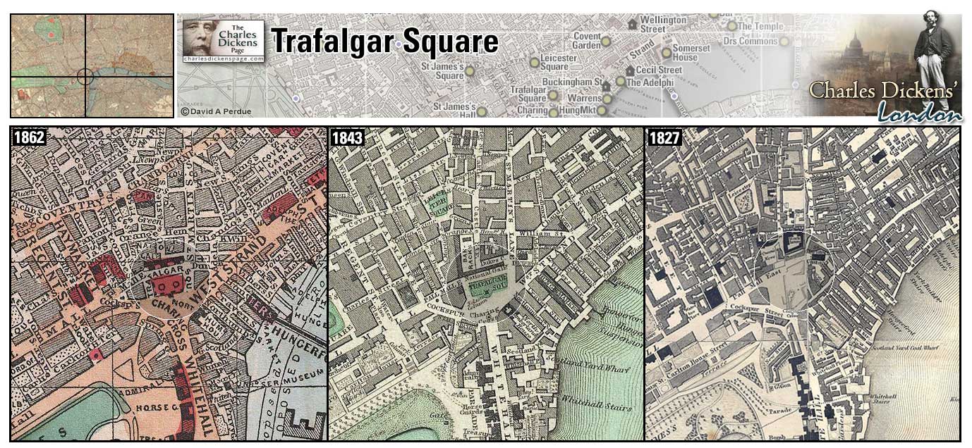
Tyburn (Map: D-3) - Principal place of public execution from 1388 until 1783. Prisoners were conveyed, often accompanied by merry-making from crowds along the route, in carts down Oxford Street from Newgate Prison. After 1783 executions were carried out at either Newgate Prison or Horsemonger Lane Gaol (Ackroyd, 2000, p. 285-295).
- Ned Dennis, hangman at Tyburn, conveys the story of Mary Jones, a young mother convicted of petty theft, who arrived at Tyburn with a child sucking at her breast. (Barnaby Rudge).
Zoom Google Wikipedia Aerial 10 Back
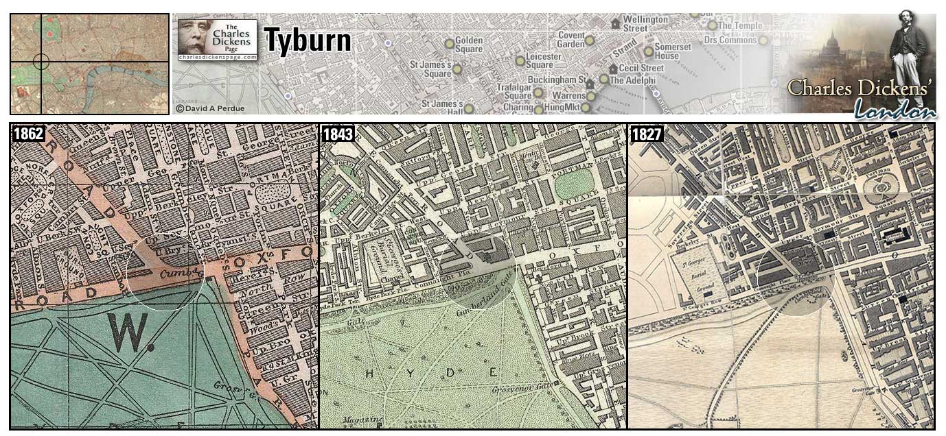
30 Upper Norton Street (Map: C-5) - Now called Bolsover Street (Wikipedia). With the birth of their son Charley the Dickens family had outgrown their chambers at Furnival's Inn. Dickens rented temporary lodgings at 30 Upper Norton Street during March of 1837 until the family took possession of their new home at 48 Doughty Street in early April (Ackroyd, 1990, p. 221).
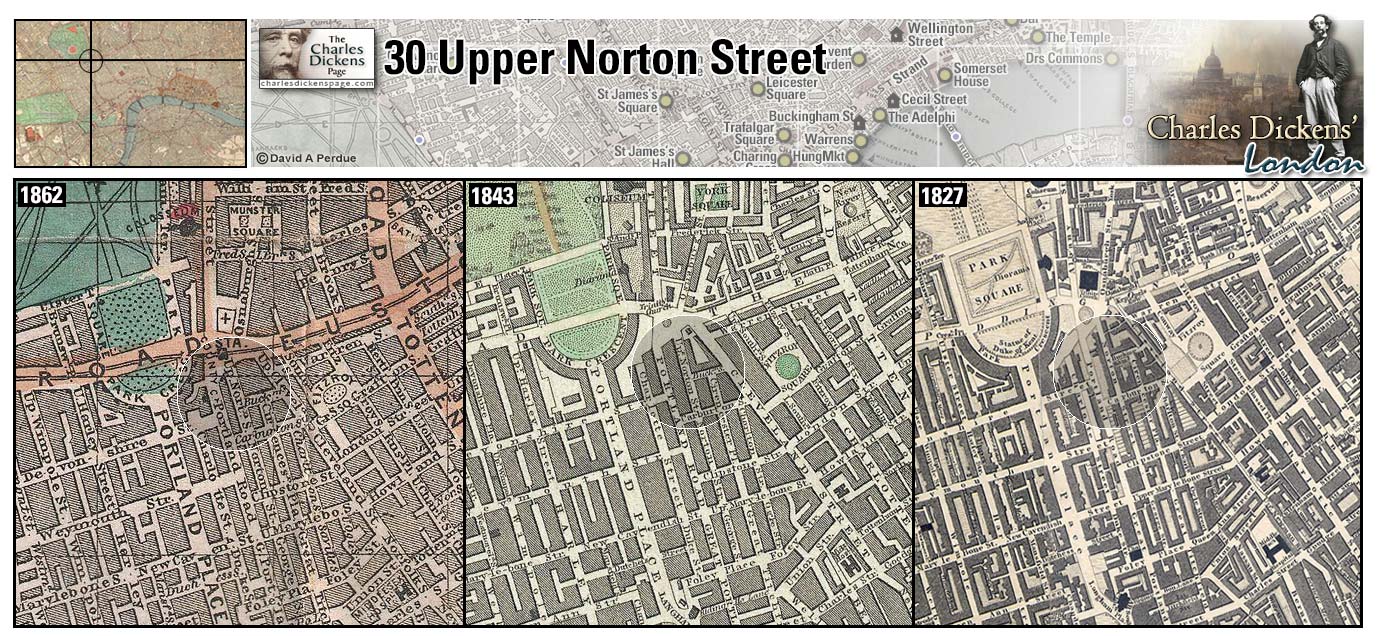
Vauxhall Bridge (Map: H-7) - A cast iron bridge, the first in London over the Thames, completed in 1816 and was originally called Regent's Bridge. During Dickens' time it was a toll bridge. It was replaced in 1906 (Weinreb et al, 2008, p. 968).
- Bradley Headstone and Charlie Hexam encounter Eugene Wrayburn on Vauxhall Bridge (Our Mutual Friend).
Zoom Dictionary Google Wikipedia Back
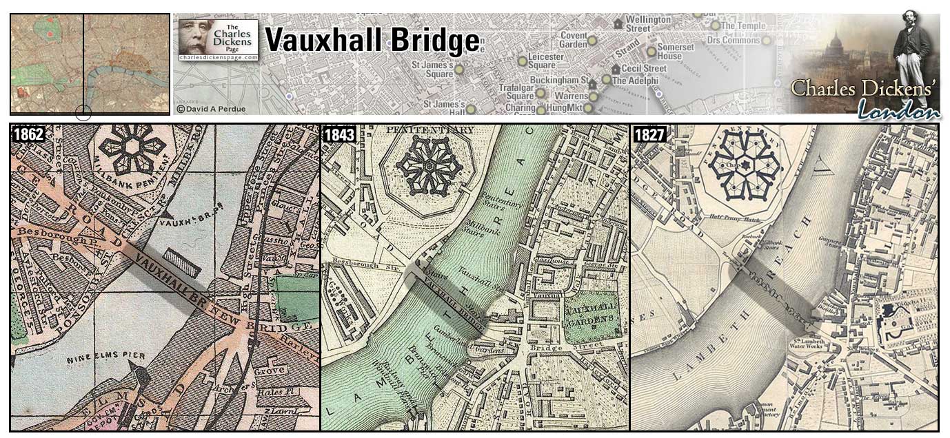
Vauxhall Gardens (Map: H-7) - Fashionable garden resort of the 18th and early 19th centuries. Jonathon Tyers made extensive improvements in the gardens in the mid 1700's and it became one of London's favorite public attractions. Concerts, plays, and even fireworks entertained the crowds there. By the mid 1800's the park had fallen out of favor and drew more disreputable crowds. The gardens were closed in 1859 (Leapman, 1989, p. 270-271).
- Dickens describes Vauxhall Gardens in the sketch Vauxhall Gardens by Day (Sketches by Boz).
- Mr Stryver proposes to take Lucie Manette to Vauxhall Gardens (A Tale of Two Cities).
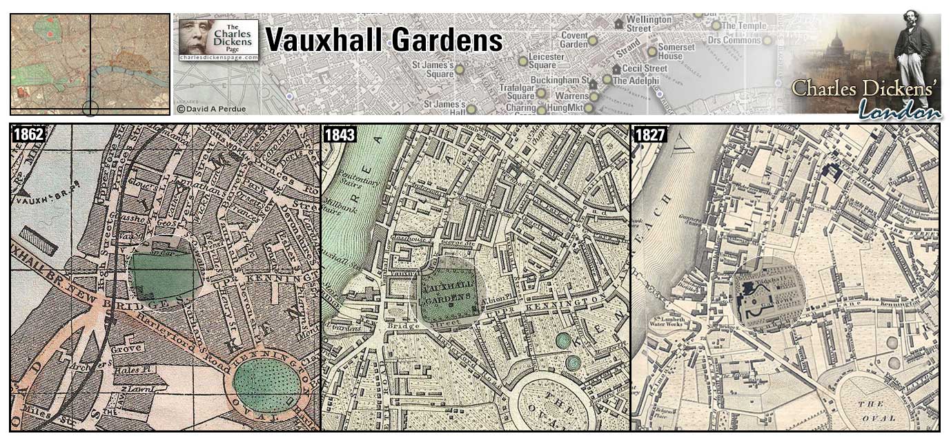
Walworth (Map: H-10) - Area of south London popular for the Surrey Zoological Gardens in the mid 1800s. Competition from the Crystal Palace in the 1850s caused a decrease in popularity and the animals and gardens were auctioned off. The Surrey Gardens Music Hall, which could accommodate 12,000 people, was built on the site (Weinreb et al, 2008, p. 900).
- Mr Tibbs moves to Walworth after the separation from his wife in the sketch The Boarding House (Sketches by Boz).
- John Wemmick's fanciful home is in Walworth (Great Expectations).
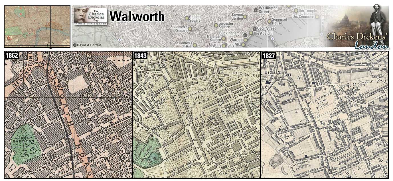
Wapping (Map: F-13) - East London riverside district, home of the London Docks built in the early 19th century causing much of the residential area to be demolished (Weinreb et al, 2008, p. 982-983).
- A portion of the rioting mob goes to Wapping to destroy a Catholic chapel (Barnaby Rudge).
- Pleasant Riderhood reports that there are complaints of robbing and murdering of seaman about Ratcliffe and Wapping (Our Mutual Friend).
- The Uncommercial Traveller visits the local workhouse in Wapping Workhouse (The Uncommercial Traveller).
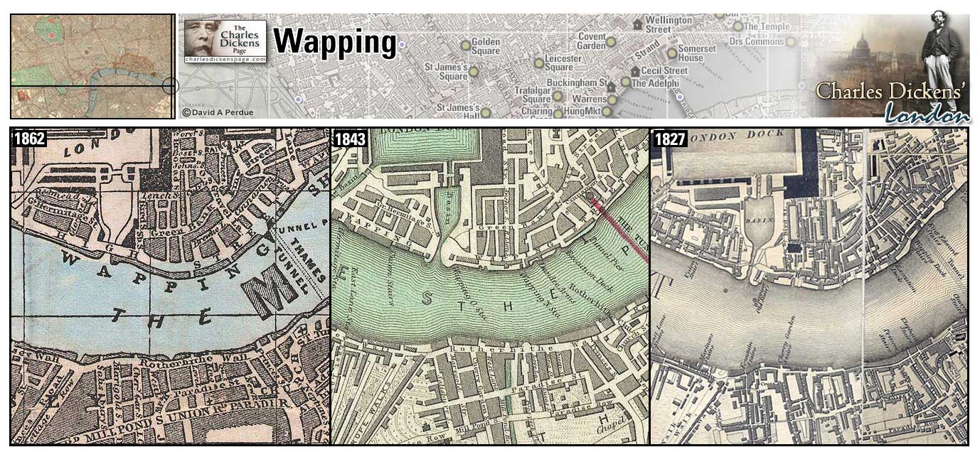
Warren's Blacking Factory (Map: E-7) - Boot polish factory where 12-year-old Dickens was sent to work, fixing labels to bottles of blacking, to help support his family while his father was in the Marshalsea debtor's prison. Dickens had dreams of becoming a gentleman and was humiliated to be working with the rough men and boys at the factory. The experience had a major impact on Dickens later life and works and also on his relationship with his mother who, after Charles left the factory as the result of a quarrel between his father and the owners of the factory, argued unsuccessfully to have him sent back (Forster, 1899, v. 1, p. 22-39). Warren's Blacking Factory was located at 30 Hungerford Stairs, the Strand. A ferry operated at the stairs until 1845 when Hungerford foot bridge opened , hoping to spur trade at Hungerford Market. The market was torn down in 1860 to make way for Charing Cross railway station and the footbridge was replaced by a railway bridge in 1863. The railway company argued that few people used the footbridge due to the smell from the river (Weinreb et al, 2008, p. 420-421).
- Dickens relates the misery he felt during this time in the fictionalized account of David Copperfield working at Murdstone and Grinby's warehouse. The Micawbers take temporary lodging in a "little, dirty, tumble-down public-house" at Hungerford stairs before emigrating to Australia (David Copperfield).
- Joe Gargery and Wopsle go to see the warehouse on arriving in London, and are disappointed (Great Expectations).
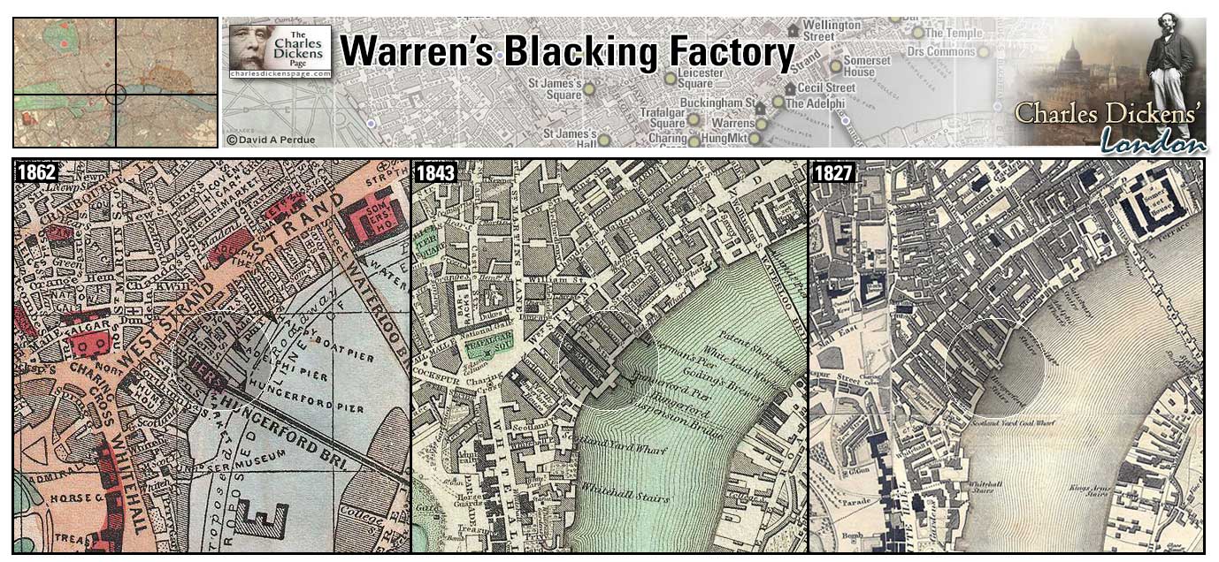
Warren's Blacking Factory 2 (Map: E-7) - During Dickens' time at the boot-blacking factory the establishment moved from Hungerford Stairs to this location at the corner of Chandos Street and Bedford Street. At this location 12-year-old Charles was forced to perform his duties before a window opened to the public street, humiliating him further. After John Dickens was released from the Marshalsea he happened to pass this window and see his son at work which led to Charles being taken from the factory and returned to school...although his mother was "warm for my being sent back" (Johnson, 1952, p. 43-44).
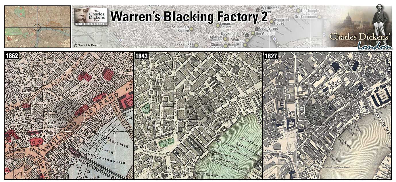
Waterloo Bridge (Map: E-8) - Designed by John Rennie, Waterloo Bridge opened in 1817. Originally to be named Strand Bridge, the name was changed to commemorate Wellington's victory over Napoleon in 1815 at Waterloo. It was demolished in 1936 and its replacement was built from 1937-1942 and designed by Sir Giles Gilbert Scott (Weinreb et al, 2008, p. 991-992).
- Sam Weller says that he once had "unfurnished lodgins' for a fortnight" under the dry arches of Waterloo Bridge (Pickwick Papers).
- George Rouncewell stops at Waterloo Bridge to read a playbill and decides to see a performance at Astley's Theatre (Bleak House).
- In the February 1853 article Down with the Tide Dickens describes being on patrol with Thames police officer 'Pea', and is introduced to 'Waterloo', the night toll-taker on Waterloo Bridge, who describes suicides and other unusual events he has seen (Household Words).
Zoom Dictionary Photo Google Wikipedia Aerial 7 Back
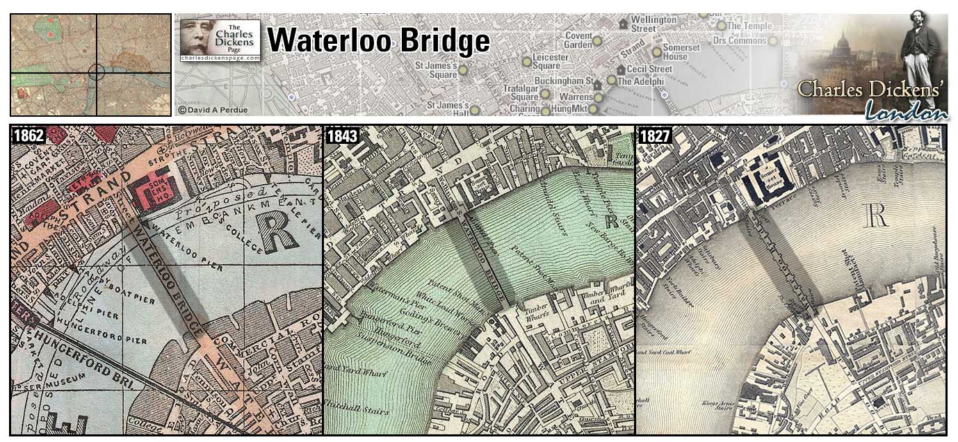
Wellington House Academy (Map: A-5) - Charles Dickens was enrolled here after leaving the Blacking Factory and while living in Johnson Street. The school was run by stern headmaster William Jones who would later be immortalized as Mr Creakle of Salem House Academy in David Copperfield. Dickens attended the school from June 1824 until the spring of 1827 (Johnson, 1952, p. 47-51).
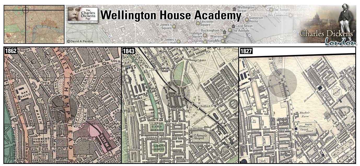
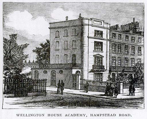
Wellington Street (Map: D-7) - Lower Wellington Street was built in 1833-35 over the site of the English Opera House which burned down in 1830. The Upper section was originally name Charles Street after Charles I, it had become notorious for brothels and in 1844 it was renamed Upper Wellington Street in an attempt to make it sound more respectable (Weinreb et al, 2008, p. 996). Editorial offices for Dickens' weekly magazines Household Words and All the Year Round were located in Wellington Street (Johnson, 1952, p. 702+944). Dickens kept an apartment over the office during the 1860s following his separation from his wife Catherine (Slater, 2009, p. 474).
Zoom Photo Google Aerial 1 Back
Westminster (Map: G-5) - Area of West London that houses Britain's governmental offices. Whitehall, St James's Palace, Buckingham Palace, and Westminster Abbey are located here.
- Nicholas Nickleby responds to an advertisement for a secretary to Mr Gregsbury, the great member of parliament, of Manchester Buildings, Westminster. Upon learning that Mr Gregsbury really wanted someone to do his job for him, Nicholas declines (Nicholas Nickleby).
- Hugh and Ned Dennis walk down to Westminster and Dennis points out how easy it would be to gain access to the interior of the House of Commons (Barnaby Rudge).
- David Copperfield and Daniel Peggotty pass through Westminster in their pursuit of Martha Endell (David Copperfield).
- Esther Summerson and Richard Carstone walk down to Westminster, where the court was then sitting, to hear the latest of Jarndyce and Jarndyce on the day Richard was to leave to join the army (Bleak House).
Zoom Google Wikipedia Aerial 7 Back
Westminster Abbey (Map: F-6) - The most famous of England's churches. The church was built by Edward the Confessor and consecrated on December 28, 1065, Edward died eight days later and was buried before the high altar. The Abbey was rebuilt in its present Gothic style starting in 1245. Henry VII added his Chapel shortly before his death in 1509 (Weinreb et al, 2008, p. 1004-1009). Every English monarch since William the Conqueror in 1066 have been crowned here except Edward V and Edward VIII (Fry, 1990, p. 18). Many of England's kings and queens are buried at Westminster Abbey as are many of its famous citizens including Chaucer, Newton, and Darwin (Weinreb et al, 2008, p. 1004-1009). Charles Dickens was buried in Poet's Corner, in the Abbey on June 14, 1870 (Davis, 1999, p. 405).
- Pip and Herbert Pocket attend services in the Abbey (Great Expectations).
- Mould the undertaker tells Sairey Gamp that gold can buy a gentleman a tomb in Westminster Abbey if he chooses to invest in such a purchase (Martin Chuzzlewit).
- Mr Snevellicci laments the fact that his friend and fellow actor Mr Glavormelly is not buried in Westminster Abbey (Nicholas Nickleby).
- David Copperfield is alarmed when his aunt, Betsey Trotwood, wakes him in the night to infer that Westminster Abbey is on fire (David Copperfield).
Zoom Dictionary Photo Google Wikipedia Aerial 5 Aerial 7 Back
Westminster Bridge (Map: F-7) - Westminster Bridge was the second bridge over the Thames, after London Bridge. Built of stone, work began in 1738 and was completed in 1750. This bridge was replaced in 1862 (Weinreb et al, 2008, p. 1009).
- David Copperfield accompanies Daniel Peggotty over Westminster Bridge during Daniel's solitary journey to look for his niece Emily (David Copperfield).
- Barnaby Rudge and his mother, Mary Rudge, cross Westminster Bridge on their journey back to London after hiding out in the country (Barnaby Rudge).
- Bradley Headstone and Charley Hexam cross Westminster Bridge on their way to Jenny Wren's house (Our Mutual Friend).
Zoom Dictionary Google Wikipedia Aerial 5 Aerial 7 Back
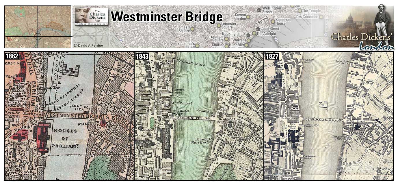
Whitechapel (Map: D-13) - Area located outside the walled city along the main route into London from Essex. Named for the whitewashed Chapel of St Mary that became a parish church around 1338. Noted for many coaching inns to accommodate travelers in Dickens' time (Weinreb et al, 2008, p. 1016). It was later made famous for the Jack the Ripper murders (Ackroyd, 2000, p. 265).
- Samuel Pickwick, Sam Weller, Tony Weller, and Peter Magnus leave for Ipswich from the Bull Inn here (Pickwick Papers).
- John Willet sends his son, Joe Willet, to London with credit to eat at the Black Lion on the Whitechapel Road (Barnaby Rudge).
- David Copperfield arrives in London for the first time, stays at an inn in Whitechapel, and relates "I forget whether it was the Blue Bull, or the Blue Boar; but I know it was the Blue something" (David Copperfield).
- Oliver Twist is taken to a house in Whitechapel after being captured by Sikes and Nancy (Oliver Twist).
Zoom Google Wikipedia Aerial 9 Back
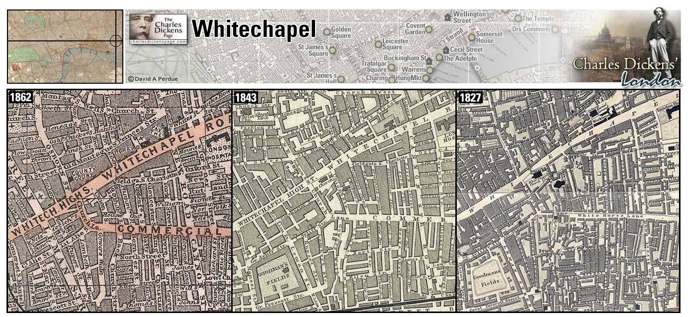
Whitehall (Map: F-6) - Thoroughfare through Westminster named for the royal palace built here in 1532 by Henry VIII. The prime minister's residence of number 10 Downing street and other government offices are located here (Weinreb et al, 2008, p. 1019).
- Alfred Jingle refers to Charles I having his head off in Whitehall (Pickwick Papers).
Zoom Photo Google Wikipedia Aerial 5 Aerial 7 Back
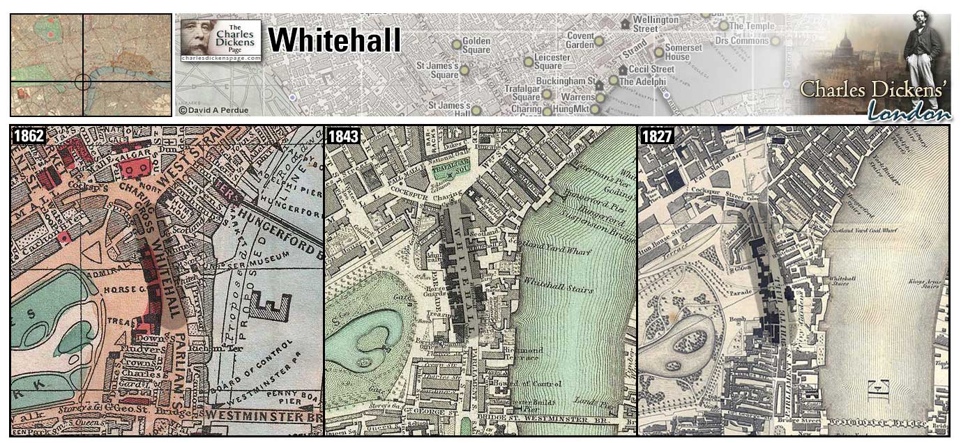
Whitehall Banqueting House (Map: F-7) - Designed by Inigo Jones in 1622 and featuring ceiling paintings by Peter Paul Rubens, it survived a fire that destroyed much of Whitehall in 1698. Charles I was beheaded on a scaffold in front of the building in January 1649.
- Mr Dick is obsessed with the beheading of Charles I (David Copperfield).
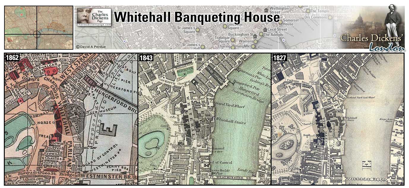
Windsor Terrace (Map: B-10) - Street off of City Road in north London (Hayward, 1924, p. 168).
- David Copperfield has "shabby" lodgings with the Micawbers here. Mrs Micawber, like Dickens' mother at Gower Street, tries to open a school for young ladies here. However, David remarks, as young Charles did, that the only people who came to the house were creditors.
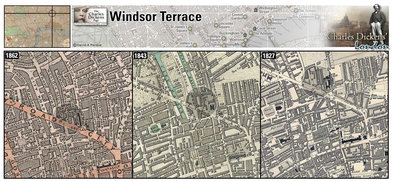
Notes:
1 - Drawings of old London by Philip Norman. Victoria and Albert Museum. Dept. of Engraving, Illustration, and Design,Norman, Philip, 1842-1931